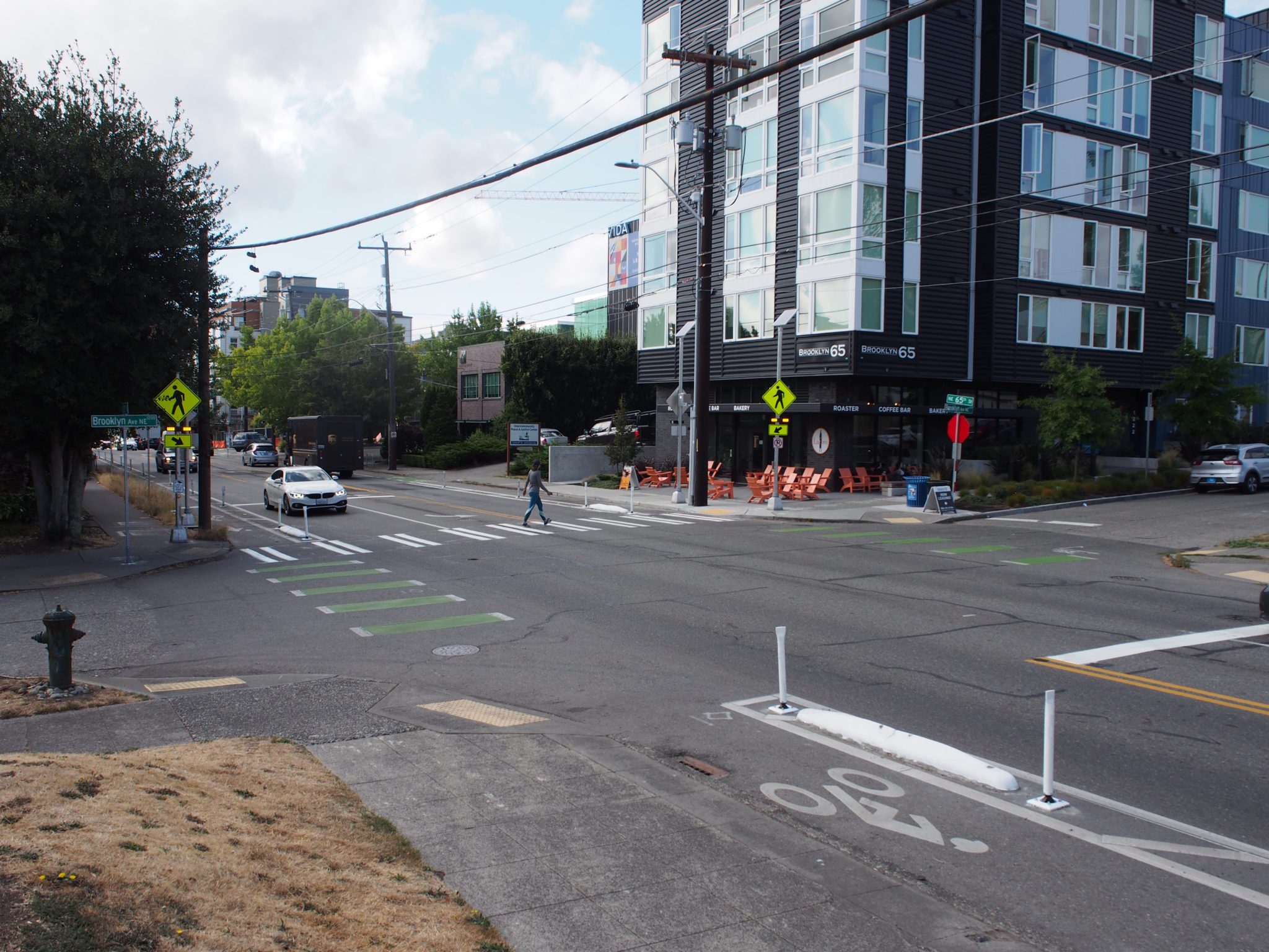
 The intersection of NE 65th St and Brooklyn Ave NE, which was improved as part of the NE 65th St Pedestrian Safety Enhancements Project, a Neighborhood Street Fund project. Photo Credit: SDOT
 We are pleased to present the Q1 2022 Levy to Move Seattle Report!
Editor’s Note: A previous version of this blog post indicated that SDOT completed paving and protected bike lanes on Delridge Way SW in the first quarter of 2022. This work was completed in late 2021.
This report highlights our work from January to March 2022 that was funded by your tax dollars through the voter-approved Levy to Move Seattle. All of this information, and much more, can also be found in the online Levy dashboard!
Highlights from January to March of this year include:
Completing basic maintenance to benefit people traveling by all modes

As we do each quarter, we have also prioritized fundamental maintenance that keeps us all moving safely and enjoying our public spaces. This includes over 7,200 sidewalk spot repairs – such as placing asphalt shims over cracks and uplifts on sidewalks, beveling the sidewalk to create a flush surface, and curb repair – to make sidewalks accessible and safe. We also completed spot improvements on important transit routes and bridges, including 12 crossing improvements, 20 paving spot improvements, and nine transit spot improvements.
Making progress on Vision Zero projects on our highest-crash streets
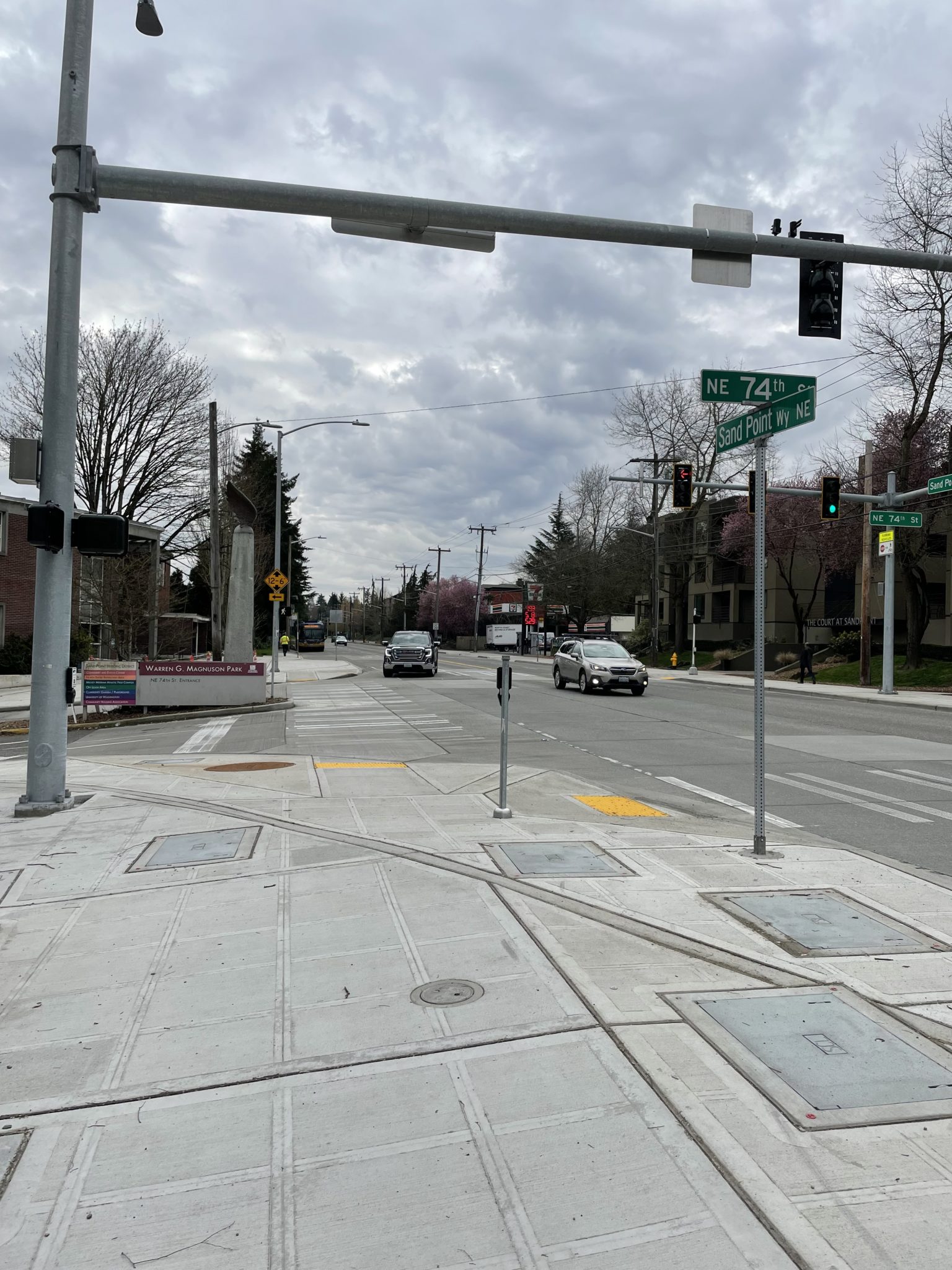
We made progress on safety corridor projects on Lake City Way, Sand Point Way NE, and 15th Ave S.
This included installing a new signal at NE 74th St and Sand Point Way NE (shown in photo) – a change that improves pedestrian safety on this busy street.
Maintaining and improving our system of over 1,100 traffic signals, and hundreds of thousands of signs
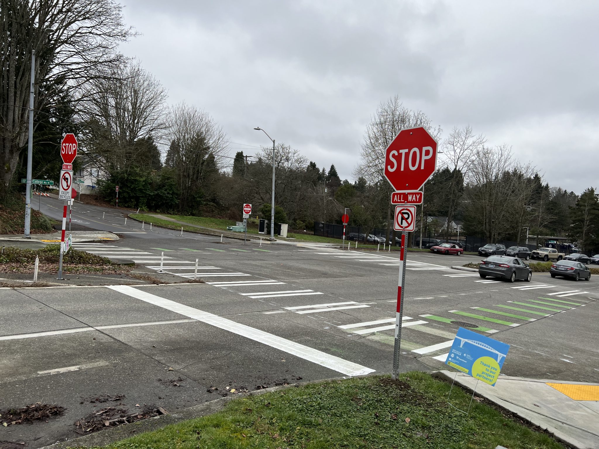
While it doesn’t always make the news, our work on traffic signals and signage makes a big difference for people walking, rolling, biking, taking transit, traveling by car, and delivering goods and services. Some recent examples include an all-way stop at College Way N & N 100th St in North Seattle. This improvement supports safety and predictability for people traveling across all modes through this intersection, including people traveling to the John Lewis Memorial Bridge and nearby bike routes. Nearby, a new traffic signal at Roosevelt Ave NE and NE 103rd St improves crossing safety on the Northgate Neighborhood Greenway.
Throughout Seattle, we have been revising pedestrian signal timing to give people more time to cross the street, and in Q1 we did so at five signals on Rainier Ave S from S Jackson St to S Charles St. We also performed preventative maintenance on 220 signals around the city to keep traffic flowing smoothly.
Completing Safe Routes to School projects to make it easier and safer for students to walk, roll, and bike to school
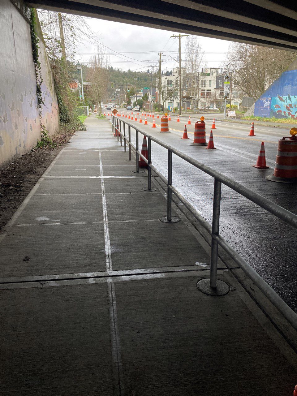
We completed three Safe Routes to School projects. One of these is a new pedestrian railing on S Cloverdale St under the SR 99 overpass. This provides a buffer between the sidewalk and travel lane, to serve Concord Elementary School students where people typically travel between school and the South Park library and community center.
The project was initiated through the Your Voice, Your Choice program, when we received a request for pedestrian improvements around Concord Elementary School.
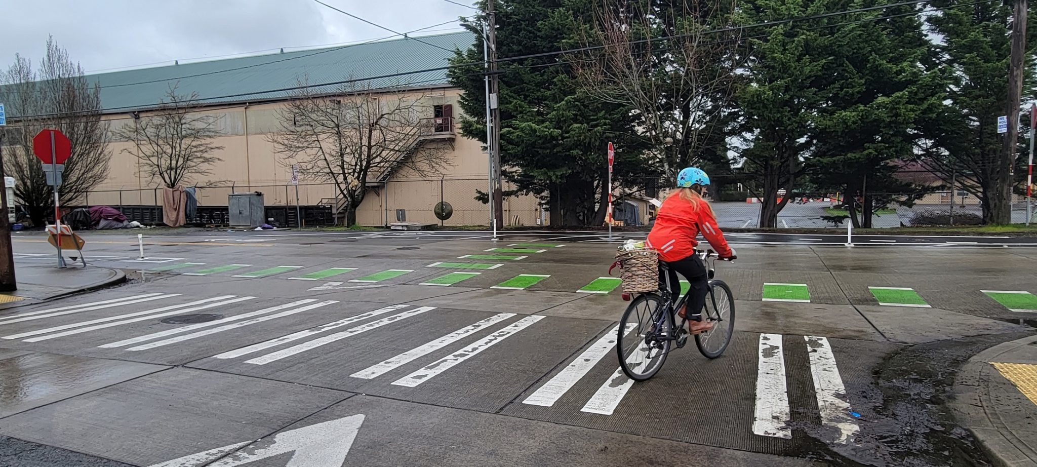
Expanding our bicycle network to make biking a healthy, affordable travel option for people of all ages and abilities
.jpg?web=1)
We expanded our bike network by a total of about three-quarters of a mile of new protected bike lanes (PBLs). These PBLs are located on 1st Ave N & Queen Anne Ave N, as well as 1st Ave & Broad St, and support mobility around the new Climate Pledge Arena and Uptown neighborhood.
Paving & multimodal improvements to upgrade paving, support more frequent and reliable buses, improve signals, and support connectivity and safety for all travelers, whether walking, biking, driving, or taking transit
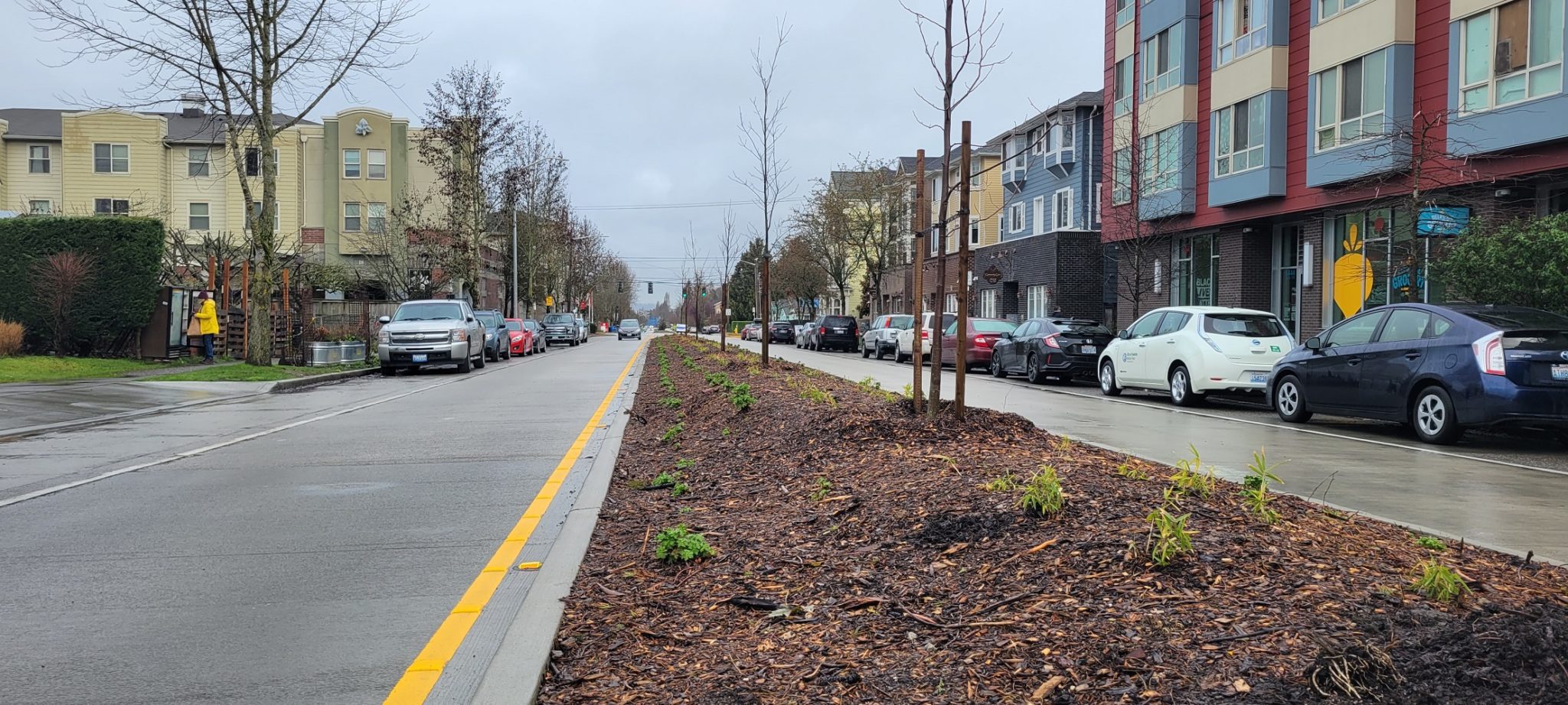
We have completed major construction on Delridge Way SW and we continue to coordinate in partnership with King County Metro as they complete the remaining portions of the Delridge RapidRide H Line. We began this project back in 2020, and it results in improvements for people using all modes of transportation. These include new bus lanes to support the future RapidRide H Line, 10 lane-miles of repaved streets (completed in late 2021), medians with landscaping and vegetation, new public art, crosswalk improvements, a new protected bike lane (completed in late 2021), and upgraded Neighborhood Greenway connections.
Completing a bridge seismic retrofit to make the SW Andover St Pedestrian and Bicycle Bridge safer in the event of an earthquake
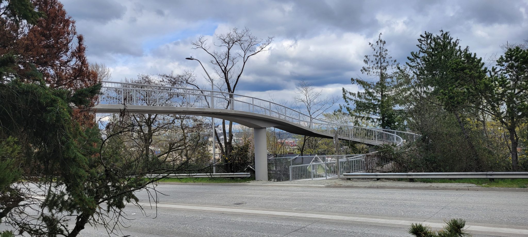
We completed the SW Andover St Pedestrian and Bicycle Bridge seismic retrofit to make the bridge safer in the event of an earthquake. We installed new bridge expansion joints to allow the concrete to naturally expand and contract without cracking. We also fused part of the bridge together with steel plates, additional rebar, and concrete, and strengthened the east side of the bridge where it is secured to the ground. Four long steel rods, called ground anchors, were installed 40 feet deep into the ground to support this side of the bridge.
Adding to our Intelligent Transportation Systems (ITS) network to create faster, reliable, and more centralized traffic signals throughout the city that are stable and secure during unexpected disruptions
We added 2.25 miles to our ITS network: 1.25 miles on 3rd Ave from Yesler Way to Wall St and 1 mile on 4th Ave from Jefferson St to Stewart St. This is part of our Network Resiliency Project, which is focused on creating faster, reliable, and more centralized traffic signals throughout the city that are stable and secure during unexpected disruptions.
Thank you, Seattle, for making these and so many other transportation investments possible.