Seattle.gov Home Page
Link to Department of Transportation Link to Seattle.gov Home Page Link to Seattle.gov About Us Page Link to Seattle.gov Contact Us Page
SDOT Blog Home Page SDOT Blog Home Page CityLink Seattle

ASK US A QUESTION!

Have a question about our current work at the Seattle Department of Transportation? We’re ready to get you an answer!

Click here and scroll down

Search SDOT Blog

Archives

Contact us

Call 206-684-ROAD

SDOT Photo Gallery


			SDOT Photos posted a photo:	The Egyptian jackal-headed god of the dead stops by for a visit. The Pacific Science Center, SDOT, and a big old crane welcome Anubis to King Street Station 5/15/2012 . He in turn is here to welcome King Tut to the Science Center May 24, 2012-January 6, 2013

			SDOT Photos posted a photo:	The Egyptian jackal-headed god of the dead stops by for a visit. The Pacific Science Center, SDOT, and a big old crane welcome Anubis to King Street Station 5/15/2012 . He in turn is here to welcome King Tut to the Science Center May 24, 2012-January 6, 2013

			SDOT Photos posted a photo:	The Egyptian jackal-headed god of the dead stops by for a visit. The Pacific Science Center, SDOT, and a big old crane welcome Anubis to King Street Station 5/15/2012 . He in turn is here to welcome King Tut to the Science Center May 24, 2012-January 6, 2013

			SDOT Photos posted a photo:	The Egyptian jackal-headed god of the dead stops by for a visit. The Pacific Science Center, SDOT, and a big old crane welcome Anubis to King Street Station 5/15/2012 . He in turn is here to welcome King Tut to the Science Center May 24, 2012-January 6, 2013
More photos

Archive for August, 2009

Making Transportation Options Accessible

Rainier Ave S near Mt. Baker Light Rail Station and Metro Bus Stops

Rainier Ave S near Mt. Baker Light Rail Station and Metro Bus Stops

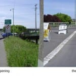
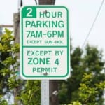
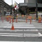
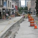
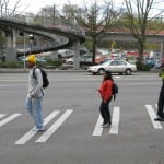
Lots of transportation changes are happening in Southeast Seattle. Link light rail, Metro bus route restructuring, along with new sidewalks, bike facilities, and parking regulations are all contributing to building a community where there are more choices for getting around.

SDOT recognizes the importance of making sure people have the resources they need to take advantage of their transportation choices. To do that, a basic resource brochure was created to let people know more about how to get around Southeast Seattle without using their cars.

This useful information is available in six languages including, Chinese, English, Khmer, Somali, Spanish, and Vietnamese. Inside the brochure is a map of the Southeast and contact information for non-English speakers to reach translation services at Sound Transit, Metro and now through SDOT’s newly established translation phone line. Check out the brochures here.

[More]

Paving Quiz – What do crews do when it rains?

Pouring Rain

Pouring Rain

Answer: Everything but asphalt and concrete work.  That’s why weather forecasts keep project managers up at night.  The possibility of rain means paving plans turn on a dime.  As the saying goes “success favors the prepared” and project managers (PM) are nothing if not prepared.  They plan for transportation projects months and often years in advance, doing everything from traffic modeling, environmental analysis and geotech pavement planning, to multiple quality control design critiques and public outreach regarding construction impacts.   And that’s just scratching the surface.

PM’s use detailed schedules to keep all the many details on track – take a look at this example (it’s so detailed it’s hard to see!):   

Detailed Schedule

Detailed Schedule

The schedule must be adhered to in order to meet the scope, schedule and budget.  Luckily, even if there’s bad weather on the horizon, there’s just about ALWAYS something a crew can be immediately re-assigned to do to keep the project on schedule. So, when it rains, the PM will consult the contingency plans included in each schedule and keep the crews and the project movin’.

[More]

2nd Update: Bike and truck improvements for south end Ballard Bridge

15AveW&EmersonJuly72009A-Model
Thanks for all of the thoughtful input! Because so many comments have been received, we need more than two days to consider them. Part of our process will include convening a small group of bicycle and freight interests to discuss feedback. Please check back in two weeks to learn more about final design decisions.
 
If you would like to read some of the comments we’ve received, check here.


[More]

Stewart and Second ‘Round-the-Clock

Good news for downtown traffic due to a ‘round-the-clock effort by paving crews: Yesterday morning Stewart Street opened back up to two lanes and the afternoon rush-hour bus-only restriction between Westlake and Second Avenue was removed.  Getting there – and a week ahead of schedule – wasn’t easy. Simultaneously last weekend crews, working 24/7, reconstructed the north side of Stewart Street between  Second and Fourth (for future bus lanes) and rebuilt Second Avenue intersections at Stewart, Yesler, Pike, Pine, and Broad.  If that weren’t enough work, crews also had to completely demolish old concrete pavement on Second Avenue in less than a three-hour window, after the last Metro trolley bus went through the work zone around 7p.m. Friday and before noise restrictions kicked in at 10p.m. Here’s a before and after look at just one of the five intersections the team reconstructed between Friday night and Monday morning… 

Second Avenue & Stewart Street Intersection Friday Night

Second Avenue & Stewart Street Intersection Friday Night

Second Avenue & Stewart Street Intersection Monday Morning

Second Avenue & Stewart Street Intersection Monday Morning

 A significant amount of coordination was required to get this work done so efficiently and we’re happy to report it was successful!  As of today bus lanes between Eastlake and Second Avenue are complete.  Crews will now refocus on the south side of Stewart in preparation for asphalt grinding and paving.

[More]

100+ Tiny Submarines or…

Does this photo from the South Spokane St project show more than 100 tiny soil-traversing submarines with periscopes up, or does it show earthquake preparedness?  Sci Fi authors aside, the correct answer is… preparation for an earthquake. 

Earthquake Drains Installed at 4th Ave. S and S. Spokane St.

Earthquake Drains Installed at 4th Ave. S and S. Spokane St.

So why the pipes at 4th Ave S and S Spokane St?  These earthquake drains (the periscope-looking things) relieve underground water pressure in the event of an earthquake.  The only time these “tiny submarines” see water is when the ground shakes vigorously – then they act as vents for the pressurized underground water to escape upward.  That minimizes ”quick sand” formation, which as you can imagine has the potential to undermine the soil’s ability to support structures.  To keep that water from weakening the soil, these drains will guide it to a surface of rocks and soil where the water can gently settle.  It’s an important construction element for the South Spokane project since the site is, at least partially, in one of Seattle’s many liquefaction zones. Suffice to say, it’s good to know these pipes, although in the end not seen, are now under there.

[More]

Making Connections

Draft recommendations for Westlake Hub to connect bus, streetcar and light rail

Looking south towards the streetcar terminus and the retail core along Westlake Ave. The City is planning to close Westlake Ave betwen Olive Way and Stewart St in 2010 to create a pedestrian-friendly plaza connecting bus, streetcar and light rail.

Looking south towards the streetcar terminus and the retail core along Westlake Ave. The City is planning to close Westlake Ave between Olive Way and Stewart St in 2010 to create a pedestrian-friendly plaza connecting bus, streetcar and light rail.

What is a transportation hub, and what makes for a good one? For starters, usually lots of transit service coming together that brings great regional access with just a single ride or transfer. In many cases this “hub” of activity takes place around a single structure, like New York City’s Grand Central Station or King Street Station here in Seattle; other times it occurs over several city blocks around a large public park or series of pedestrian plazas.

Westlake is one of the latter: it’s five (soon to be six) forms of transit, plus easy access to thousands of jobs and world-class shopping, make it a popular stopover for both local and regional trips. Only a portion of this activity, however, takes place underground in Westlake Station. For the most part, Westlake is defined by what happens on the surface – people using city streets to reach transit, shop, and often simply to hang out and observe other people. In fact, Pine Street over the Westlake Station has more pedestrians per day (> 30,000) than any other street in Washington.

The number of people and connections will increase as both Seattle and the region continue growing with more housing and jobs, and the transit system expands to bring new riders.  That is why SDOT has laid out a vision for the Westlake Hub.

Top on the list? Developing a pedestrian plaza to improve access between the Seattle Streetcar, buses and light rail, to be constructed in 2010. By closing Westlake Avenue between Olive and Stewart, the project will help improve wayfinding and reduce unnecessary crossings at a complex five-way intersection. With an additional focus on addressing public safety concerns and neighborhood walkability, the project is one of several recommendations that emphasize livable streets – and inviting urban places – as critical elements to a successful Westlake Hub and vibrant Center City. 

You can find the draft set of recommendations, and more conceptual drawings of the improvements on our website at www.seattle.gov/transportation/westlakehub.htm 

streetcar opening 12-12-07
Westlake hub connects five (soon to be six) forms of transit: light rail, streetcar, electric trolley bus, hybrid diesel bus, monorail, and……drum roll…..Bus Rapid Transit

Read more »

[More]

Comments Needed on RPZ Program Director’s Rule

zone 4 sign cleanStarting in 2007, SDOT initiated a major policy review to redesign the RPZ program to better achieve City’s goals for parking management, transportation, economic development, social equity, and sustainability. On Monday, SDOT reached an important step in revising the Restricted Parking Zone (RPZ ) program and released a draft “Director’s Rule”. The rule provides important guidelines and information for the new RPZ program, based on recently passed legislation.

This Director’s Rule explains how SDOT determines:

  • who is eligible for RPZ and guest permits
  • how the business parking permit pilot program in Southeast Seattle will operate
  • what the process is for starting a new RPZ
  • how communities can expand their existing RPZ

You can review the draft Director’s Rule here. It will be available for review until September 8, 2009 at 5pm.

Please send your comments and questions to Ruth Harper at (206) 684-4103 or via e-mail to rpzparking@seattle.gov.

Seattle’s RPZ program is designed to help residential neighborhoods by discouraging long-term parking by non-residents (e.g.commuters or employees) on residential streets. There are currently 31 RPZs throughout the city, with over 17,000 vehicles displaying RPZ decals.

[More]

Are They Tearing Up New Pavement?

When traveling in the area of the Westin Hotel, along 5th Avenue, you may have noticed a section of the roadway recently paved. Now you may be asking yourself…why oh why are they repaving that section again if that stretch of roadway was paved in 2008?

Outside of the Westin Hotel on 5th Ave.

Not to worry, we haven’t gone paving mad! Last year, the project team coordinated with Seattle Public Utilities (SPU) when they found out that SPU had sewer service work scheduled for 2009 that would require undoing our recent efforts.  Instead, SDOT left this area unpaved to be replaced when the sewer service work was scheduled this year. Now that’s connecting the dots.

outside the Westin1

[More]

Take a spin through the new SR 99 bored tunnel and along Alaskan Way

Alaskan Way Viaduct
Current configuration of the Alaskan Way Viaduct

Curious about how driving through the bored tunnel may look and feel? WSDOT in partnership with SDOT, King County Metro and the Port of Seattle developed two simulation videos that are now posted to YouTube.  The first video shows the current design concept for the proposed SR 99 bored tunnel. 

Northbound tunnel entrance

Northbound tunnel entrance

The second video depicts our proposed plan to build a new Alaskan Way boulevard in the footprint of the current viaduct. Removal of the viaduct will allow creation of a great new public open space on the waterfront.

Central Waterfront via Alaskan Way

Central Waterfront via Alaskan Way

You can visit the Alaskan Way Viaduct program Web site at www.alaskanwayviaduct.org to learn more about these and other improvements that are part of the viaduct’s replacement.

[More]

Whether the Weather Matters

After months of working with businesses and residents to prepare for impending construction impacts, weather still determines whether or not plans change at the last moment.   Case in Point: Stewart Street.  Stewart Street paving between Third and Fourth Avenues was supposed to happen the last weekend of July.  Then Seattle’s record-breaking heat wave made the materials literally too hot to handle.  One-hundred-degree-plus heat wreaks havoc with the concrete mix.  Now that temps are “back to normal” crews will tackle the work this weekend, along with paving from Second to Third.   

Stewart St. Paving
Stewart St. Paving

Weather has a close, albeit tumultuous, relationship with paving, which requires mild conditions for concrete to properly cure and asphalt to correctly set (ah, the prima donna…).  Hence the busy summer construction season!

[More]