
We believe that streets, sidewalks, parks, & plazas full of social and commercial activity have the power to improve our city’s health, prosperity, & happiness.
It’s important for us to listen and see how people actually use these infrastructure for us to make improvements. That’s why we created a Public Life Program that is focused on bringing people-centered data into the work we do every day.
In 2018 the Public Life Program completed our first citywide study to understand how people use our streets and sidewalks. Collecting data about these activities allows us to measure how the city is fulfilling its goal of having vibrant, active, and well-used public spaces.
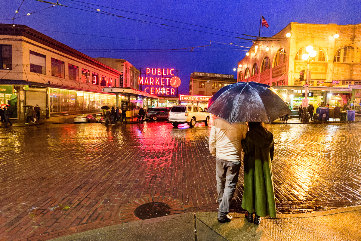
This past year, we partnered with Seattle Parks and Recreation to get a more in-depth look of how people are using the public spaces in the Yesler Crescent area of Pioneer Square.
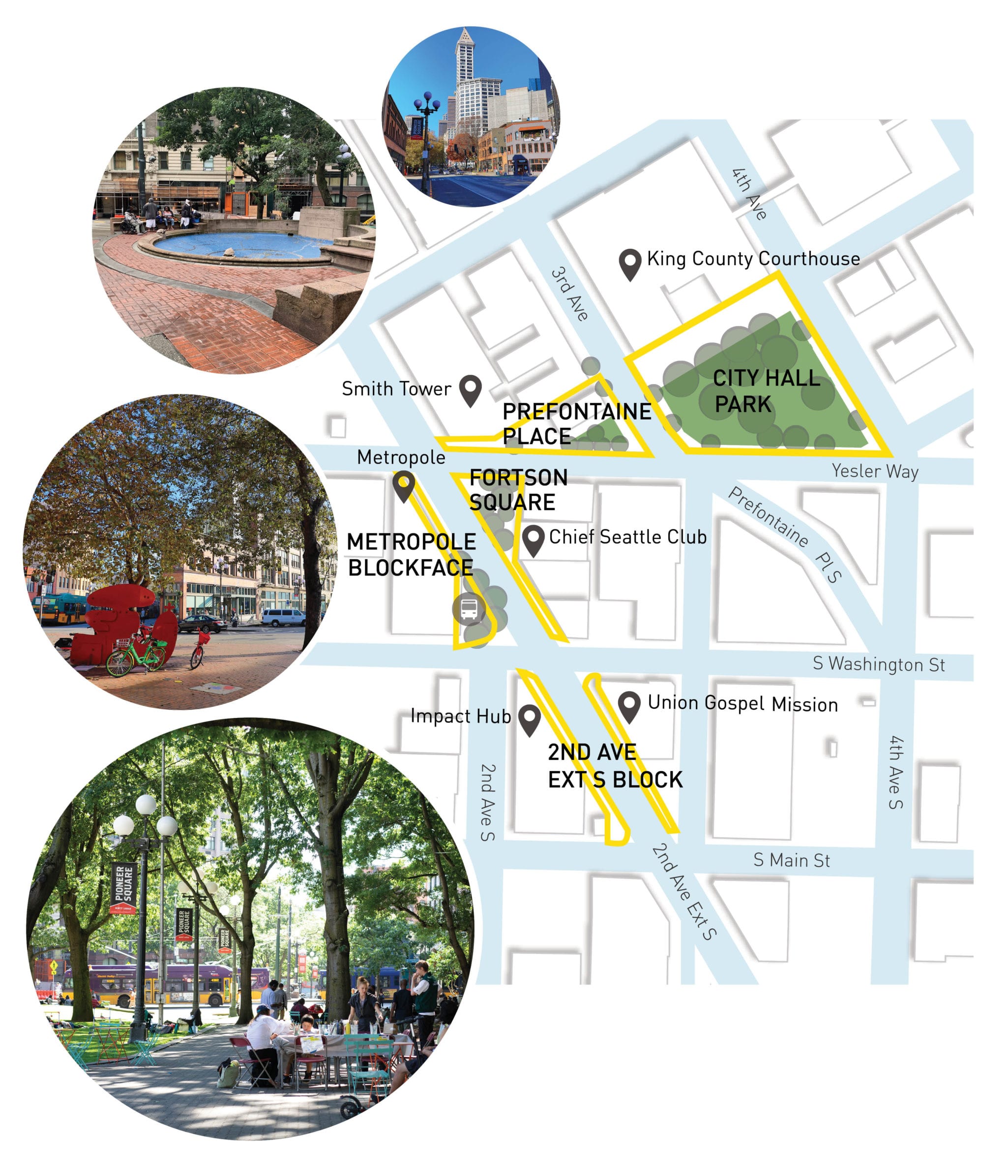
Yesler Crescent is a collection of public spaces in Pioneer Square, which includes City Hall Park (Downtown Seattle’s second largest green space), Prefontaine Place (a key entrance to the Sound Transit Pioneer Square lightrail station), Fortson Square, and several block faces along 2nd Ave Ext S.
The Yesler Crescent Public Life Action Plan—a first of its kind for the City of Seattle—establishes a new approach to public space planning.
This new approach is focused on “people data” where we look at data gathered from people’s experience using the space, and then developed design recommendations based off those findings. For the action plan we collected data in the following ways:
- Observing the social environment and public realm
- Collecting opinions of users of the spaces through intercept surveys
- Discussing the spaces with neighborhood stakeholders through focus groups.
Here’s some of what we learned:
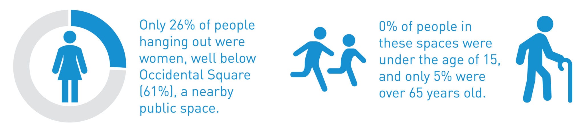
Very few women, youth, or elderly use these public spaces.
For such a central public space in our downtown core, there is incredible potential to make it an inclusive destination for the region.
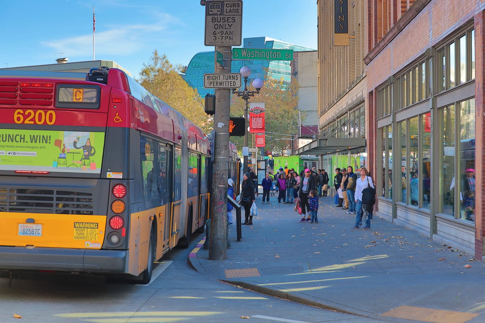
The highest concentrations of people hanging out was near busy transit locations
This happened near the Link light rail tunnel entrance and sometimes to the detriment of people moving through the area. As SDOT, we ask ourselves: how can we leverage the volume of people in these spaces to improve public life on these blocks?
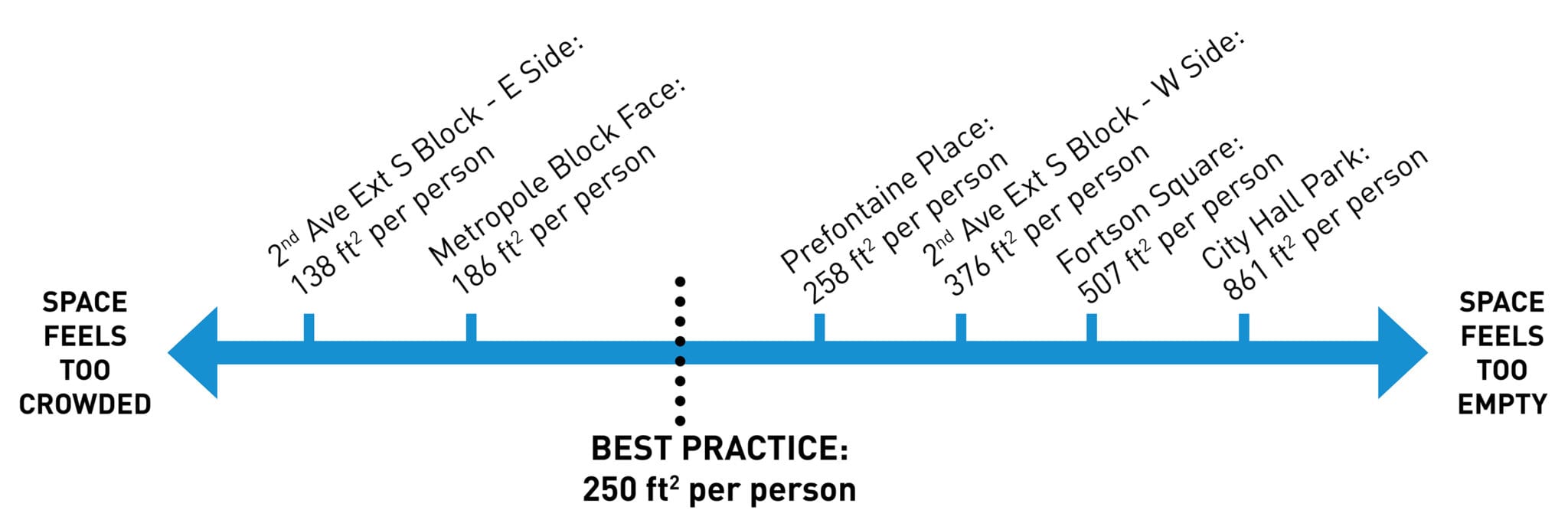
City Hall Park—the second largest green space in downtown Seattle—is underutilized.
Even after previous efforts to bring people into the space by providing seating, music performances, vendors, and games, there is still potential for City Hall Park to become more of a destination in the downtown area.
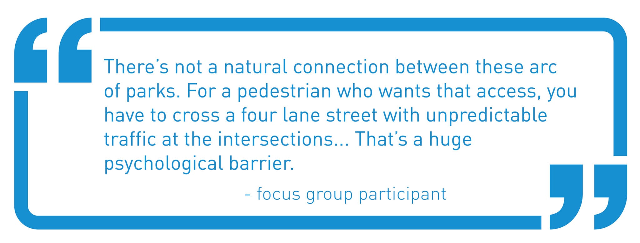
These public spaces lack identity and sense of place, and do not function as a cohesive network of public spaces.
After speaking with people who have deep knowledge of the area, we found that there is an opportunity to make the spaces inviting to more people and foster connections between the spaces to optimize the area as a whole for people both moving and staying.
Take a look at the Yesler Crescent Public Life Action Plan for a more thorough look of our findings.
Putting data into action:
The action plan uses this data to inform recommendations for improving these spaces. The recommendations are directly tied to actions that City departments will be taking on to implement the plan and realize it’s vision.
Prefontaine Place
Investigate design solutions that promote mobility, improve sight lines, and strengthen connection with City Hall Park to encourage utilization.
City Hall Park
Develop a plan to improve circulation through the park, meet the basic needs of park users, and explore design strategies that focus on attracting people to utilize the park for a variety of uses.
3rd Ave Connection
Study operations on 3rd Ave such as re-channelization, intersection efficiencies, and crossing improvements to improve the connection between City Hall Park and Prefontaine Place.
2nd Ave Ext S
Add streetscape elements to improve user comfort and enjoyment, including pedestrian-scale lighting, shade opportunities, landscape buffer, and seating options.
The Public Life Program plans conduct another citywide study in 2020 to build on the 2018’s initial dataset, capturing more neighborhoods, types of public spaces, and times of the day.
We will also be working with other communities to develop Public Life Action Plans.
Questions? Or interested in conducting a study in your neighborhood? For more information about this work, email SDOTpubliclife@seattle.gov or susan.mchlaughlin@seattle.gov.