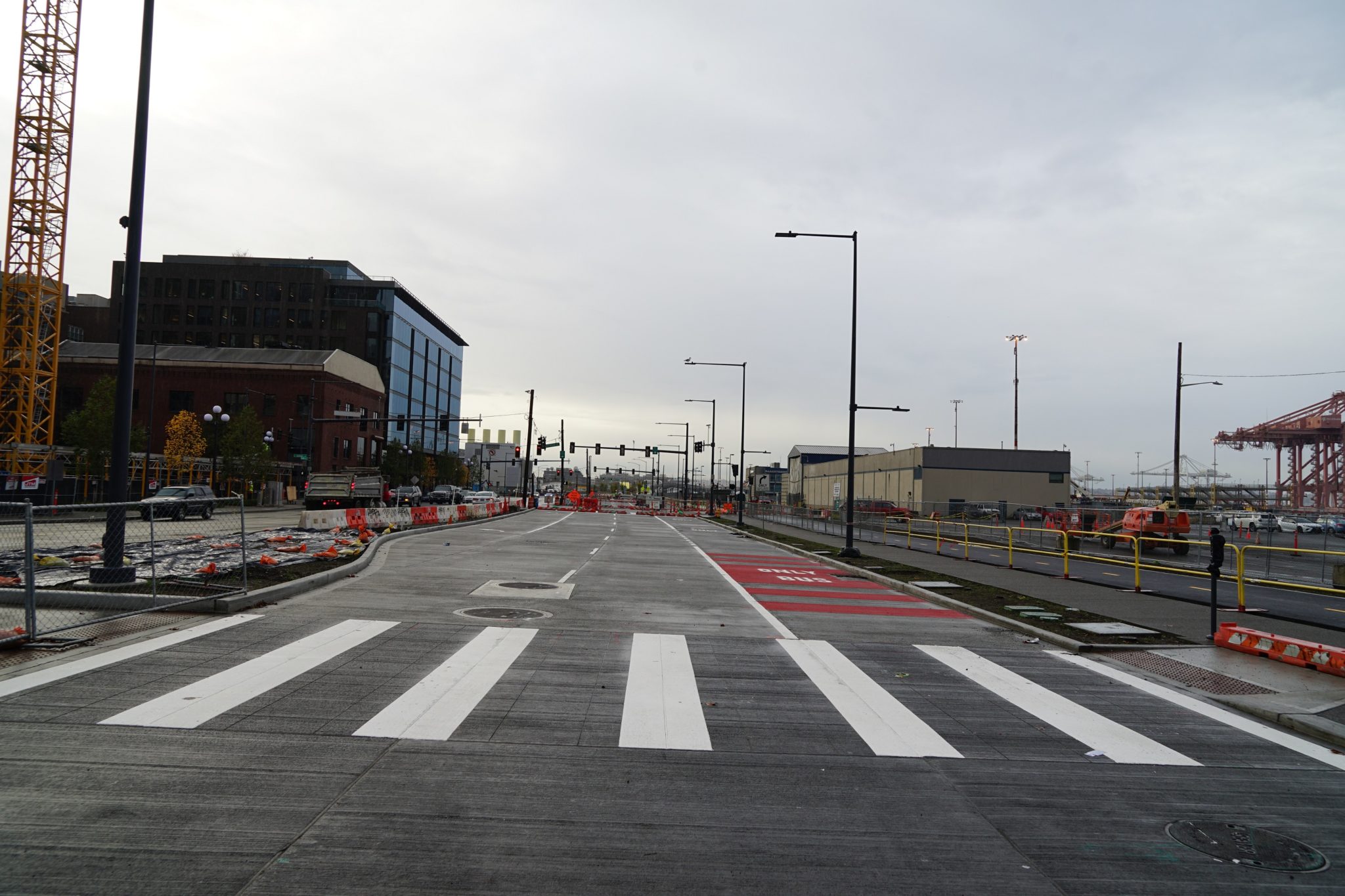
 View looking south of new southbound lanes, a crosswalk, sidewalks and bike lanes on Alaskan Way S at S Main St. The new southbound lanes will soon open to traffic, once an upcoming traffic shift is complete. Photo credit: City of Seattle.
 The Waterfront Seattle Program has been busy constructing the new Alaskan Way since late 2019, following the completion of the Alaskan Way Viaduct removal. Shifting traffic to the east between S King and Marion streets last December allowed Waterfront Seattle to construct new southbound lanes, along with new sidewalks and part of the new bike path on the west side of Alaskan Way between S King and Columbia streets.
Starting the evening of Friday, November 12 (weather permitting) and continuing through the weekend, Alaskan Way will be reduced to one lane in each direction between S King and Columbia streets to perform final preparations for opening new improvements on the waterfront. By Monday morning, November 15, crews will move southbound traffic onto new concrete lanes, open a new southbound transit lane, open new sidewalks, and open a part of the new bike path on the west side of Alaskan Way.
These new improvements along the waterfront in Pioneer Square will provide for a better experience for people walking, rolling, driving, or enjoying views of Elliott Bay. Specifically, this change includes:
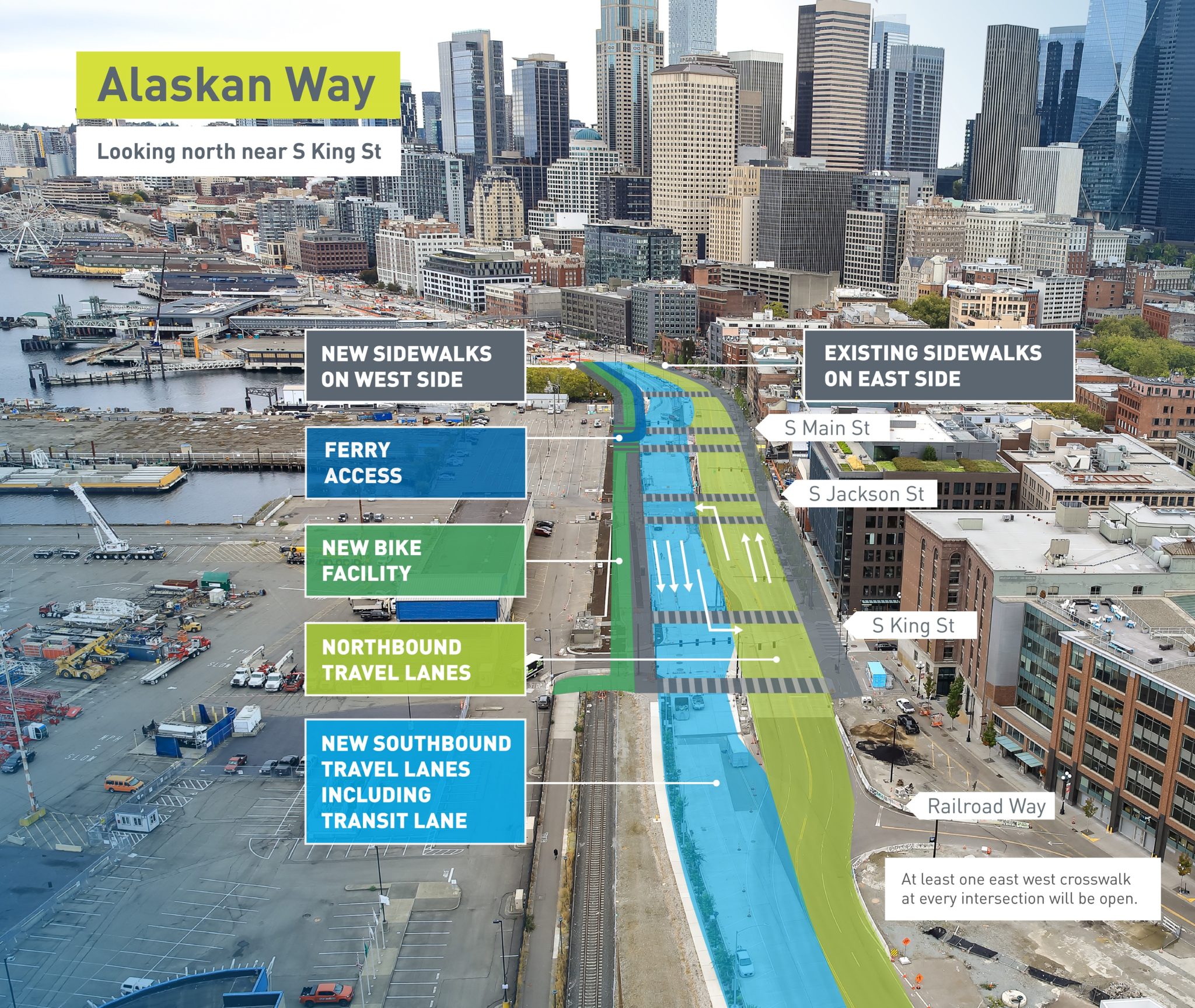
- Two new general-purpose travel lanes on Alaskan Way S between S King and S Main streets
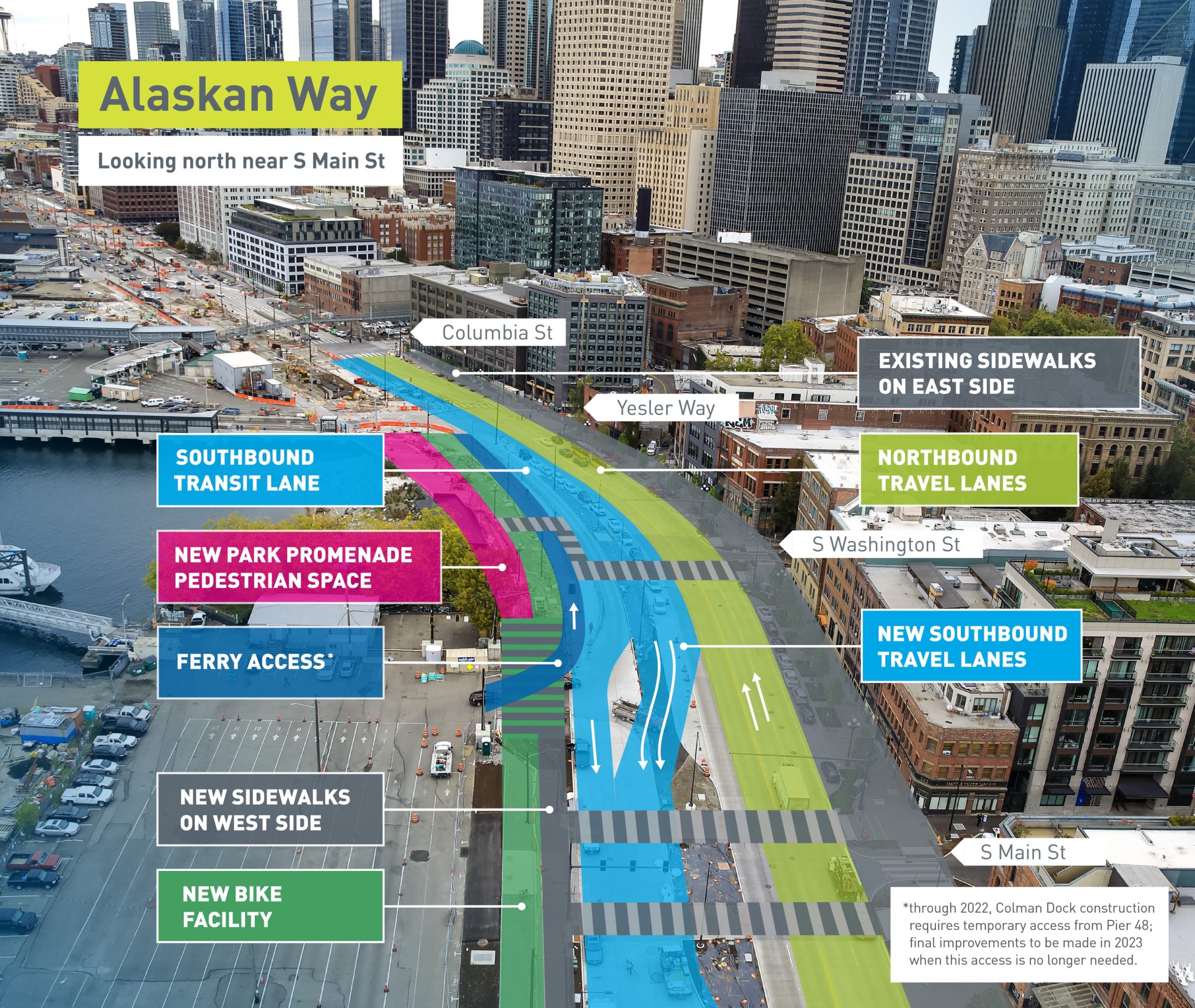
- A southbound transit lane between S King and Columbia streets
- New sidewalks on the west side of the road
- A portion of the brand new 2-way protected bike path between S King St and Yesler Way
- New east-west crosswalks across Alaskan Way S at S Main and S Washington streets
- The first area of the new park promenade between S Washington St and Yesler Way
- North of Yesler Way the area west of the southbound transit lane will remain a work zone
Starting as early as 7 PM on Friday, November 12 through Sunday, November 14, we will be working around the clock to transition traffic to this new configuration safely and efficiently. Access on Alaskan Way will be maintained with one lane in each direction between S King and Columbia streets and officers will be on site to assist in directing traffic.
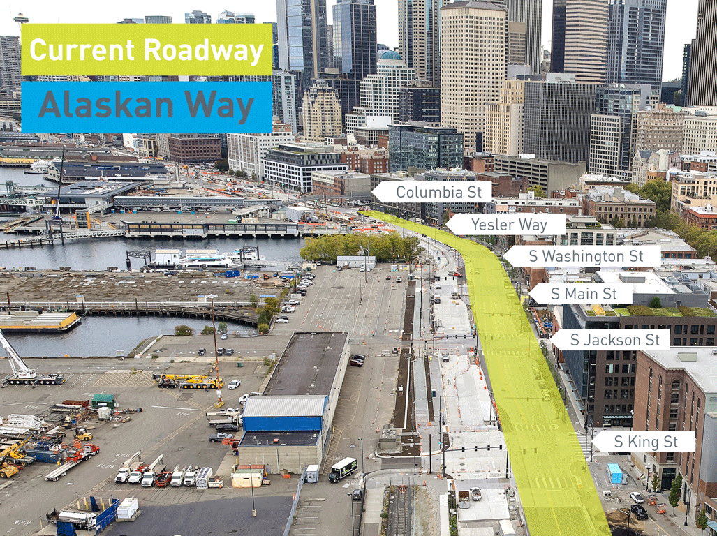
The current configuration of Alaskan Way includes 2 general purpose lanes in each direction within the yellow area in the graphic below:
For more information, please read our flyer.
Here’s what you can expect on Alaskan Way between S King and Columbia streets as part of the new traffic shift:
Once the traffic shift occurs, we will continue to construct improvements along Alaskan Way S, including curbs at S Main St, telecommunications upgrades for compatibility with 4G and 5G technology, construction of medians and permanent bus stop shelters. Accommodating these continued improvements will require temporary lane closures and pedestrian detours. We will continue to share specific construction impacts through our weekly construction email updates – please sign up here, or visit our website at https://waterfrontseattle.org for more information.
In early 2022, a new northbound transit-only lane will be opening on Alaskan Way S, along with new bus stops in both directions in Pioneer Square. We plan to open a northbound stop between S Main and S Jackson streets and another just south of Columbia St, as well as a new southbound bus stop located between S King and S Jackson streets.
North of Columbia St, the traffic configuration will remain as-is until the next planned traffic shift in early 2022, when we anticipate opening new lanes on the east side of Alaskan Way between Marion and Union streets.
Our work in the south end along Alaskan Way cannot be completed in its ultimate and final configuration until Washington State Ferries (WSF) completes the majority of its work to replace the busy ferry terminal at Colman Dock. A “counterflow lane” currently accommodates travel between Pier 48 and Colman Dock and this lane will remain in place until late 2022/early 2023, at which point, our team will come back to this area to remove the counterflow lane and complete our final vehicle lane and 2-way bike lane configuration, median and landscaping, and sidewalk work. We are working closely with WSF on scheduling and access needs throughout construction of both projects.
Learn more:
The Waterfront Seattle Program is a collaboration between the Office of the Waterfront and Civic Projects and other Seattle departments including the Mayor’s Office, the Seattle Department of Transportation, Planning and Development, and Parks and Recreation.
- Contact us by email at info@waterfrontseattle.org or by phone at (206) 499-8040.
- Visit our website: waterfrontseattle.org.