Blog stats: 900 words | 5-minute read
Editor’s Note: This is a blog post from the Waterfront Seattle Program.
The Waterfront Seattle Program is a collaboration between the Office of the Waterfront and Civic Projects and other Seattle departments including the Mayor’s Office, the Seattle Department of Transportation (SDOT), Planning and Community Development, and Parks and Recreation.
The Waterfront Seattle Program is reaching a milestone several years in the making. A new street between the waterfront and Belltown – Elliott Way – opens to the traveling public by 6 a.m. on Monday, May 1.
Construction to open the new connection will begin Friday night (April 28) and continue through the weekend. The completion of this work means that people can travel from the waterfront to Belltown without delays due to train crossings.
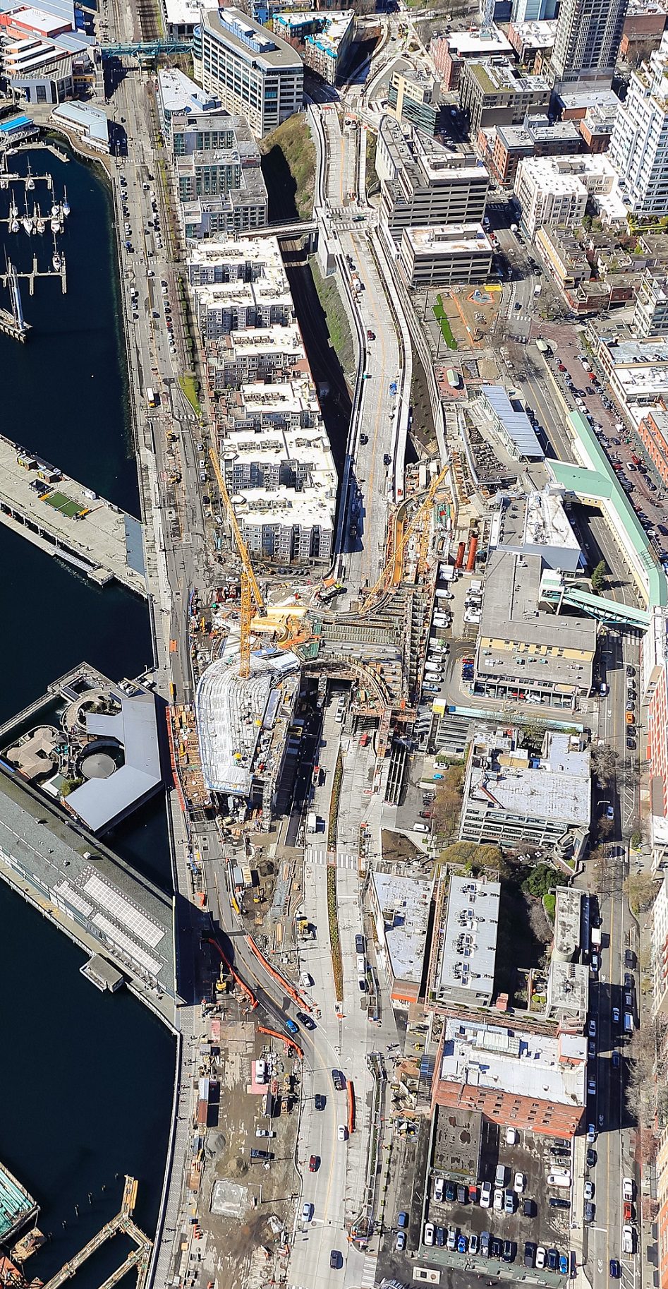
Ever since the State’s completion of the SR 99 Tunnel and the demolition of the Alaskan Way Viaduct in late 2019, the City’s Office of the Waterfront and Civic Projects has been working to build this new street for people walking, rolling, biking, driving, and moving freight. Opening Elliott Way marks a major milestone for the City and the region, providing a vital and direct connection for residents, employees, and visitors alike to use.
How will I get around?
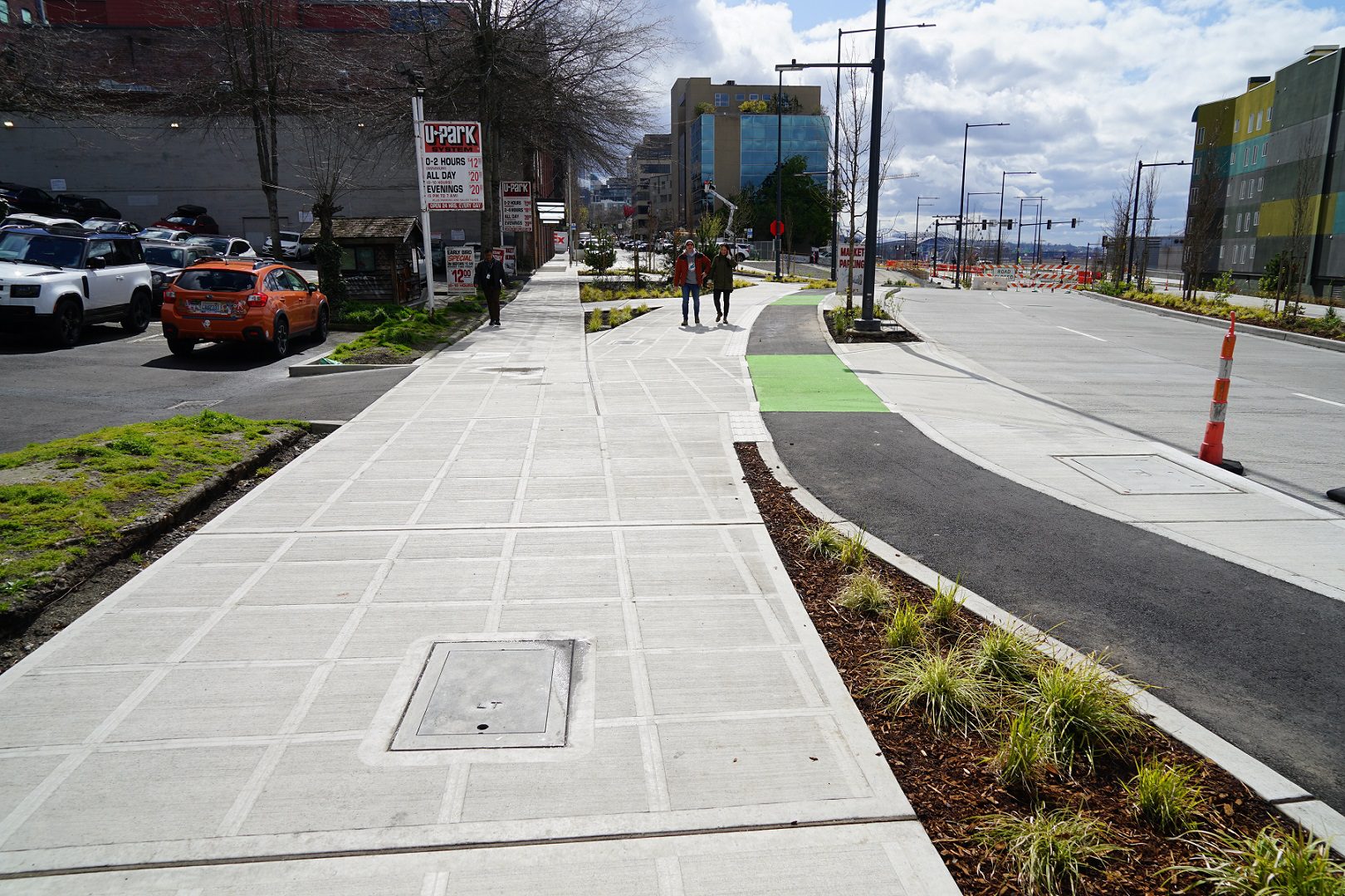
The new Elliott Way provides key connections for pedestrians and people biking and driving. Ultimately, there will be two southbound and two northbound lanes available for travel. However, due to ongoing construction of the new waterfront, there will initially be two southbound lanes and one northbound lane open between the waterfront and Belltown.
People driving will soon be able to traverse between industrial areas south and north of downtown without being interrupted by train crossings at Broad St, supporting essential freight movement through the city.
At the south end, Elliott Way will connect to Alaskan Way near Pine St. At the north end, Elliott Way will connect to Elliott and Western avenues, between Blanchard and Bell streets.
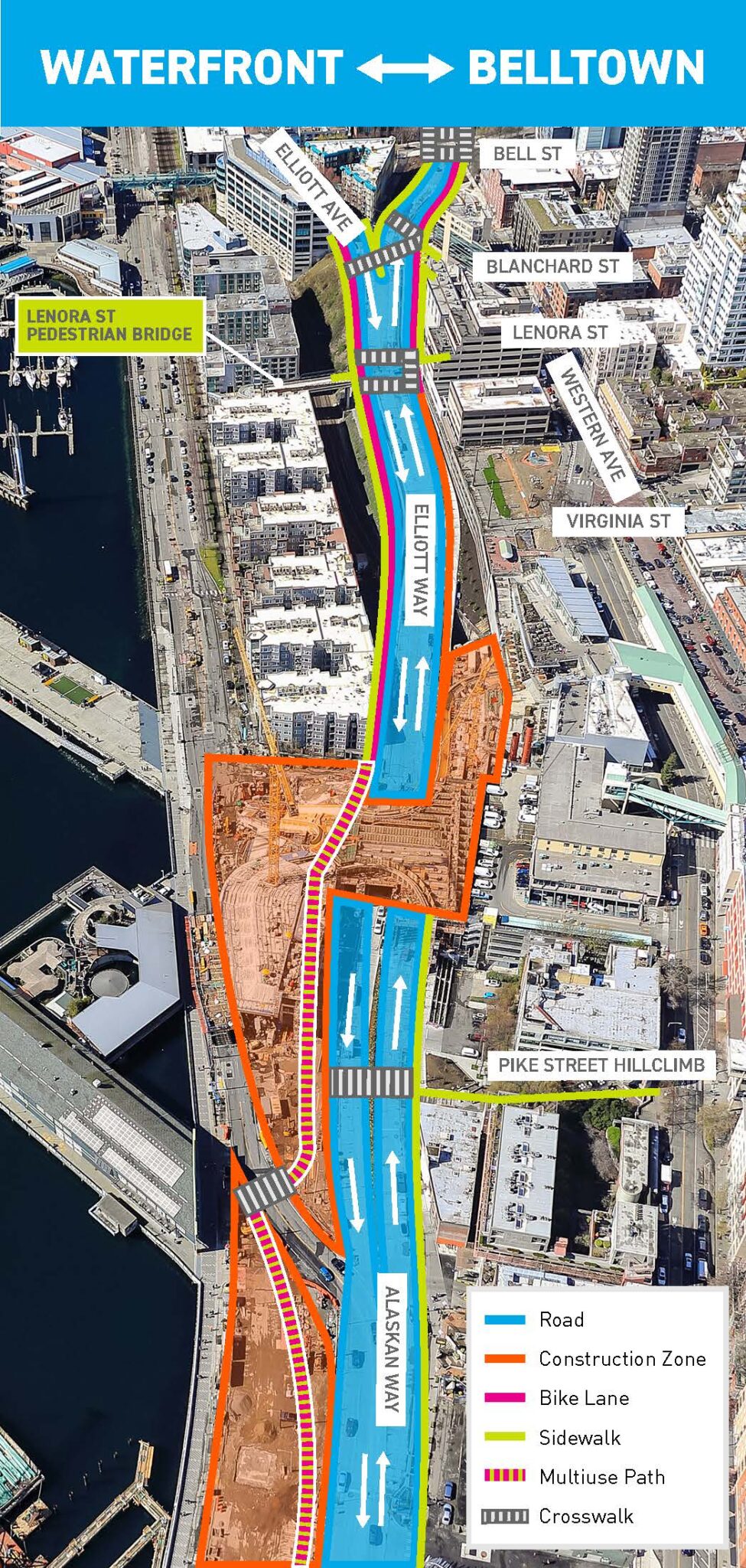
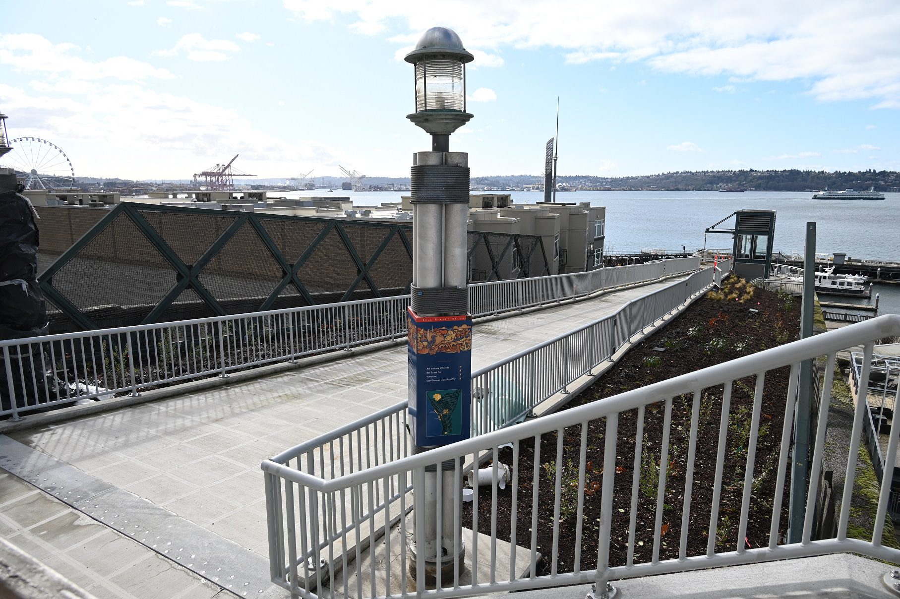
An improved pedestrian bridge and stairs at Lenora St will also be opening to the public along with Elliott Way on May 1. The bridge features new railings, landscaping, and a signalized intersection at Elliott Way. Our partners at the Port of Seattle are working diligently to complete improvements to the elevator. Check out our flyer for more information on how to use this new connection, whether you are walking or rolling.
When all lanes on Elliott Way are operating, car volumes on Alaskan Way are expected to be significantly reduced between Pine and Broad streets. The reduction in traffic provides an opportunity for SDOT to redesign the street to include a protected bike lane connecting the Elliott Bay Trail with the Park Promenade and Bike Path. Design is underway and construction may be complete as soon as the end of 2024.
Construction overview
Construction on Elliott Way began in late 2019 and included setting 18 concrete girders, each weighing up to 75 tons, over the railroad tracks and building roughly 900 feet of retaining wall with 77 piles and 142 anchors to support the new street. There is approximately a 70-foot elevation difference between Union and Bell streets. Work also included connecting the new street into existing streets on both ends, while keeping people moving.
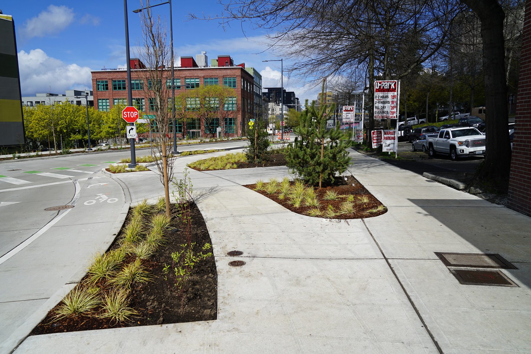
Over 40 varieties of plants, more than 165 trees, and over 46,000 individual plantings were added along the sidewalk to support the City’s and community’s priority for more greenery and natural elements in this area.
Honoring Seattle as Native land
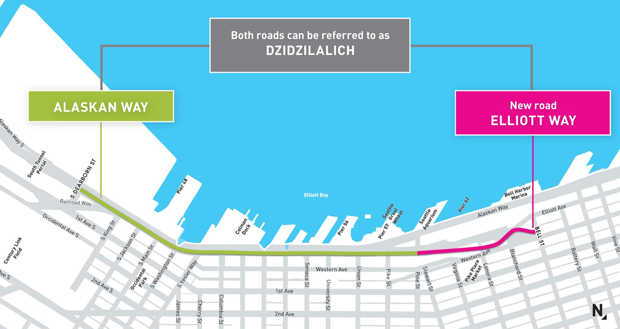
Brown street signs with the honorary street name Dzidzilalich, approved by the Seattle City Council earlier this year, will be in place along Elliott Way and Alaskan Way, between S Dearborn and Bell streets. To learn more about the honorary street name, including an audio clip on how to pronounce the name, courtesy of the Muckleshoot Tribe, please visit our website.
What’s next?
This opening will mark the final alignment of Alaskan Way between S King and Pine streets, which has been shifted several times from east to west during various phases of construction. The area west of the new street will become public park space, which is already under construction between Yesler Way and Union St.
Opening Elliott Way is also the first step in creating the park area between the Seattle Aquarium and Pier 62. There, the Overlook Walk, an elevated public park, will provide a direct pedestrian connection between the waterfront and Pike Place Market. Work is now primarily focused on the promenade, east-west connections, and the protected bike lanes.
Learn more:
- Contact the Waterfront Seattle team at: info@waterfrontseattle.org or (206) 499-8040.
- Visit the Waterfront Seattle website: waterfrontseattle.org.