- The Rainier Ave S efforts are a part of our Vision Zero program to reach zero traffic fatalities or serious injuries by 2030, and our Safe Routes to School program to make it easier and safer for kids to walk or bike to school.
- This year, we’ll complete the new street layout from S Kenny St to S Henderson St.
- As part of our Safe Routes to School program, we’re working to make the intersection of Rainier Ave S and S Rose St safer for everyone.
- We’re also adding a community crosswalk and adjusting signals at Rainier Ave S and S Holly St.
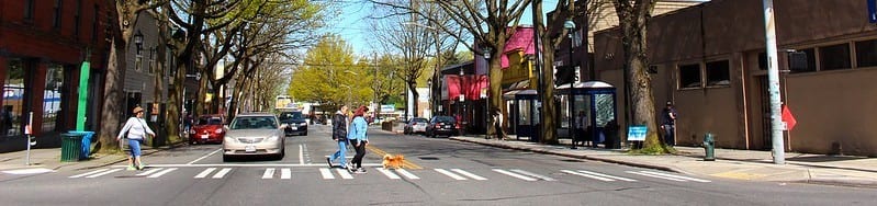
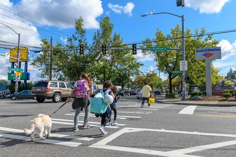
Rainier Ave S is a busy street with restaurants, retail, salons, community centers, libraries, schools, and some of the highest levels of bus ridership in Seattle. Unfortunately, Rainier Ave S also leads the city in vehicle crashes. We can and we must do better, and we are working with the community and our partners to do exactly that. Those efforts – through our Vision Zero and Safe Routes to School programs – have reached another important milestone that we’re excited to share with you today.
Since 2014, we launched a collaborative process to improve Rainier Ave S as part of Seattle’s Vision Zero program to reach zero traffic fatalities or serious injuries by 2030.
During the first phase of this collaborative process, we redesigned the street between Columbia City and Hillman City and successfully improved safety: in the year following the first phase, collisions decreased by 15% overall. Notably, there was a 40% decrease in pedestrian and bicycle collisions, and there were no serious collisions. Building on that success, we launched the second phase of the project between Hillman City and Rainier Beach and last year we made intersection improvements and added bus lanes in specific locations.
“Making it safer to cross the street and more reliable to travel to jobs, schools, and health care are part of our overall approach to community safety, and we are excited to be bringing the next set of investments to Rainier Ave S.”
Sam Zimbabwe, Director of the Seattle Department of Transportation
This year (likely this month!), we’ll complete the new street layout from S Kenny St to S Henderson St. The new street layout typically includes a parking lane (either on the west or east side of the street), one driving lane in each direction, center turn lane, and bus lanes.
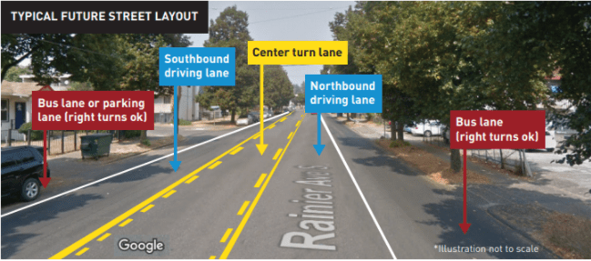
Reducing the number of travel lanes has been proven to reduce speeding – a key factor in the frequency and severity of crashes. The World Health Organization concluded that a 5% reduction in average speed can decrease traffic fatalities by 30%. Also, speeding causes collisions and collisions cause 25% of traffic congestion.
As part of our Safe Routes to School program, we’re working to make the intersection of Rainier Ave S and S Rose St safer for everyone.
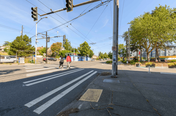
This intersection has one of the highest incidences of crashes in the corridor. Most happen when drivers are turning left onto and off from Rainier Ave S, and many have involved people walking.
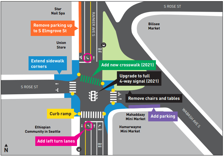
Last year, we expanded the crosswalk and improved visibility for left turns. This September,we‘ll extend the sidewalk corners and upgrade the curb ramps which will make the crossings shorter and more comfortable.
We will do more. Based on feedback from neighboring businesses and the Ethiopian Community in Seattle, next year, we’re also planning to upgrade the pedestrian signal to a full 4-way signal.
The Rainier and Rose project is part of our Safe Routes to School program to help kids get to school safely. Read more about Safe Routes to School in Rainier Valley.
We’re adding a community crosswalk and adjusting signals at Rainier Ave S and S Holly St.
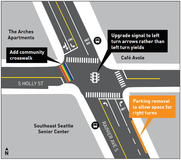
We will add a colorful community crosswalk next to the Southeast Seattle Senior Center and upgrade the signal to have left turn arrows rather than left turn yields. This work on Rainier Ave S and S Holly St will likely happen this September, depending on SDOT crew availability.
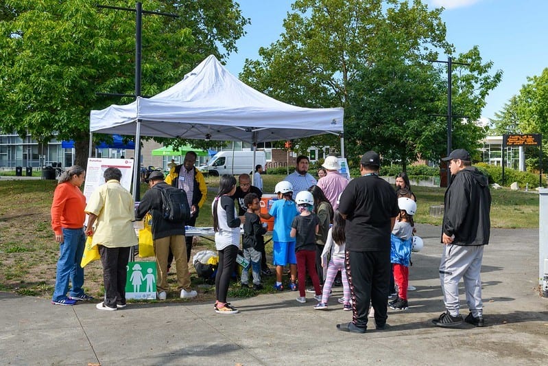
We got to this point by hosting “community conversations” with neighbors at apartment buildings and community centers, collecting surveys in multiple languages, hosting pop-up events, meeting with community groups, going door-to-door, and attending neighborhood events and festivals to learn from neighbors what their priorities and ideas are for Rainier Ave S.
Thank you to all who provided input! We heard people want Rainier Ave S to be safer and easier to cross, while keeping buses moving. These projects will build on previous success and take bold steps to accomplish those goals.
For more information:
- Join our email list.
- Visit our websites at Seattle.gov/Transportation/SRTSRainierValley and Seattle.gov/VisionZero/Projects/Rainier-Ave-S
- Call 206-900-8724 or email us at RainierAveS@Seattle.gov