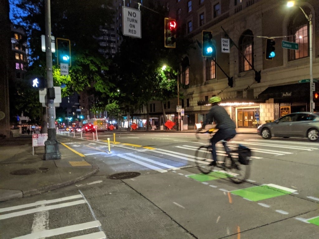
 Using the new 4th Ave protected bike lane on a recent fall evening. Photo Credit: Dongho Chang.
 Summary
- Late last month, we built the first phase of the 4th Ave protected bike lane between Madison St and Pine St.
- With the Levy to Move Seattle, we’re investing in all kinds of transportation options – including this bike route on 4th Ave – to get people of all ages and abilities where they need to go.
- As early as mid-November (weather and crew capacity permitting), we’ll extend the protected bike lane one way northbound another 5 blocks (about 0.4 miles) to Bell St Park.
- Next year, we plan to make the protected bike lane 2-way (within the same footprint) and extend it to Vine St.
We built the first phase of the 4th Ave protected bike lane in September!
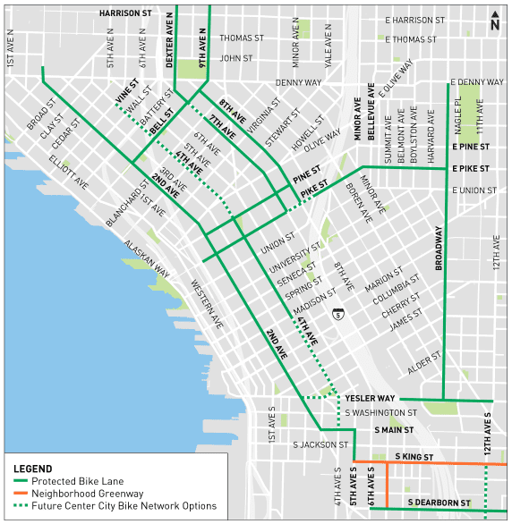
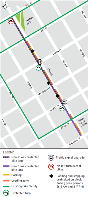
This 0.4-mile-long segment along 4th Ave connects Pine and Madison streets downtown (see the map below for details). This is part of the downtown Center City Bike Network. We previously shared our plans for 4th Ave in a September blog post.
The 4th Ave protected bike lane expands the Center City Bike Network, a priority identified in the Seattle Bicycle Master Plan, and is part of Mayor Durkan’s vision to enhance bike infrastructure and provide more travel options for getting around during the COVID-19 pandemic.
Better, safer bike lanes make biking a more viable transportation option to and from downtown. As we prepare for our new normal in the midst of the pandemic, Seattle has the opportunity to build lasting, positive change toward a more livable, safer city for all.
Especially now, people who live, work, and visit Seattle need safe, healthy, and affordable options to get around. The new protected bike lanes on 4th Ave are one piece of the puzzle to help people travel safely while Seattle works to reopen and fight the climate crisis. We also recognize that not everyone is able to bike, so a high priority of the Center City Bike Network and this project is to maintain transit accommodations and make it easier to cross the street at intersections.
The completion of this first phase was a team effort with several construction crews working on the same weekend to minimize impact on neighbors.
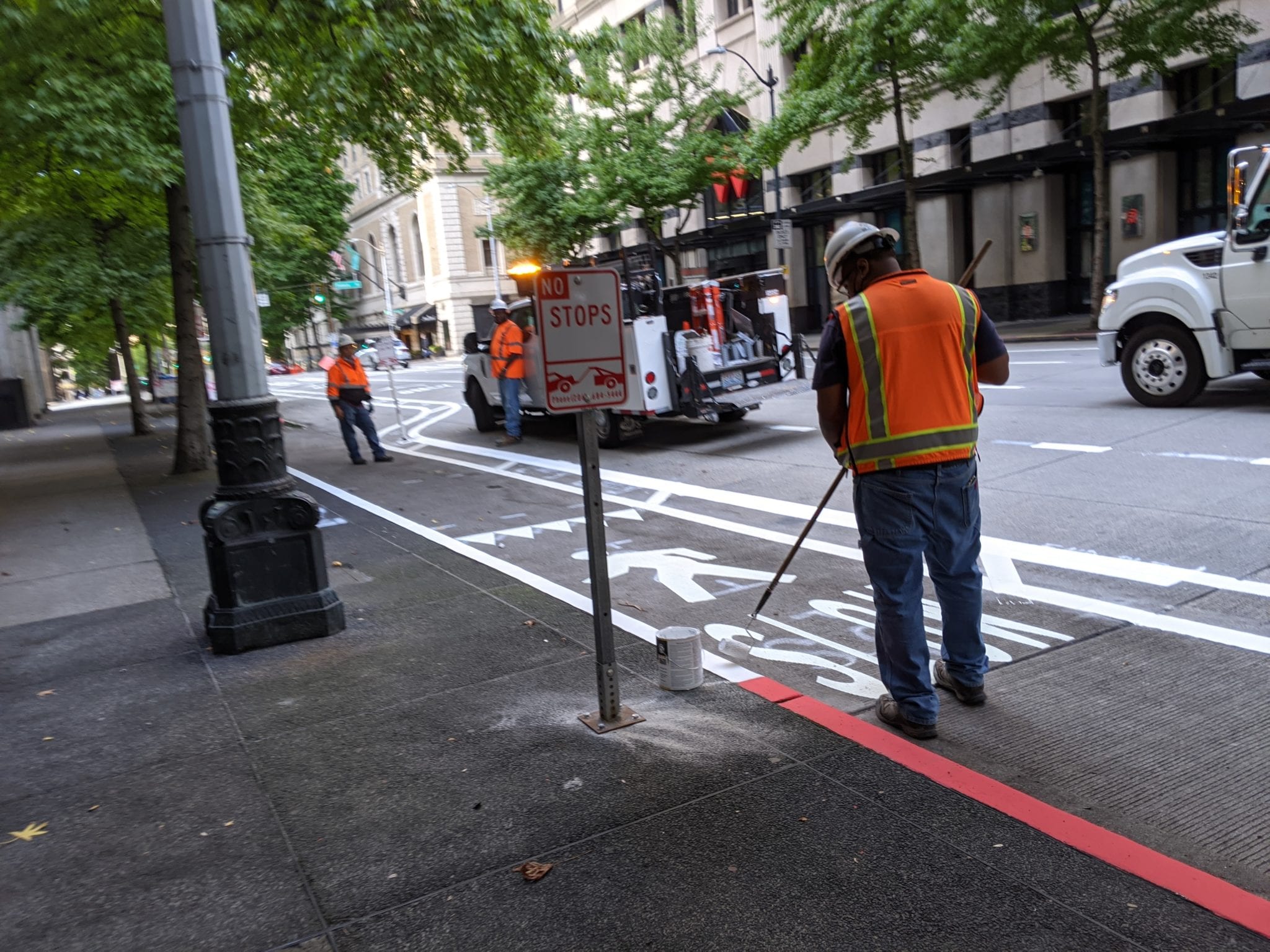
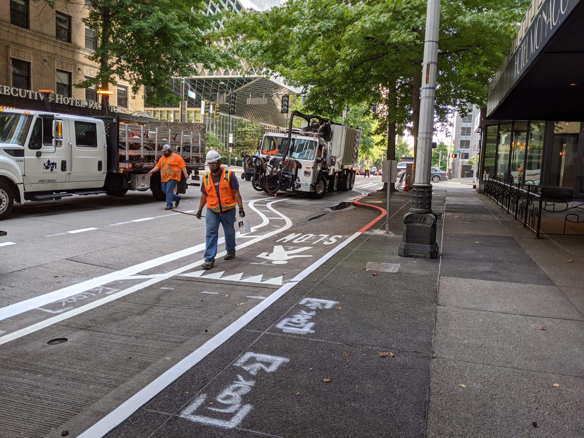
We worked with Specialized Pavement Marking (SPM), based in Portland, to remove the old lane markings using a high-pressure water jet (a technique called hydroblasting). Water and paint were vacuumed up and thermoplastic markings were placed for the new lanes. Thermoplastic markings are more resilient than paint.
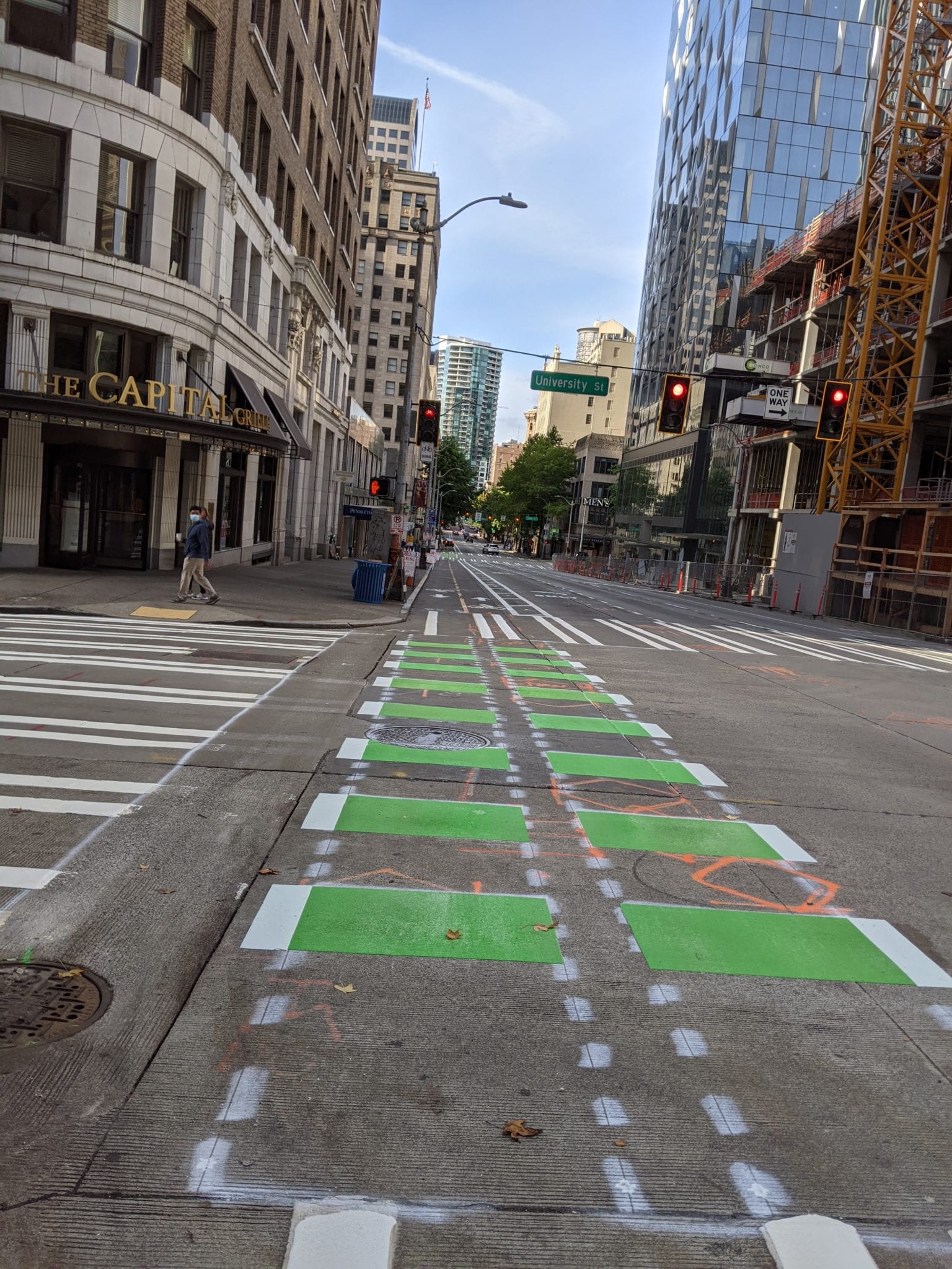
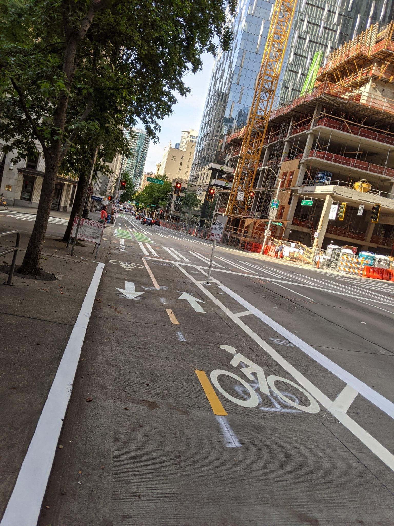
We also repainted crosswalks, installed new parking signs, and our signals team finished the installation of all the bicycle signals, left-turn signals, and overhead signs on Sunday, September 20. We finished installing the flex posts and green bike lane markings on Monday, September 21.
Flashback to 2017! SDOT City Traffic Engineer Dongho Chang explains what different markings in the bike lanes mean in this video.
With the Levy to Move Seattle, we’re investing in all kinds of transportation options – including this bike route on 4th Ave – to get people of all ages and abilities where they need to go.
In 2015, Seattle voted to approve the Levy to Move Seattle. This was a vote to invest in transportation safety improvements, street and bridge maintenance, and expanded options for reliable, affordable transportation in our growing city.
Our work on 4th Ave and the Center City Bike Network would not be possible without your contributions through the Levy, which provides almost 30% of our transportation budget to fund hundreds of projects throughout the city. These projects make it easier, safer, and smoother to get around town – whether you’re walking, rolling, biking, driving, or taking public transportation. Thank you!
We’re aiming to take another big step for the Center City Bike Network as soon as November.
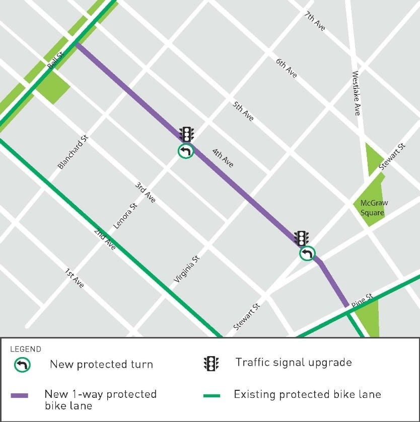
Weather and crew capacity permitting, our goal is to extend the protected bike lane northbound another 5 blocks (about 0.4 miles) to Bell St.
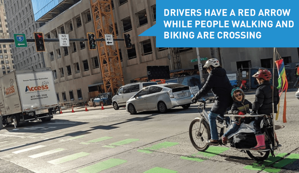
These changes come with improvements for everyone. At the intersections of 4th Ave and Stewart St & 4th Ave and Lenora St, we’ll upgrade the traffic signals so people biking, walking, and rolling have separate signal phases from drivers. This reduces collisions and makes walking, biking, driving more comfortable and predictable.
Next year, we plan to make the protected bike lane 2-way (within the same footprint) and extend it to Vine St.
We also plan to extend the 2-way protected bike lane south from Spring St to the 2nd Ave protected bike lane via Dilling Way / Yesler Way. The map below shows the existing and planned Center City Bike Network.