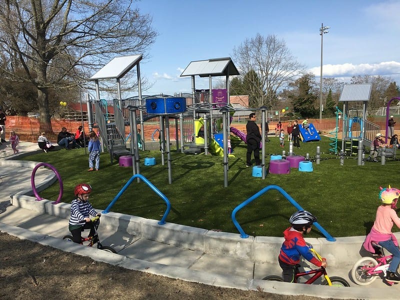
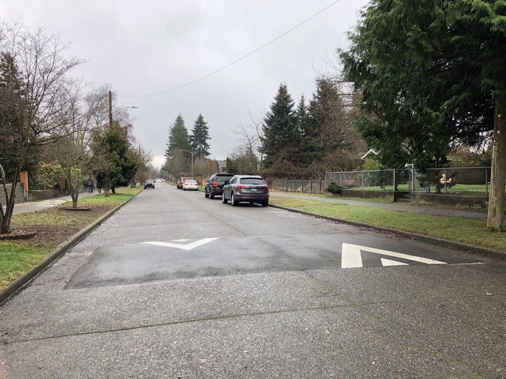
 A sunny bike ride near the High Point play area in West Seattle. Photo Credit: SDOT Flickr.
 Thanks to the ongoing engagement and enthusiasm of the community, this new north-south neighborhood greenway is becoming a reality! We’re starting construction later this month on the second phase of the West Seattle Neighborhood Greenway and a new walk/roll/bike signal across 35th Ave SW.
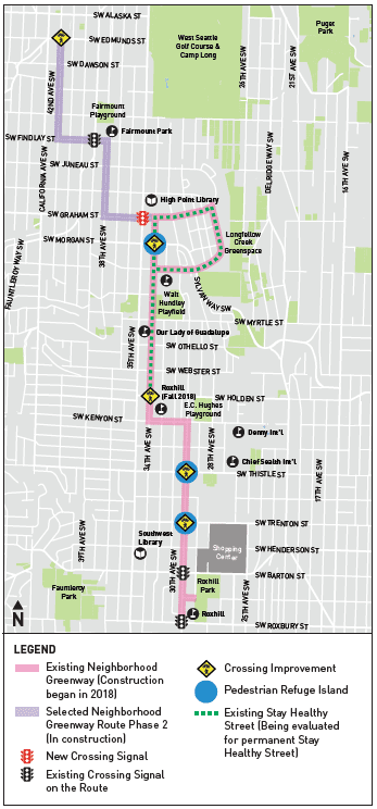
Phase 2 of the neighborhood greenway runs from SW Graham St to SW Edmunds St using 38th Ave SW, SW Findlay St, and 42nd Ave SW. See the second phase of the neighborhood greenway route in purple in the map below.
Our neighbors in West Seattle have helped us design this neighborhood greenway to connect people with schools, parks, local businesses, and the greater transportation network. During our community outreach, lots of people gave feedback via an online survey, public events, and conversations with the project team. We heard requests for a neighborhood greenway with improved connections to the Junction and Westwood Village, parks and schools; fewer hills to climb; slower speeds; and safer crossings at busy streets like 35th Ave SW.
Our Bicycle Master Plan also calls for neighborhood greenways in this area.
We planned the final route in a collaborative process after listening to the community, reviewing existing transportation plans, and analyzing traffic data. The route avoids the steepest hills and prioritizes streets with lower vehicle speeds and traffic volumes.
All in all, the new greenway brings affordable, active transportation options to people in the neighborhood of all ages and abilities.
Neighborhood greenways are safer, calmer residential streets for you, your family, and neighbors. We make people walking, rolling, and biking the priority.
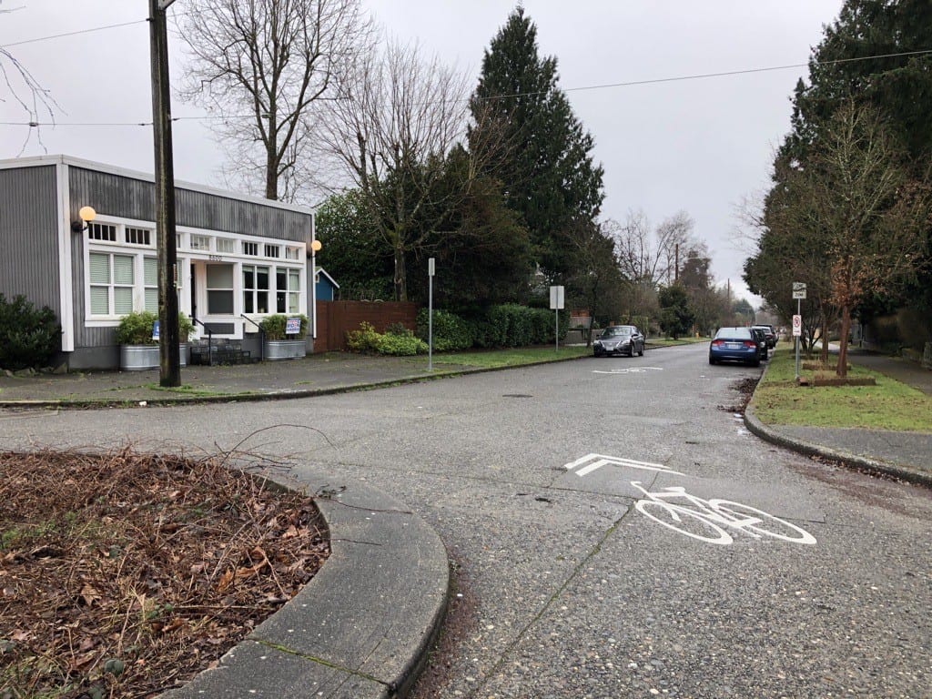
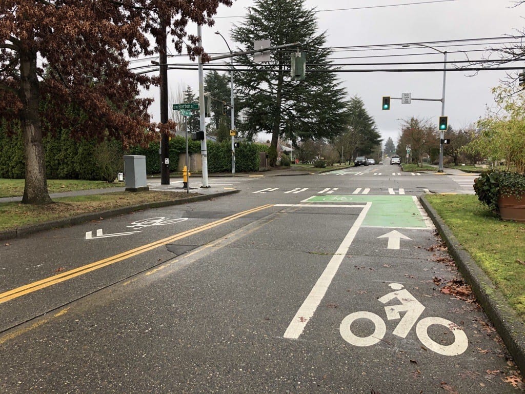
Neighborhood greenways can include: 20 mph speed limit signs, speed humps to calm traffic, stop signs for side streets crossing the neighborhood greenway, signs and pavement markings to help people find their way, and easier crossings of busy streets with crosswalks, flashing beacons, or traffic signals.
Here’s some of what we have heard from neighbors about this project:
“I received the mailer this weekend and am excited to see that the WS Greenway will go right in front of our house.”
“As a driver, bike rider, and bus rider I feel like I understand the sharing of road resources. As a person that drives to do video production I definitely value my ability to move about the city easily. Thanks again.”
These changes help us all reach our Reconnect West Seattle mode-shift goals. With support from us and our transportation partners, we are looking to people in and around West Seattle to – within their means – consider changing how they travel when it is safe to return to typical travel habits. One way we support this is by making it easier and safer to ride bikes through these neighborhood greenways and other bicycle network improvement projects.
We’re also making the intersection of 35th Ave SW and SW Graham St safer for people walking, rolling, and biking to travel through.
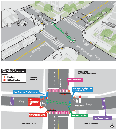
The rendering to the left shows what the intersection of 35th Ave SW and SW Graham St will look like once construction is complete.
We will add a traffic signal on 35th Ave SW – partially funded by a grant by our partners at the Washington State Department of Transportation – which will also include a safe crossing for people biking, and a crosswalk for people walking and rolling. We’ll also make it so people driving can only turn right onto 35th Ave SW, which means they won’t be able to legally cross over the path intended for people biking.
These changes will make the intersection feel safer and better lighting will make everyone more visible. Prioritizing the safety of people walking, rolling, and biking – while restricting the ability of people driving to make left turns onto 35th Ave SW – at this signal is especially critical because we have seen tragic injury and loss of life nearby. Two people have died at this intersection in recent years as a result of crashes. James St. Clair was killed while walking and Susanne Scaringi was killed while biking.
These were our neighbors. They were someone’s child, someone’s partner, someone’s sibling or parent. Our hearts are heavy for each person who has passed. This type of loss impacts, yet connects, so many of us. With this grief also comes a shared affirmation of our support for safe streets and to our Vision Zero efforts – efforts that we know are long-term and require a collective, systems approach to change at every level, including with signals like this one.
We will let the community know more about the construction start date for this intersection once we have a schedule from the contractor.
The construction on the neighborhood streets will have a small impact on you and your neighbors. We will work with you and the construction contractor to minimize construction impacts as much as possible. Construction at the 35th Ave SW and SW Graham St intersection may be a little more involved and impactful.
When work is about to begin on your street, you will see “No Park” signs placed in advance.
At 35th Ave SW and SW Graham St intersection, you can expect work to occur during the typical weekday hours of 7 a.m. – 5 p.m., Monday through Friday. You can also expect:
- Temporary on-street parking restrictions, with “No Park” signs placed in advance
- Driveway closures when crews are prepping and building the sidewalk in front of driveways
- Flaggers directing people driving and biking around the work
- Parking restrictions to allow space for work and equipment
- Detours around the work area for people walking, rolling, and driving
- Noise, dust, and vibrations during work hours