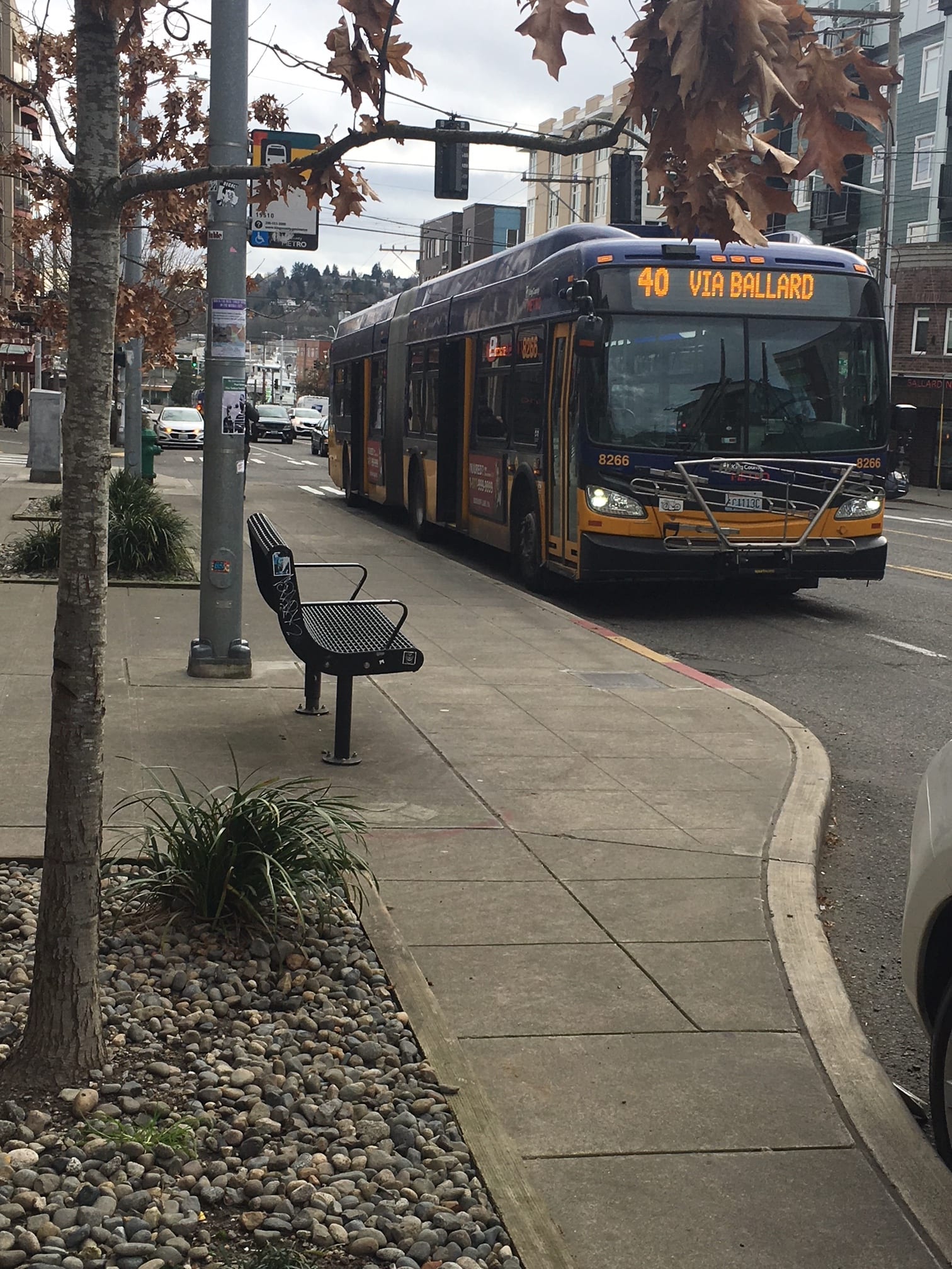
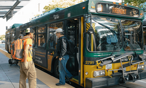
 Route 40 bus. Photo Credit: SDOT.
 Summary
- We’re working to make Route 40 bus trips more reliable, safe, and on-time for you and your neighbors – thanks to your Levy to Move Seattle tax dollars.
- We want to get your feedback on the concepts we’ve proposed! Read about them and take our survey.
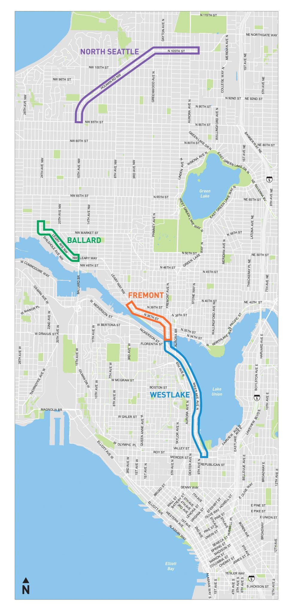
- Our proposal focuses on four areas: Westlake, Fremont, Ballard, and North Seattle. These are affected most by transit speed/reliability concerns.
- You can watch the project update video and visit the Route 40 page on our website for more details.
King County Metro’s Route 40 helps thousands of people get around the city each day. Over the past few years, we’ve been working with Metro and the community to find ways to make this bus route more reliable, safe, and on-time.
The Route 40 bus line is over 13 miles long and serves the Northgate, Crown Hill, Loyal Heights, Ballard, Fremont, South Lake Union, Downtown Seattle, and Pioneer Square neighborhoods. Over 95,000 people live within a half-mile of Route 40!
Before the COVID-19 related reductions in transit ridership, Route 40 had 3 million rides annually and accounted for 3% of all Metro’s ridership. During the pandemic, it has remained one of Metro’s top highest ridership routes and currently serves approximately 3,800 customers each day.
Due to Route 40’s high ridership and pathway through areas that are often congested, it is often late – especially the northbound direction. Delays can cause stress and tangible issues for people trying to get to work, appointments, activities, or wherever else they need to go. That’s one important reason why we’re making changes.
We’re developing a project in partnership with Metro to make Route 40 bus trips more reliable and on-time. This work will also improve safety for people walking, biking, and rolling along this route.
Our goal is to reduce transit travel times by 5-10% during peak periods (the equivalent of 3-6 minutes over an hour), improve service reliability, and make it safer and easier to access transit.
Along the way, we’ve been engaging with Route 40 riders, the nearby community, and transit operators to understand needs and priorities. Last year, this included a ride-along with Route 40 bus operators to hear their thoughts and see the route from their perspective; drop-in sessions; and a community survey taken by over 1,000 community members. This feedback helped us decide which ideas to pursue and analyze.
We’ve come up with some concepts and want to know what you think!
We heard strong support for improvements that make buses on-time and reliable, including installing bus-only lanes. So, those – among other ideas – are in our plans!
We’re currently in the process of narrowing down our concept plans and would like your feedback. Your input will help us refine and prioritize our concepts.
To learn more about the project and share what you think:
First, watch the project update video.
Learn more about Route 40 and check out our proposed changes along the Route 40 corridor in our 25 minute pre-recorded presentation. Click on the links below to jump to various parts of the video.
- View a Route 40 corridor overview.
- Learn about the project objectives and timeline.
- Check out specific improvements in Westlake, Fremont, Ballard, and North Seattle.
Fill out our online survey by April 16.
Let us know your thoughts on the proposed changes through a quick survey.
Participate in a drop-in session.
Attend an online drop-in sessions with the project team to ask questions and share your feedback about the concepts. Join the April 7th 5:30-6:30 pm drop-in session or the April 8th 12:00-1:00 pm drop-in session. For more information on the project, visit our Route 40 webpage.
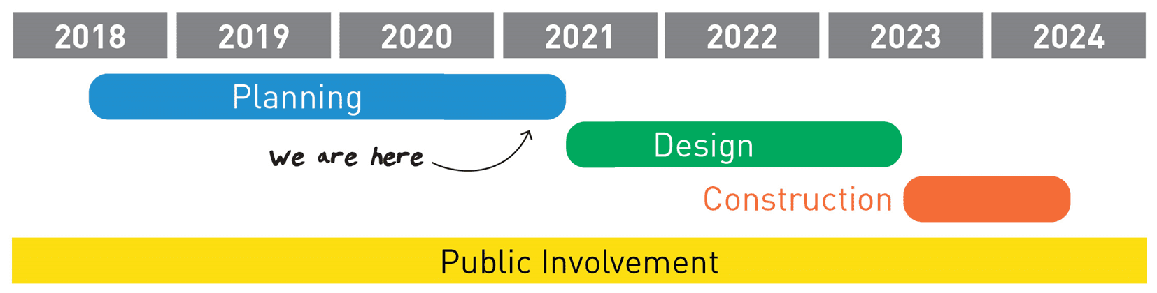
Our community outreach won’t end when the survey closes! Throughout this project, we’ll continue to work closely with you. We anticipate reaching final design and starting construction in 2023.
Your Levy to Move Seattle tax dollars are hard at work alongside federal funding and grants. Take a look at the ways we’re planning to keep you moving safely, on-time, and reliably wherever Route 40 takes you.
Suggested improvements are focused around four key areas: Westlake, Fremont, Ballard, and North Seattle.
In some areas, we propose improvements like “queue jumps,” which allow buses a head start at traffic signals at intersections and bridges. Changes like new bus-only lanes will also help transit riders travel faster and more reliably.
Other changes would make this corridor safer for walking, biking, and rolling. New turn lanes and improved bike lane connections are proposed alongside new accessible pedestrian signals, curb bulbs, and concrete bus pads for people to wait on at bus stops. Together, these help people board and de-board the bus and move around the city safely, supporting Seattle’s Vision Zero initiative to end traffic deaths and serious injuries on city streets by 2030.
Learn more:
Watch the project update video and visit the Route 40 page on our website for more details on the proposed improvements.