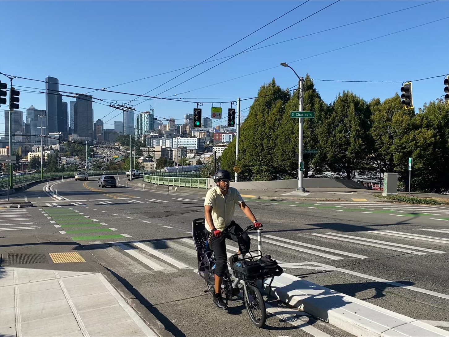
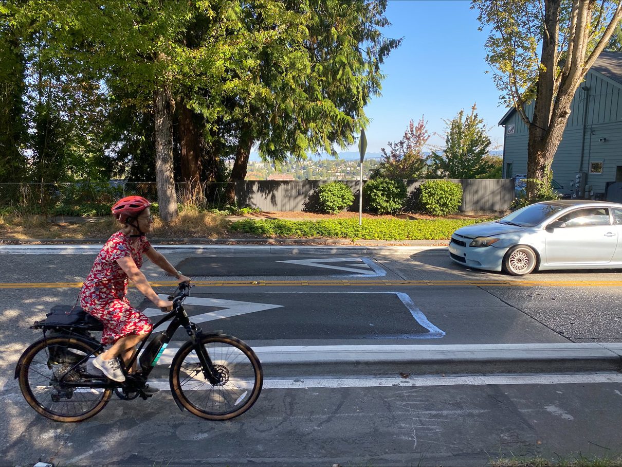
 A person bikes into Beacon Hill using a new protected bike lane, just south of the Dr. Jose Rizal Bridge. Photo: SDOT
 Blog stats: 600 words | 3-minute read
At-a-glance:
- The Beacon Ave S & 15th Ave S Safety Project is officially complete!
- This project transformed a section of Beacon Ave S and 15th Ave S through the North Beacon Hill neighborhood to add new protected bike lanes, repair sidewalks, add new ADA-accessible curb ramps, support easier access to bus stops, and more.
- The project makes it safer and easier to walk, bike, and roll to the many businesses, community destinations, and transit stations in the growing North Beacon Hill neighborhood.
- Today we’re hosting a community celebration at El Centro de la Raza in Beacon Hill from 4-6 PM to mark the milestone.
- We appreciate everyone in the community who was involved in advocating for the project, shaping the design, and working together with us during construction.
- This project was funded by the voter-approved 2015 Seattle Transportation Levy. Thank you, Seattle!
- We’re continuing to celebrate new and upgraded bike routes across the city this year – learn more about our “Hot Bike Summer” celebrations in this blog post.
We’re excited to announce the completion of the Beacon Ave & 15th Ave Safety Project. As one of several important projects reaching completion this summer and fall, it’s part of an ever-growing network of safer, more comfortable connections, particularly in South Seattle.
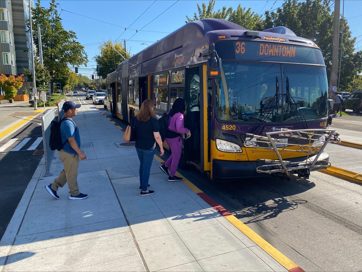
Whether you’re biking, scooting, walking, rolling, riding transit, or driving, you can now use these improved streets to get where you’re going. The project helps connect Beacon Hill with Little Saigon, which extends into Downtown Seattle, Capitol Hill, and many other Seattle neighborhoods.
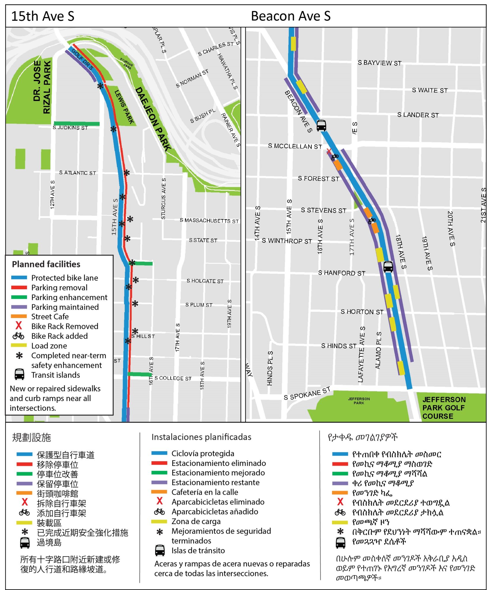
Key Features
- Repaired sections of sidewalk near every intersection along the entire route.
- New pedestrian push buttons at every crossing at S Hanford St and Beacon Ave S and at the south and west crossings of 15th Ave S and S College St.
- 62 new or upgraded curb ramps helping people who use wheels to safely travel from Dr. Jose Rizal Bridge to S Spokane St.
- Concrete-protected bike lanes on both sides of 15th Ave S.
- Post-protected bike lanes on both sides of Beacon Ave S.
- New bike signals at the intersections of 15th Ave S & Beacon Ave S and Beacon Ave S & S Spokane St.
- New bus stop islands on both sides of Beacon Ave S at S Hanford St and outside of Beacon Hill Station.
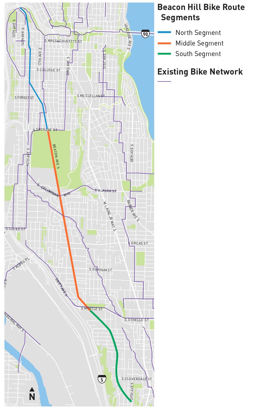
Project Map
Words from the Community
“I have been commuting by bike through the rough roads of Beacon Hill for close to a decade. Needless to say I was thrilled when work started on protected bike lane with new smooth pavement. Now that the project is complete, I get to experience another, unexpected joy: watching groups of kids commute to school using the bike lanes (photo from this morning attached). This is not something I ever saw before. What a positive difference this makes for them and our community as a whole. Great job bike lanes team!!” – Beacon Hill resident
What’s Next
The north segment is just the beginning! Soon, we’ll continue the planning and design process for the middle and south segments of the project to extend these safety improvements for the rest of Beacon Hill.
Subscribe to our project email listserv to hear about community engagement and project feedback opportunities.