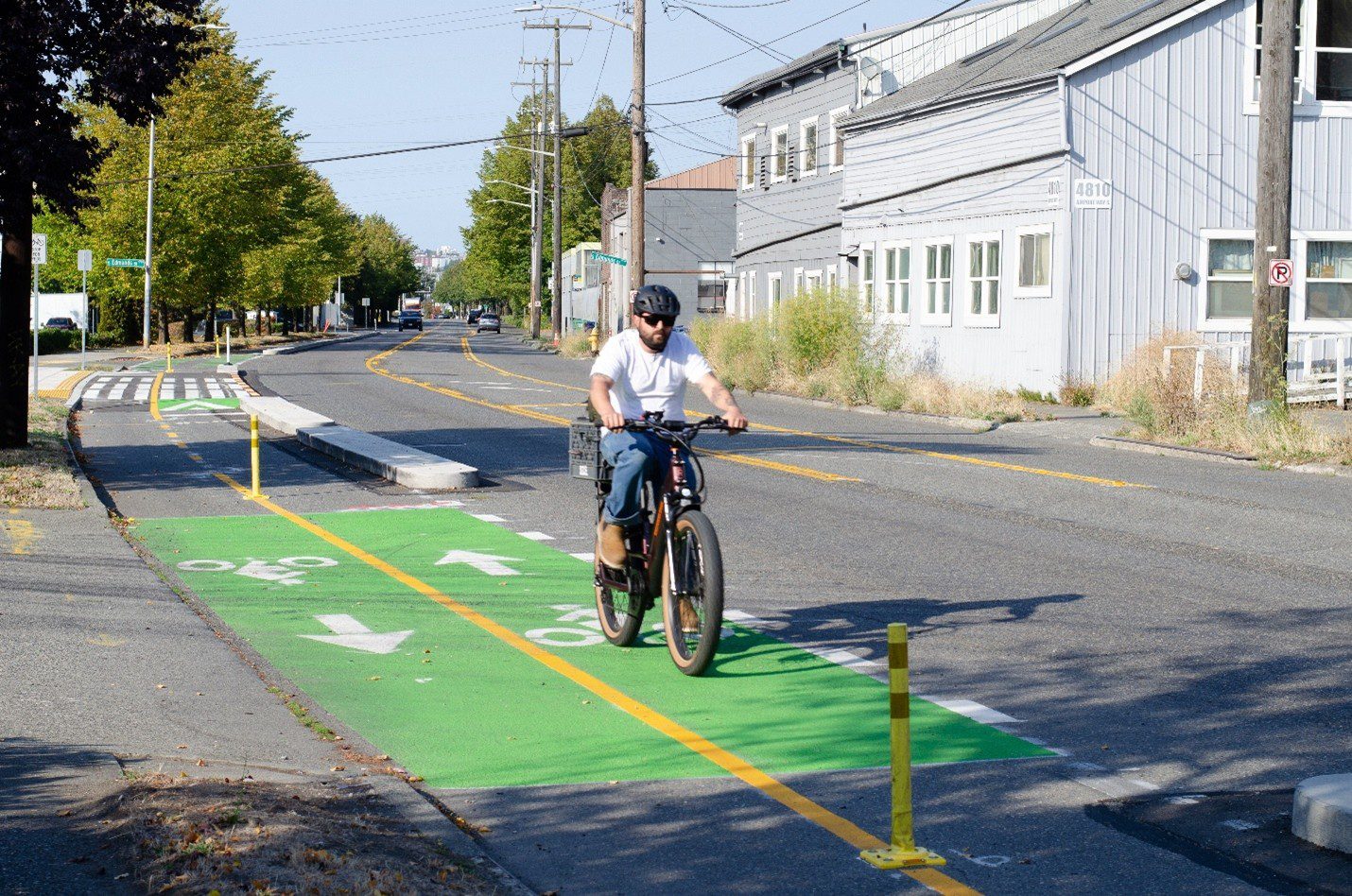
 A person bikes on a new two-way protected bike lane on Airport Way S. Photo: SDOT
 Blog stats: 650 words | 3-minute read
At-a-glance:
- Major construction on the Georgetown to Downtown Safety Project is now complete!
- This project, which began construction last fall, builds a 3-mile route for people biking and riding scooters in an area with a history of crashes and injuries.
- It improves safety for people traveling, working, and living in Georgetown, SODO, Downtown, and nearby neighborhoods.
- The project also completes a vital link in a system of north-south trails between central Seattle and the South End while expanding access to light rail and other transit routes.
- We’re hosting a local community celebration this Sunday to mark the milestone. We appreciate the close involvement of everyone who helped shape the design and worked together with us during construction.
- This project was funded by the voter-approved 2015 Seattle Transportation Levy. Thank you, Seattle!
We’re excited to announce the completion of the Georgetown to Downtown Safety Project! The project helps keep everyone safe by adding protected bike lanes on busy arterial streets to keep people biking and scooting separated from cars and trucks. It also added a wide range of safety features such as all-way stops, a raised bus stop, and signal upgrades.
Georgetown and SODO are unique Seattle neighborhoods – a blend of commercial and industrial businesses, retail, dining, breweries, and other small businesses, as well as residential communities. The design was developed by traffic safety engineers engaged with community members, businesses, and local organizations.
Project Overview
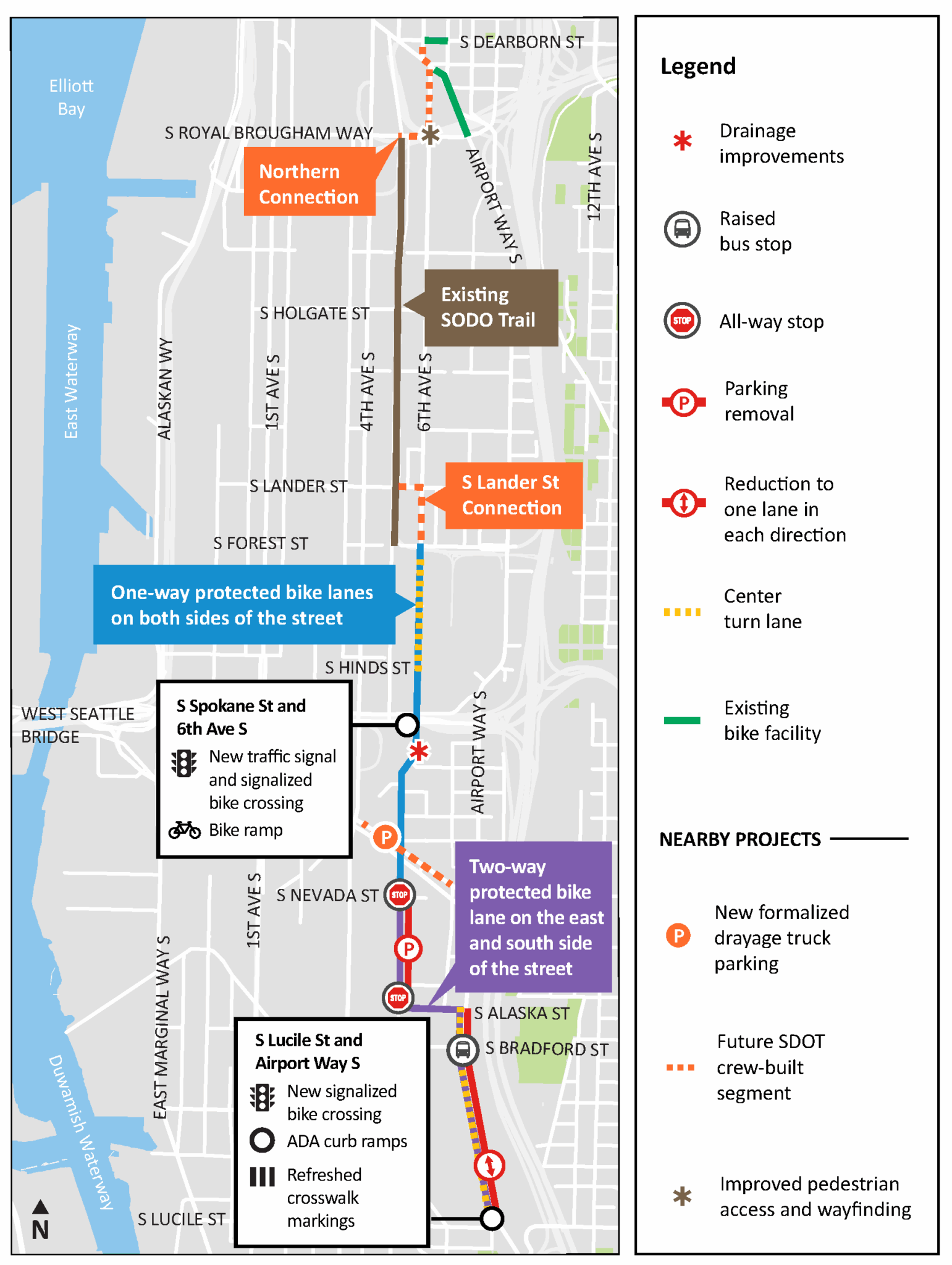
Overall, this project extends the separated route for people biking and scooting on the north and south ends of the existing SODO Trail on 5th Ave S in SODO.
At the south end, the project added a new connection from the trail to 6th Ave S, where the project’s protected bike lanes now extend all the way to S Lucile St in Georgetown. The project helps people more easily connect to existing light rail stations in SODO and Downtown Seattle and more conveniently catch their bus.
The project will also add new protected bike lanes at its north end, from the existing Center City Bike Network and S Dearborn St lanes in Chinatown-International District, to the SODO Trail. Design for this portion is nearly complete, and we are coordinating with partners in the neighborhood prior to construction.
Key Features
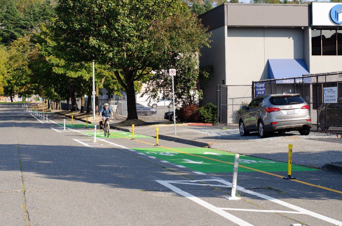
- Two-way protected bike lane on the west side of Airport Way S from S Lucille St to S Alaska St, then extending to S Nevada St and 6th Ave S.
- One-way protected bike lanes on 6th Ave S from S Nevada St to S Forest St.
- Two-way, center turn lane on 6th Ave S from south of S Forest St to S SpokaneSt, calming traffic and making it easier for vehicles to enter and exit driveways.
- S Spokane St and 6th Ave S: New traffic signal, signalized bike crossing (to be installed), and bike ramp.
- S Lucile St and Airport Way S: New bike signal with crossing (to be installed), ADA-accessible curb ramps, and refreshed crosswalk markings.
- All-way stop on 6th Ave S at both the intersections with S Alaska St and S Nevada St.
- Raised bus stop on the west side of Airport Way S at S Edmunds St.
- Two-way freight movement necessitated the removal of parking on the west side of 6th Ave S from Alaska to Industrial streets

Project Map
Thank you for your interest in this project, and your input if you engaged during planning, design, or construction. We hope you check out the new route for yourself soon!