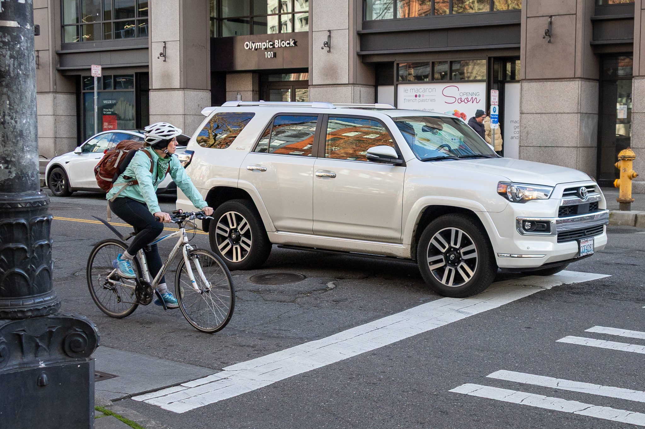
 A person biking waits for a green light alongside an SUV on Yesler Way and 1st Ave S, where SDOT is installing a new two-way protected lane. Photo: SDOT
 Blog stats: 600 words | 4-minute read
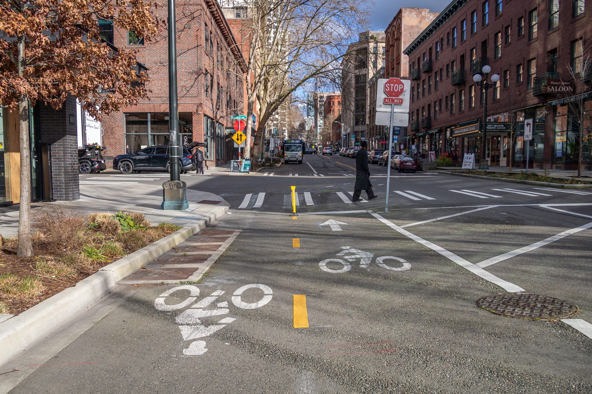
Yesler Way is getting a new protected bike lane from Occidental Ave S to the waterfront. This project fills a gap in Seattle’s City Center Bike Network and creates a much-anticipated, safer connection between Pioneer Square, downtown, and the waterfront.
Building this missing piece to the city’s bike network wasn’t simple. The historic nature of Pioneer Square and the age of the infrastructure made adding modern bike and signal improvements complicated, requiring careful design and coordination.
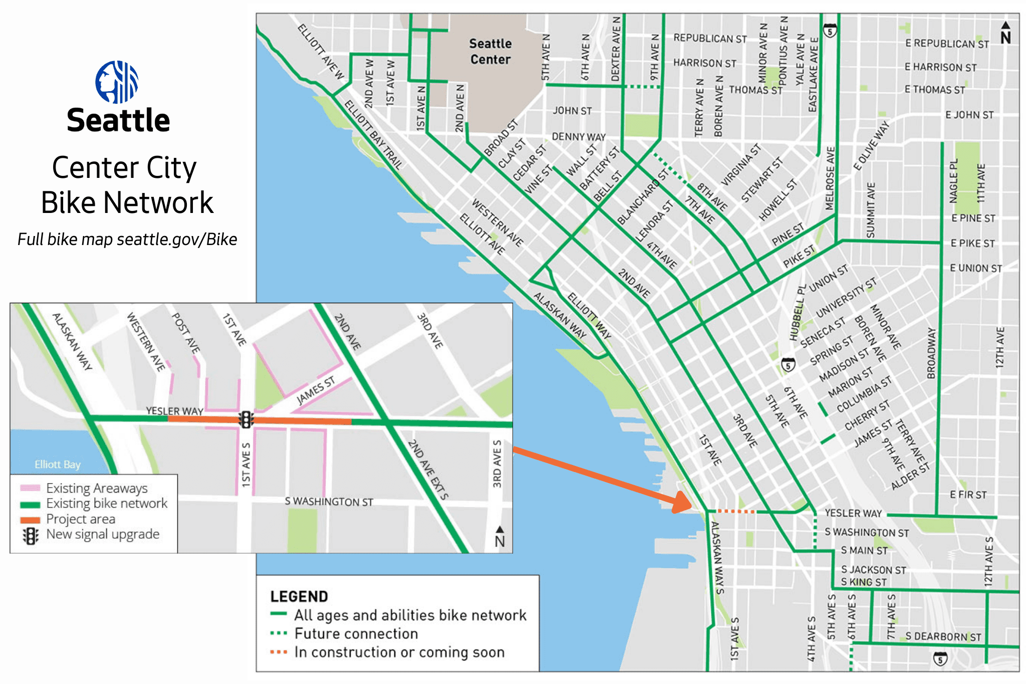
We worked closely with the Alliance for Pioneer Square to move this long-planned connection forward and include an all-walk for pedestrians.
Construction officially began Monday with underground work to prepare signal improvements, and more visible changes on the street will follow in the coming weeks.
Modernizing our streets while preserving history
Many sidewalks and streets in Pioneer Square are built over empty spaces called “areaways.” This has to do with the neighborhood’s unique history.
Pioneer Square was built in the 1800s along Elliott Bay and was the city’s original downtown. A massive fire broke out in 1889, destroying 25 blocks of the area.
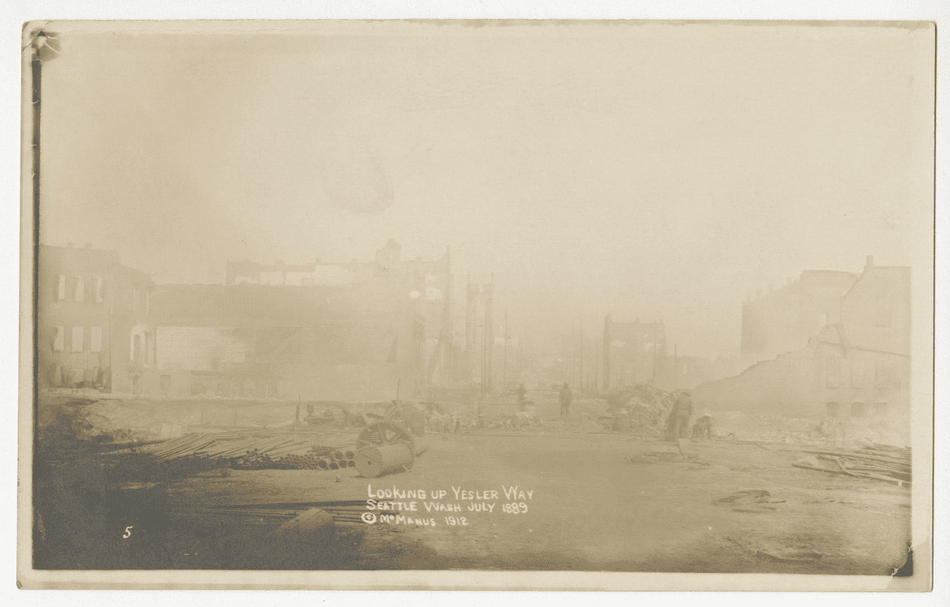
When the city was rebuilt, street levels were raised and many of the sidewalks were built on top of empty passageways at the original ground level. Like our philosophy today, City leaders were striving to keep local businesses thriving while looking forward to what they and travelers would need in the future.
To this day, there are support walls underneath the sidewalks of Pioneer Square holding up the street.
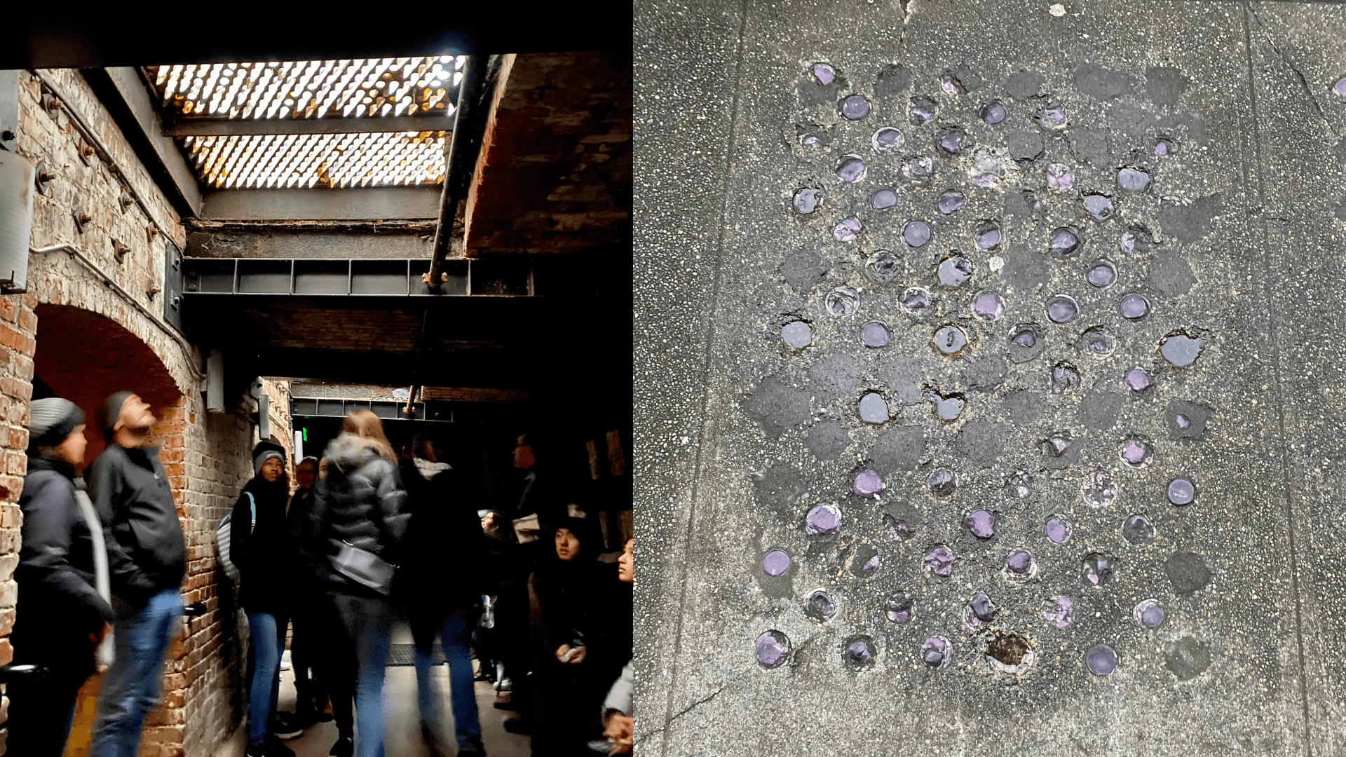
Some of the underground tunnels have been preserved and used for historical tours, others have been turned into basements or parts of buildings.
Underground tours are a popular attraction in Seattle. You can learn more about Pioneer Square’s fascinating history here.
What you can expect
Construction is underway now. Crews began work underground, prepping this unique area to support the new pedestrian signal that makes the all-walk and protected bike lane project possible.
The signals could be activated as early as March or April, once we conduct final tests after installing the upgrades. There will be more visible changes on the street in the coming weeks.
While we work, you may experience:
- Some temporary shifts in how traffic navigates the intersection (this keeps our crews safe and the work site clear)
- Some temporary parking restrictions along the curb
- Continued access to local businesses and sidewalks
When we finish the project, there will be:
- A new protected bike lane for people biking along Yesler Way from Occidental Ave S to Western Ave that connects the downtown bike lane network to the new and improved Waterfront bike path
- A modernized signal on Yesler Way and 1st Ave that shows pedestrians and people biking how much time is left to cross
- A street that clearly shows where people walking, rolling, biking and driving can travel
Funding the connection
This project is partially funded by the voter approved Seattle Transportation Levy. Levy investments support safety improvements and expand Seattle’s protected bike lane network.
Additional transportation investments tied to Seattle’s preparation for the FIFA World Cup 2026 helped accelerate this long-planned connection.
These improvements will support increased pedestrian and bicycle activity in the city center during major events — and will continue to benefit residents, workers, and visitors long after the World Cup.
You can learn more about this project and others nearby on the Yesler Way Protected Bike Lane page of seattle.gov/transportation. Thanks for your interest!