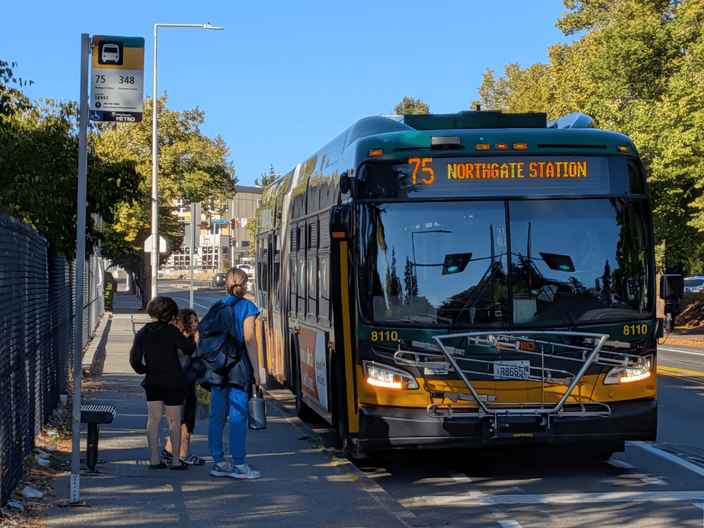
 A family boarding a Route 75 bus at Pinehurst Way NE next to Hazel Wolf K-8 school. Photo: SDOT
 Roosevelt Way NE and Pinehurst Way NE connect homes, schools, parks, businesses, and transit across north Seattle.
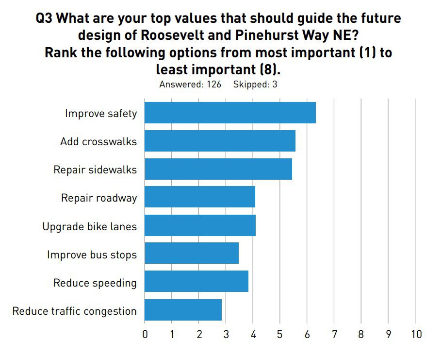
But today, this wide street can be uncomfortable to cross. Driving speeds are high, comfortable crossing can be far apart, and too many crashes have injured people walking and biking.
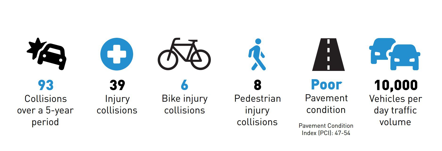
That matters especially here. More than 650 students attend Hazel Wolf K-8 near Pinehurst Way NE, and more than 350 attend Olympic View Elementary near Roosevelt Way NE. Families travel along and across these streets every school day. These streets also connect people with Maple Leaf Reservoir Park, Pinehurst Playground, the Northgate business district and community hub, local businesses, bus stops, and destinations throughout Maple Leaf, Northgate, and Pinehurst.
Now, a major safety transformation is coming thanks to the 2024 Seattle Transportation Levy and a transformative paving project.
This month, we completed the design for the Roosevelt and Pinehurst Way NE Paving & Safety Project. Along with paving the street, the project will:
- Build new and upgraded crossings
- Add pedestrian islands so people can cross one direction of traffic at a time
- Upgrade sidewalks and accessible curb ramps
- Improve bus stops
- Redesign key intersections for safety
- Add protected bike lanes
- Create clearer vehicle and turn lanes to help slow driver speeds and reduce conflicts
- Repave Roosevelt Way NE and Pinehurst Way NE, extending the life of the street by decades
Designing a safer street from one end to the other
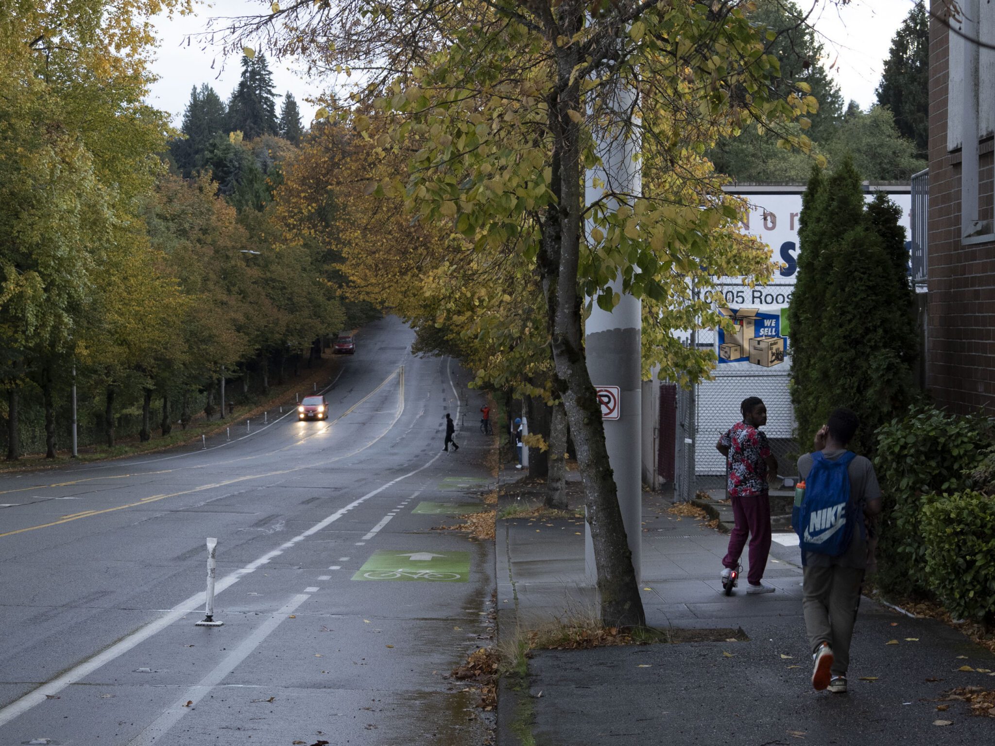
The project responds to a history of crashes and injuries along Roosevelt Way NE and Pinehurst Way NE, including crashes involving people walking and biking. Over the last five years there were 93 crashes along this corridor.
Rather than relying on one improvement in one location, the new design addresses safety throughout the corridor.
Two intersections will see significant changes:
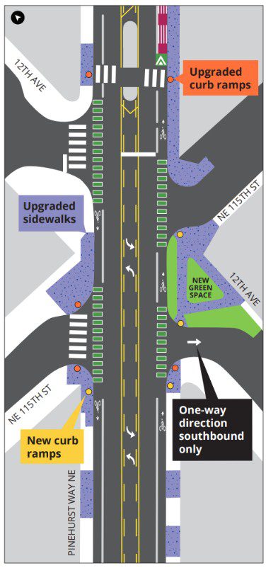
At Pinehurst Way NE and NE 115TH St and 12TH Ave NE the project will install new greenspace, new and updated curb ramps, new pedestrian refuge islands, new protected bike lanes, and upgraded sidewalks. new design will shorten or simplify the crossing, make people walking more visible, and make vehicle movements more predictable.
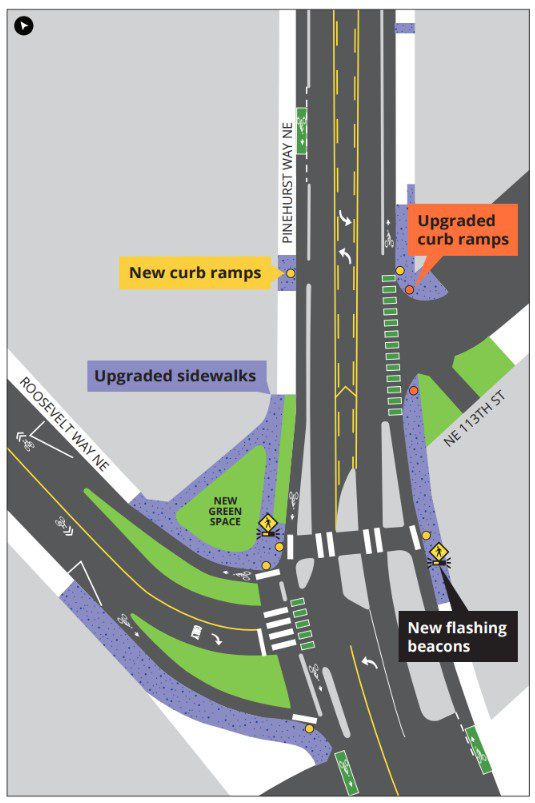
At Pinehurst Way NE and Roosevelt Way NE and Ne 113th St the project will install new greenspace, new and upgraded curb ramps, new protected bike lanes, new crossing on NE 113th St with new rapid flashing beacons, new pedestrian refuge islands, and upgraded sidewalks. These changes will give people a more protected place to cross and reduce potential conflicts at the intersection.
Elsewhere, new and upgraded crosswalks, pedestrian islands, curb ramps, and clearly defined travel and turn lanes will make the street easier to understand and safer to navigate.
Filling a gap in the bike network
Protected bike lanes will also fill an important missing connection in North Seattle. At the south end, the project connects with the Maple Leaf Neighborhood Greenway at NE 103rd St. That network connects toward Maple Leaf Reservoir Park, Roosevelt, Green Lake, and the University District.
At the north end, the project connects with the neighborhood greenways on NE 117th St at Hazel Wolf K-8 school. Those routes lead people to Pinehurst, Victory Heights, Olympic Hills, Lake City.
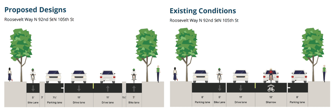
Protected bike lanes are safe and comfortable and help make sidewalks safer, plus they narrow driving lanes, which results in slower driving speeds.
Safer access to transit
King County Metro Route 348 serves Pinehurst Way NE, connecting Pinehurst with Northgate Link Station and destinations farther north. About 2,000 people ride the route on an average weekday. Metro Route 67 serves Roosevelt Way NE, providing connections to Northgate, Roosevelt, the University of Washington, and University Village.
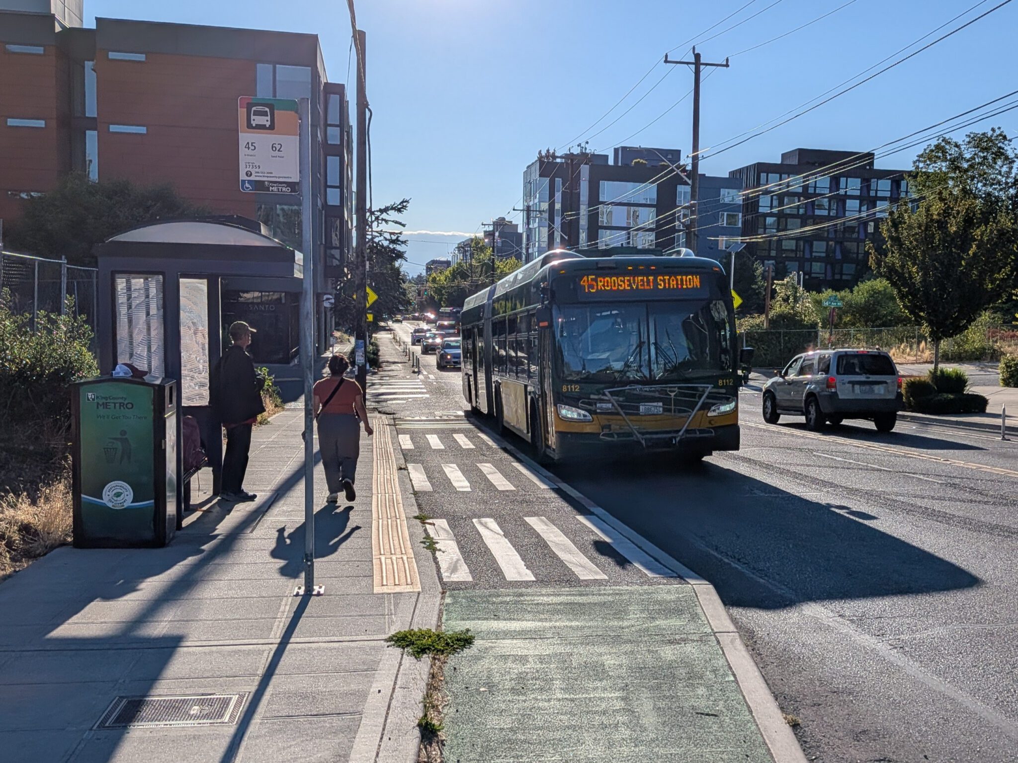
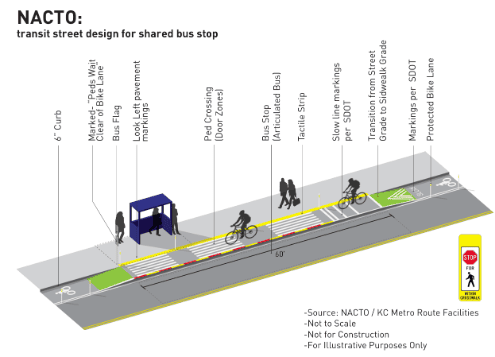
The project will improve bus stops and the connections between transit, sidewalks, bike lanes, and crossings so people have safer ways to reach the bus and continue their trip.
We know safer street designs work
We have seen the difference this kind of work can make nearby. SDOT redesigned NE 65th St in Roosevelt and Ravenna after years of serious crashes. The project added safer crossings and turns, protected bike lanes, and a street design intended to reduce speeding and crashes.
The results were dramatic. After the redesign:
- Crashes fell 67% on the western portion of NE 65th St. Pedestrian crashes there also fell 67%.
- There were no fatal or serious-injury crashes after the full redesign was completed
- The share of drivers traveling over 30 mph also dropped substantially
That experience shows why street design matters. A safer street should not depend only on every person making the right decision every time. The street itself can encourage slower speeds, provide safer places to cross, and reduce opportunities for serious crashes.
What’s next
Construction on Roosevelt Way NE and Pinehurst Way NE is scheduled to begin in 2027.
The project is funded by the voter-approved 2024 Seattle Transportation Levy, with additional support from a Federal Highway Administration grant.
This is just one of several projects in the area. Last month, the first arterial roundabout in Seattle opened just a few blocks north while construction continues on the NE 125th and 130th St Mobility and Safety Project.
28 blocks of new sidewalks and walkways are on the way too. They are the first to come from our “walkshop program” and are part of our Seattle Transportation Levy-funded initiative to add 350 blocks of new sidewalks and walkways across the city.
Learn more and see the final designs for this project on the Roosevelt Way NE and Pinehurst Way NE project page.