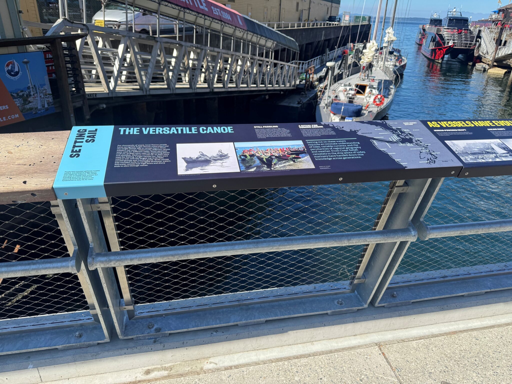
 A sign on a railing at Waterfront Park shares the history of how people traveled through Puget Sound waters. Photo: City of Seattle
 This is a blog post from the Waterfront Seattle Program. The Waterfront Seattle Program is a collaboration between the Office of the Waterfront, Civic Projects, and Sound Transit, and other Seattle departments including the Mayor’s Office, Parks and Recreation, the Seattle Department of Transportation (SDOT), Seattle Center, and Planning and Community Development.
Blog stats: 1,000 words | 5-minute read
All places have a story to tell. How the land was formed, whether by nature or by people, who lived and worked there, what events occurred and what activities still happen – all of these aspects helped create the place described by the informational signs we’ve placed along the waterfront.
The transformation of Seattle’s central waterfront is a significant civic undertaking guided by years of community engagement, careful urban design, and strong leadership and management by the City. Millions of visitors have enjoyed the park, its plantings, play areas, and other new amenities. The addition of interpretive signs offers a deeper understanding that this site has been transforming for centuries and holds significance in the development of Seattle itself.
You can find the waterfront’s wayfinding program – consisting of directional and operational signs, and interpretive materials – on panels from the south end of Railroad Way to Pier 62 and on Overlook Walk. Created to complement the overall urban design of Waterfront Park, the directional and operational signs use white letters and symbols on a dark gray background that matches the light fixtures on the promenade. This same color scheme appears on panels crediting artists’ contributions and on signs that highlight many kinds of plants nearby. Both types of signs fall into the “interpretive” category – they create visual consistency with adjacent urban design elements.
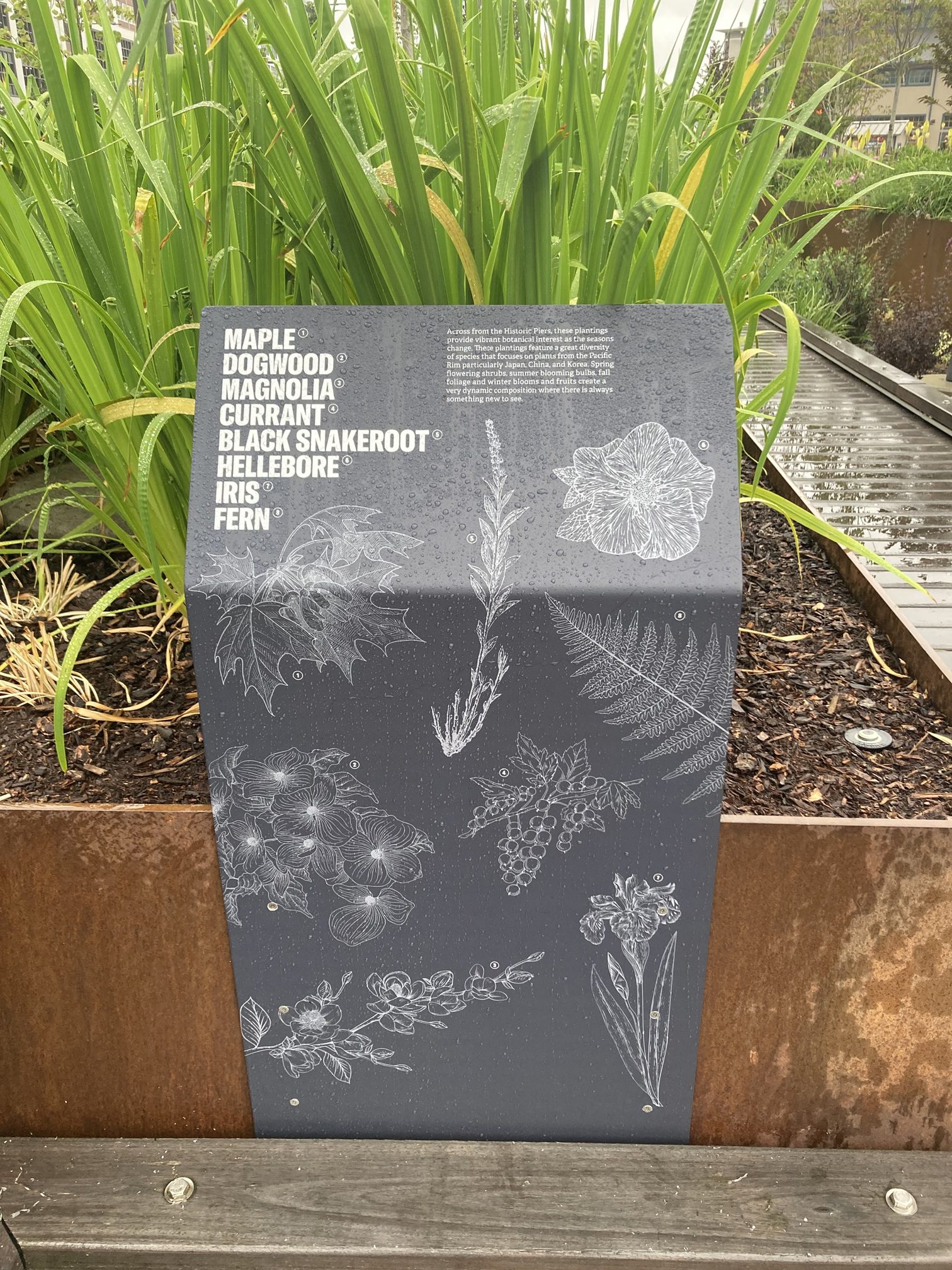
In order to avoid adding clutter to the Waterfront Park Promenade, much of the interpretive material is attached to existing infrastructure elements – things like planters, benches, and the handrails on various guardrails. Each story is self-contained within a signage location – you don’t need to read another sign elsewhere to understand the information on a particular panel or set of panels. The design is focused mostly on images – with text primarily in the form of captions for photographs or drawings.
Collaboration to include many voices
The process to select the information shared was iterative and engaged both consultants and community. With the participation of Jennifer Ott of HistoryLink and several graphic designers, the City outlined goals for the program and identified themes that would assist in the selection of specific stories to feature on the interpretive panels.
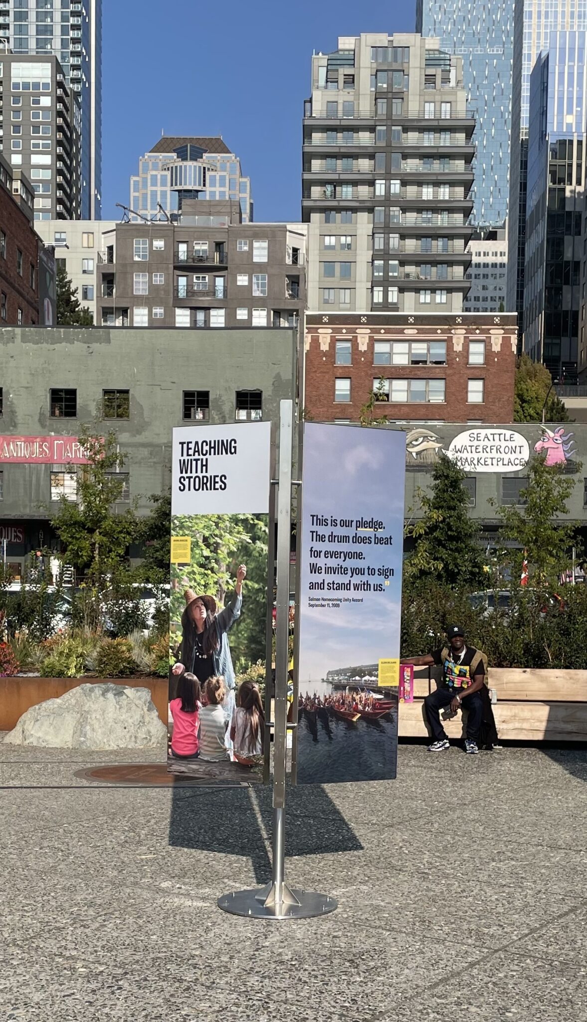
The goals included connecting viewers to an evolving waterfront through the perspectives of the wide range of people who shaped it, and to allow for the addition of new stories and new voices over time. A particular focus was to convey the stories of the many communities who influenced the waterfront, and especially to elevate the stories of the tribes who were the original inhabitants and stewards of the waterfront.
Four broad themes aided in the decisions of what stories to feature:
- Gathering – Waterfront as a place for communities to gather, live and celebrate.
- Shaping – Waterfront as an evolving place with shifting boundaries, both natural and human-made.
- Working – Waterfront as the historical center for industry and trade.
- In and Out – Waterfront as the point of departure and arrival for people and things.
Once these broader goals and themes were established, the City also convened an advisory working group that assisted in further narrowing down the stories, looking for a balance of perspectives and voices.
The group included:
- Elder Marilyn Wandry of the Suquamish Tribe
- Councilmember Donny Stevenson of the Muckleshoot Indian Tribe
- Leonard Garfield, Executive Director of the Museum of History & Industry (MOHAI)
- Diane Sugimura, former director of the City’s Department of Planning and Development
- Chieko Phillips, the Heritage Director at 4Culture
A closer look at our history, geography, and Native communities
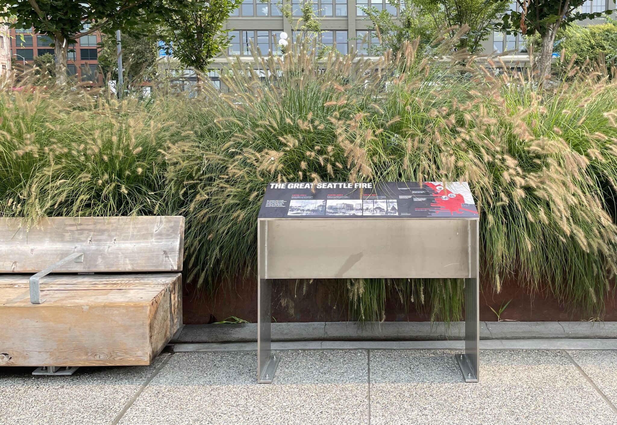
Some stories focus on specific events in Seattle’s history – for example, several panels feature the Klondike Gold Rush, laid out graphically like a map on a board game, or the Great Seattle Fire, on a free-standing sign that faces east into the city towards where the fire occurred. Other signs tie their subject matter to a location – such as information about the physical and environmental aspects of creating Pioneer Square Habitat Beach. Yet others celebrate the Native community, both historic and contemporary, for whom the waterfront was a seasonal home and is still Coast Salish.
On Overlook Walk, you can get oriented to where the waterfront sits geographically within the larger Puget Sound region. And sometimes, we address the unfortunate events the waterfront has witnessed, such as the expulsion of Chinese workers in the 19th century, or the process of incarceration of Japanese Americans in the mid-20th century. These events are captured on a sign at the Washington Street Boat Landing, near Pier 48 where they occurred; the panel speaks also about immigration and commemorates the site of Ballast Island, which lies below. We encourage people to learn about these topics, and much more, on a stroll along the waterfront.
More ways to enjoy the signs
To reach a broader audience, we placed panels on the railings and on welcome monument signs that include raised text and braille, and a QR code that directs the visitor to the city’s website, where material about the waterfront, and the signs, can be accessed in different languages and by voice for those with applicable apps on their phones. Eventually, the City’s website, seattle.gov/waterfront, will feature a “StoryMap” that will offer an interactive tour of the signs.
For additional wayfinding assistance, Seamless Seattle, the directional sign program from the Seattle Department of Transportation, will be installing the blue and teal monument signs that you can see all over downtown neighborhoods. These signs feature maps and call out average walking times to nearby landmarks and places of interest. These panels, as well as the last of the Waterfront Seattle Program’s signs, add a layer of convenience as well as educational experience to a visit to the waterfront. Thanks for your interest.