Seattle.gov Home Page
Link to Department of Transportation Link to Seattle.gov Home Page Link to Seattle.gov About Us Page Link to Seattle.gov Contact Us Page
SDOT Blog Home Page SDOT Blog Home Page CityLink Seattle

ASK US A QUESTION!

Have a question about our current work at the Seattle Department of Transportation? We’re ready to get you an answer!

Click here and scroll down

Search SDOT Blog

Archives

Contact us

Call 206-684-ROAD

SDOT Photo Gallery


			SDOT Photos posted a photo:	The bascule portion of the Ballard Bridge is draped during painting. February 9, 2012

			SDOT Photos posted a photo:	This photo was taken while the bascule portion of the Ballard Bridge was being painted. The bascule is the center portion of the bridge that opens and closes for maring traffic. There are long approaches on each end of the bascule bridge. The bridge crosses Salmon Bay leading to the Lake Washington Ship Canal. February 9, 2012

			SDOT Photos posted a photo:	This photo was taken while the bascule portion of the Ballard Bridge was being painted. The bascule is the center portion of the bridge that opens and closes for maring traffic. There are long approaches on each end of the bascule bridge. The bridge crosses Salmon Bay leading to the Lake Washington Ship Canal. February 9, 2012

			SDOT Photos posted a photo:	The railings and other steel portions on the bridge were painted last year. This photo was taken on February 9, 2012.
More photos

Archive for September, 2009

Meet the Talent

Claeys at podium1
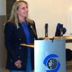
We like to recognize the good work of members of our team and want to share these highlights with our blog readers. This month the American Public Works Association (APWA) recognized one of SDOT’s lead engineers, Katherine Claeys, in their seasonal publication. Katherine has been an engineer with the City of Seattle for over 20 years and has been a part of numerous high profile projects. Two of the most notable are recent and in-progress projects; construction of the LINK Light Rail, and construction of SR-519 adjacent to Safeco and Qwest Fields. Her projects have given her the opportunity to work with other public works agencies like WSDOT and Sound Transit and develop productive working relationships with their lead project engineers.

Her work is heralded by colleagues both within the City of Seattle and across regional agencies. This praise is not limited to her professional work and expertise, but her community and volunteer service efforts as well. She has served the APWA in quite possibly every position possible, as a co-chair, board member, secretary, vice-president, and then president. She has also stayed active in our community by participating in career fairs and tutoring, introducing young people to the career opportunities in math, science, and engineering. Katherine has skillfully served, and continues to serve, the City with enthusiasm. SDOT is proud to have her on our team!

[More]

Sharing the Road with Sharrows

sharrow12NE2

Many people wonder what those little bike symbols mean and why they are there.  Shared lane pavement markings, or “sharrows”, are bicycle symbols carefully placed to guide bicyclists to the best place to ride on the road,  avoid car doors and remind drivers to share the road with cyclists.  Unlike bicycle lanes, sharrows do not designate a particular part of the roadway for the exclusive use of bicyclists.  They are simply a marking to help motorists expect to see and share the lane with bicyclists.sharrowcardoor

As we move forward with implementing our bike master plan; our first choice is always to put a bike lane on both sides of the street.  Sometimes the street isn’t quite wide enough.  So second choice is a bike lane on the uphill climb; and sharrow on the downhill roll.  If we can’t fit in a bike lane, we still want to make it clear bikes share the road, and make connections between trails for cyclists.  Sometimes we put in sharrows because the road is just not wide enough for bike lanes.  Other times it is because we know it will take a while to get the lane in place.  On some streets there is a lot of controversy as stakeholders debate over having (for example) a bike lane vs.  parking vs. a road diet vs. a bus priority lane.  If we know it might take a long time to come to consensus on how to stripe the street; we might put sharrows on the street while we work through the issues.  More than 30 miles of sharrows have been installed over the past two years. 

We hope they are making Seattle feel more safe and comfortable for cycling in by sending the message to share the road!  How do you think we could help both drivers and cyclists know what the sharrows mean?

[More]

Hear the Fremont Bridge Talk Back this Saturday

Bridge Talks Back JACQUES1

Did you know that all summer there’s been an artist up there in the Fremont Bridge towers with Rapunzel?  Artist Kristen Ramirez has been using a tower as a studio, spending time with bridge operators and neighbors, and working on an artistic response to the bridge.  The project, part of the SDOT Art Plan, was made possible by SDOT 1% for Art. 

This Saturday, Kristen wraps up her summer residency at the bridge with a temporary art project celebrating the daily rhythms and sounds of the bridge. Bridge Talks Back, a sound artwork, opens with a celebratory performance at the bridge Sept. 26, 1 to 4 p.m. Each bridge opening will be greeted with pageantry and fanfare. Watch a colorful procession and see the bridge festooned with flags while musicians play from the bridge towers.

Ramirez’s three-minute audio composition will play through the bridge’s sound system during daytime bridge openings. The sound collage includes clips of boat horns, bird songs, bridge bells and more. People waiting for the bridge to open will also be able to dial a phone number (posted on nearby road signs) to hear a version of the soundscape which will include residents’ recorded musings about the bridge.

More info here.  Kristen’s blog:  http://www.thebridgereport.blogspot.com/

[More]

2009 Downtown Paving looking Rosy

This Monday crews start the work to completely reconstruct Fourth Avenue from South Jackson Street to Olive Way.  Some of the concrete panels along the roadway are up to 60 years old -even though the common life span of these panels is 40 years.  Phase one of the project, from South Jackson Street to James Street, is expected to wrap up in early January, 2010, then work moves north toward Olive. 

Do these project details sound daunting?  Not to fear.  There is a light at the end of the tunnel (metaphoric reference – no actual tunneling involved) and the proof is in completed projects.  This month Marion Street, Stewart Street and Second Avenue are all expected to wrap up, with only minor touch ups remaining.  And when you consider that Fourth Avenue in Belltown and Pike Street at the Market are also now complete, the picture starts to look pretty rosy (or grey, as it were, for concrete).  So thank you for your patience – thanks for hanging in there. 

The reconstruction of Fourth requires the four-lane roadway to go down to two lanes and parking to go away temporarily (to make room for the equipment and workers).  Remember those first few days of any project are tough as drivers get used to the change, but as we did with Second Avenue we will closely monitor impacts and tweak as needed.

4thMap1
[More]

Neighborhood Plan Update Community Open House – You are Invited!

open house 1If you live in the North Beacon Hill, North Rainier, or MLK Jr. @ Holly (Othello) neighborhoods, we welcome you to attend  a Neighborhood Plan Update Open House. Here’s an opportunity to talk with City staff about your neighborhood, review neighborhood plan update draft goals and strategies and provide feedback. These draft updates build on  the neighborhood plans that were originally completed between 1995 and 2000. We are looking for comments on the proposed strategies that will address issues like community growth, transportation, and overall quality of life. 

Check out the Department of Planning and Development’s (DPD) website for the online versions of the draft plans, as well as streetscape designs and built environment alternatives.  

Two dates:  Sunday, September 27 (1:00 p.m. – 5:00 p.m.) and Wednesday, September 30 (6:00 p.m. – 8:00 p.m.) 

One great location: Asian Counseling and Referral Service (ACRS) – 3639 Martin Luther King Jr. Way S

To see the invitation, click here.

See you there!

[More]

Go Car Free and Don’t Stop

carfree day rsSeptember 22 is World Car Free Day. People from around the world get together in the streets, intersections and neighborhood blocks to demonstrate how livable city streets are when opened to people and bikes. But we do not want just one day of celebration and then a return to “normal” life. It is up to us, our community members, our cities, and our governments to help create permanent change to benefit pedestrians, cyclists, and other people who do not drive cars.

In 2009, the city hosted several car free events called Summer Streets. To learn more about what we did click here. SDOT also supports people driving less through Way to Go, Seattle! It’s a resource we’ve created where you can find out about rewards for walking, biking and using transit more as well as useful tools and tips to help you get around without driving.

Join us and celebrate World Car Free Day, every day.

[More]

Meet the Artist Event in Central District

Example of work from Artist: Troy R. Miles

Example of work from Artist: Troy R. Miles

 Troy R. Miles is designing images to be placed on signal boxes in the Central District. Come meet Troy and share your ideas of the kind of images you think represent the Central District.

When: Wednesday, September 23
Time: 6:00 to 7:30 p.m.
Where: Langston Hughes Performing Arts Center, West Room
104 17th Avenue S

Signal boxes are metal boxes located at each signalized intersection in the city. The Seattle Department of Transportation (SDOT) is working with the Seattle Office of Arts and Cultural Affairs to transform these boxes into a site for community artwork that represents the neighborhood and engages pedestrians. For more info contact Vaughn Bell, Vaughn.Bell@Seattle.gov, 206-733-9960.

Work done by Troy R. Miles

Work done by Troy R. Miles

[More]

Bit by Bit, Making Seattle a Better Place to Ride

Seattle’s Bicycle Master Plan got a lot of attention when it was completed in 2006.  It’s an ambitious plan with a goal of installing 450 miles of on and off-street bike facilities in ten years.  In the three years since it was released, SDOT engineers and crews have been systematically designing and installing lanes, sharrows, signals, signs, lockers and other bike facilities that make Seattle a better place to ride.  By the end of this construction season, new bike lanes, sharrows, signed routes and off-street trails will total 135.57 miles of the 450 mile goal.

Cherry St Bike Lanes

E. Cherry Street just contributed to that total today.  The project that just wrapped up this afternoon includes bike lanes on the south side of E Cherry Street between 12th Avenue and 21st Avenue and shared lane pavement markings (or “sharrows”) between 21st Avenue and 23rd Avenue. On the north side of E Cherry Street, sharrows have been placed between 12th Avenue and 23rd Avenue.  Last, but not least, a new marked crosswalk has been installed on the west leg of E Cherry Street and 16th Avenue.

 Happy riding!

[More]

A Step Up for Walking

Here's the view...

Here's the view...

Getting around in Seattle involves more than streets and bridges. Here at SDOT we also tend to 491 outdoor public sidewalks that scale steep hillsides where streets don’t cut through.

Last week the department’s Bridge and Roadway Structures crews improved one of these public stairways in West Seattle connecting Admiral Way to Harbor Avenue, just north of the cut off to the West Seattle Bridge. New railing and curbing, made possible by the Bridging the Gap transportation initiative approved by Seattle voters, will extend the life of this link in the pedestrian circuit.

A walk in this area on a sunny September day like today, down from the Admiral Way green belt, provides the kind of spectacular view that makes you fall in love with Seattle all over again. Enjoy!

...and here are the stair that get you to the view.

...and here are the stairs that get you to the view.

[More]

From the Bottom Up…

The complete reconstruction of First Avenue South between Stacy and Horton Streets is nearly done!  Crews finished paving over the weekend and this week finished striping all five travel lanes.  Crosswalks and arrows will require an occasional single lane closure, but otherwise the project is expected to wrap up by Friday, weather permitting (the caveat SDOT lives by).  The last bastion of construction activity, the no park signs preventing parallel parking, will be removed in the next week or so as final touches are made.  The crowning detail, the addition of American Hornbeam trees, takes place in November when the trees are more likely to survive the transplant.

Night work being done by crews over the weekend

Crews working overnight

This project began in early February, with the scope of work necessitating temporary elimination of parking on both sides of First Ave. S, and restriction of traffic to two northbound lanes and a single southbound lane during construction. Crews rebuilt the road from the bottom up, adding a new 24” main waterline; replacing storm drains to improve surface drainage; creating street curbs and curb cuts for vehicle and pedestrian access; installing new vehicle detection loops under the pavement to aid in signal operation; building concrete pads for Metro buses, to reduce future maintenance costs; and rebuilding approximately 75 percent of the area sidewalks.

The view of the newly stripped center lanes at Stacy Street
The view of the newly striped center lanes at Stacy Street
View of the new crosswalk at Forest Street

This project, as all paving projects underway, is funded by Bridging the Gap, the voter-approved $365 million dollar levy for transportation maintenance and improvements.

[More]