
Image credit: Chun Kwan. Sunset on our beautiful city. Also pictured the SR 99 Alaskan Way Viaduct 2019.
Aerial images captured by one of our own.
This picture of the fading sunlight over Seattle’s cityscape seems appropriate for us as we sunset a part of Seattle’s history (#GoodbyeViaduct, we will miss you) and prepare for the present/future (hello, #99Tunnel) in the coming days. This is truly a new season of thriving changes for our beautiful city and we wanted to pay tribute by pictures to a structure that helped people and goods get to and through Seattle for the last 65 years-ish.
One of our colleagues, Chun Kwan, apparently moonlights as a stellar drone photographer ? JK, Chun, JK. He captured these photos to help document the history at play here, and in doing so, remind us (not that we need the reminder) of the beautiful place we call home.
Meet Chun Kwan.

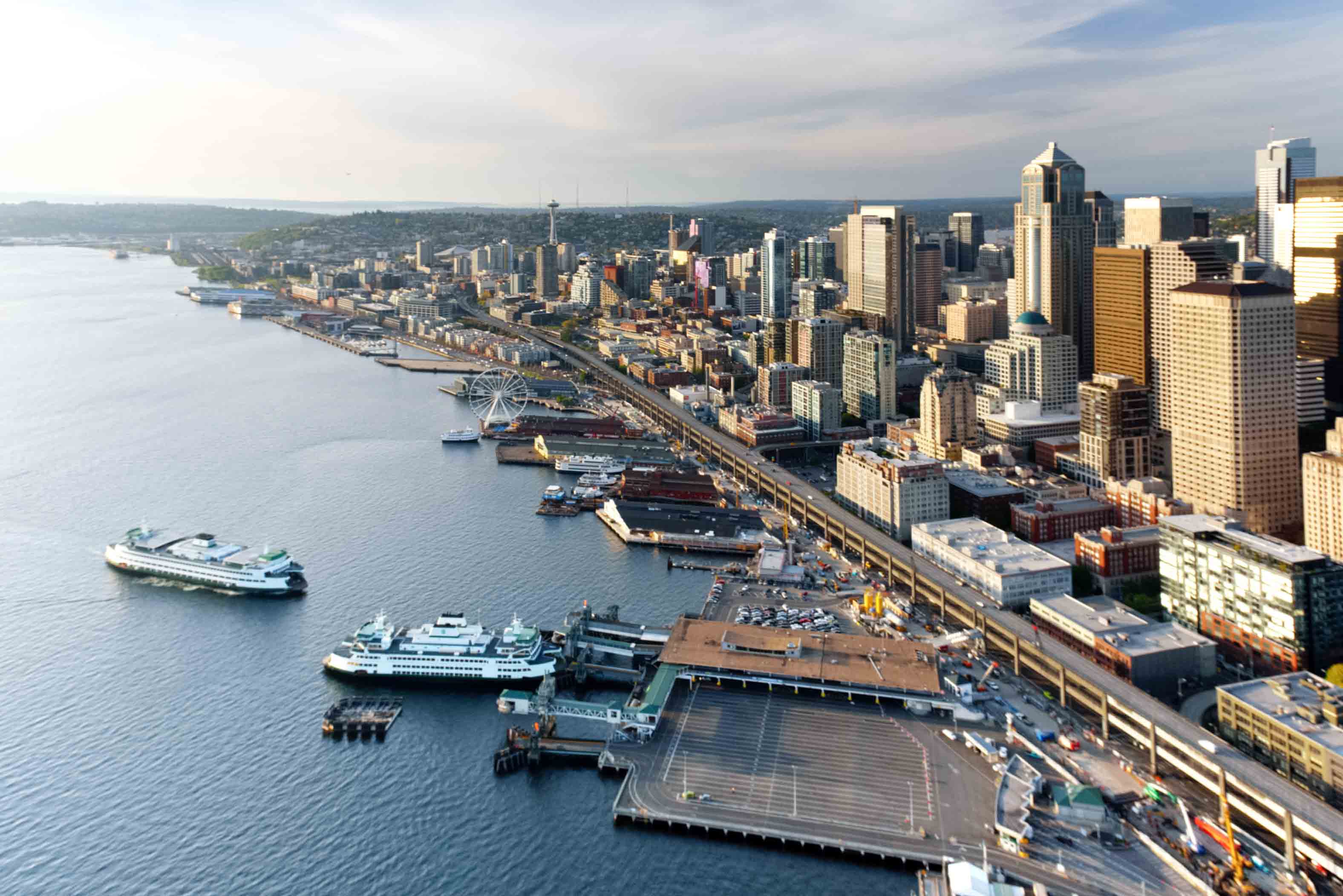
Image credit: Chun Kwan. SR 99 Alaskan Way Viaduct 2019. Looking north.
By day, Chun is a supervisor in our Traffic Data and Records team, part of our Transportation Operations Division. The team collects and archives a variety of traffic data, including vehicle and bicycle counts. He’s been with SDOT just under a year and a half. His favorite part of working here? Being able to collaborate in a fun, supportive, and productive environment with teammates of diverse backgrounds in delivering the traffic data that powers decisions for the future of our City’s multimodal transportation network. ?

Image credit: Chun Kwan. SR 99 Alaskan Way Viaduct 2019.
Chun has been into photography for the past 15+ years, starting with point and shoots, working his way up to large DSLRs, and using a drone to take the amazing photos highlighted in this post. His work life is inundated with data that he and others at here use to make good decisions. And while he often pre-plans his photo shoots using data and weather forecasts, he says that when it comes to photography, sometimes the best opportunities can present themselves spontaneously.

Image credit: Chun Kwan.
FYI, Chun’s been getting to and from work before and during the #SeattleSqueeze via transit (not drone).
#GoodbyeViaduct, hello waterfront and #99Tunnel!

Source: Waterfront Seattle via https://waterfrontseattle.org/overlook-walk
Now that you’ve seen all these awesome overhead shots, imagine what this view will look like (from above, and more importantly, from street level) once the viaduct comes down and the reimagined waterfront takes shape.
The struggle (of the Squeeze) is real. Making it through the construction and disruptions over the next several years will be challenging, but over the past few weeks, we’ve seen what regional teamwork can do – people made changes and those changes added up. Keep it up and let’s not forget the amazing changes yet to come.

Source: Waterfront Seattle via https://waterfrontseattle.org/overlook-walk

Source: Waterfront Seattle via https://waterfrontseattle.org/overlook-walk

Source: Waterfront Seattle via https://waterfrontseattle.org/overlook-walk

Source: Waterfront Seattle via https://waterfrontseattle.org/overlook-walk
For additional tools, tips, and resources about the #SeattleSqueeze, visit our website!
