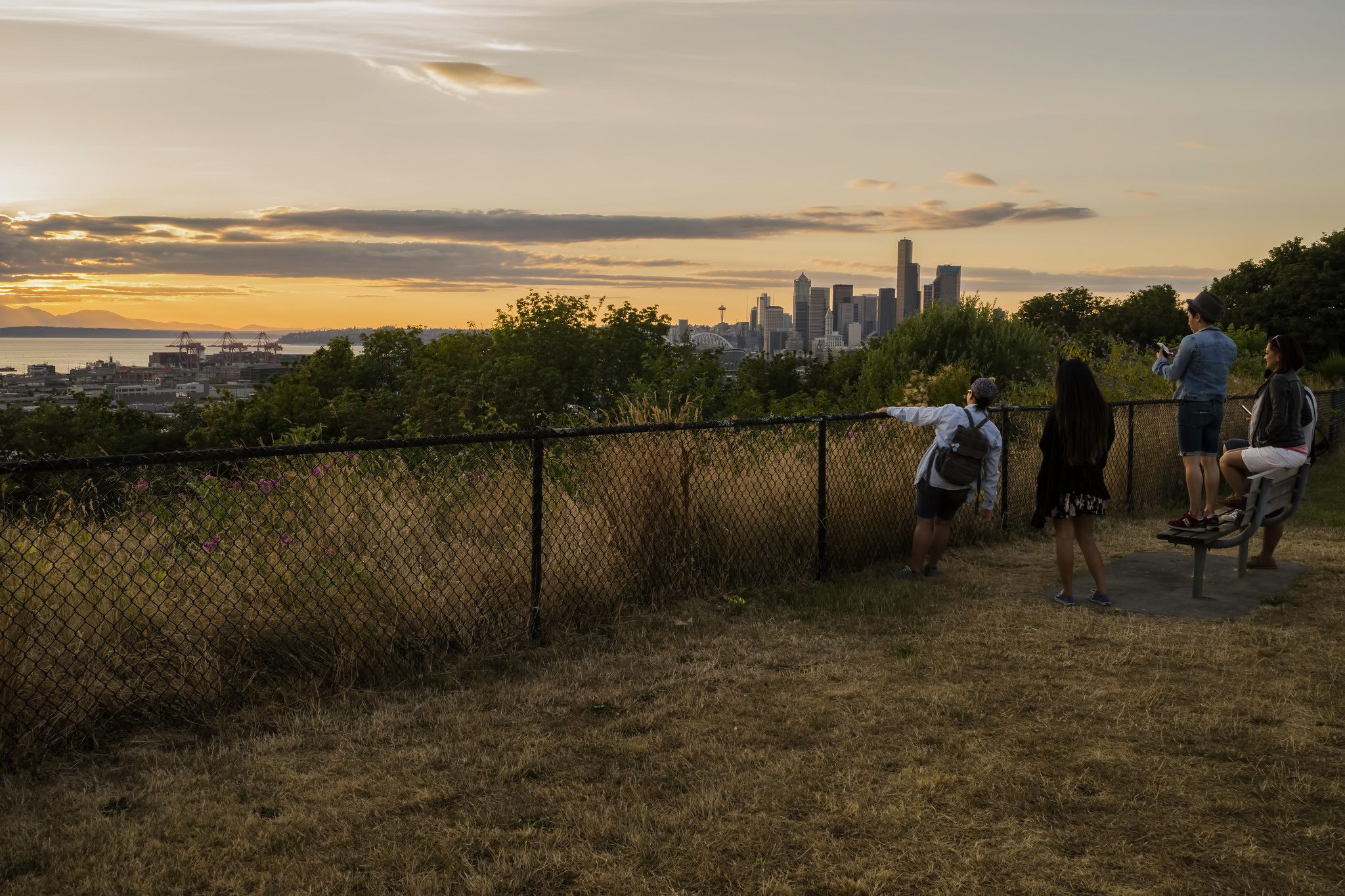
 Community members take in city views from the 12th Ave S Viewpoint in North Beacon Hill. Photo credit: TIA International Photography via Seattle Parks & Recreation Flickr.
 We’ve been working with Beacon Hill and southeast Seattle communities to create people-focused streets that help everyone get around safely and gets us closer to completing the citywide active transportation network.
Today, we’re sharing new plans for the 15th Ave S and Beacon Ave S bike route that embody best practices for safer, sustainable street design based what these communities have told us is important to them.
Our Beacon Hill project will:
- Provide a north-south bike connection in southeast Seattle, which is challenging because of the hills and available street network. This route would create a new active transportation corridor between Beacon Hill and other vibrant neighborhoods across the Dr. Jose Rizal Bridge, like Little Saigon, and destinations in south Beacon Hill in the future.
- Install protected bike lanes at the north end (Segment 1) on 15th Ave S and Beacon Ave S between the Dr. Jose Rizal Bridge and S Spokane St at Jefferson Park, separating people biking from car and truck traffic.
- Redesign key intersections to make it safer and more comfortable for people crossing the street. Streets and intersections would prioritize people walking, biking, rolling, and taking transit.
- Focus on the needs of the Beacon Hill community who are going to local businesses and destinations instead of prioritizing people driving through the community at unsafe speeds. It also provides all-ages and abilities routes off the hill to the places people want to go like the Chinatown-International District and Rainier Valley.
- Encourage people to drive at safer speeds by narrowing traffic lanes to match current safety best practices. This creates a safer street design, which is easier for people to cross – especially children, elders, and people with disabilities.
- Manage public parking and access for residents, businesses, and institutions by shifting some parking spaces from the busy arterial streets to side streets. Detailed parking studies will help us have community conversations around parking and access plans.
Here are graphics showing the Segment 1 preliminary design concepts:
- 15th Ave S cross-sections (One-Way or Two-Way Protected Bike Lane)
- Beacon Ave S cross-sections (One-Way Protected Bike Lane)
You can also view the full Segment 1 preliminary design plans:
- 15th Ave S One-Way Protected Bike Lane
- 15th Ave S Two-Way Protected Bike Lane
- Beacon Ave S One-Way Protected Bike Lane
Our project timeline recently shifted to being in construction later than planned. We’re looking at ways to reduce the overall timeline and get these improvements implemented sooner.
We created this early design concept based on what we’ve been hearing from the community and businesses through an inclusive, multicultural engagement process:
- Create a safe, sustainable network of walk/bike/transit streets across Seattle.
- Don’t leave Beacon Hill and southeast Seattle out of the growing active transportation network.
- Make it safer and easier to cross the street, especially on busier arterials near businesses, schools, homes, and transit stops
- Give residents enough on-street parking close to home and for people who drive to jobs, visit friends or family in the neighborhood, or deliver goods and packages.
- Create streets and sidewalks where people feel safe and comfortable walking between their home and the bus, parking, or other community destinations.
- Design streets in business districts where customers can easily access stores by walking, biking, rolling, taking transit, or driving.
- Improve intersections where people say it is challenging or confusing to cross the street.
- Learn and understand the history of the Beacon Hill community to better inform the process and project. Understand the history of segregation, disenfranchisement, and displacement that has shaped the experiences of many of the people who live, work, and travel in this unique and vibrant community.
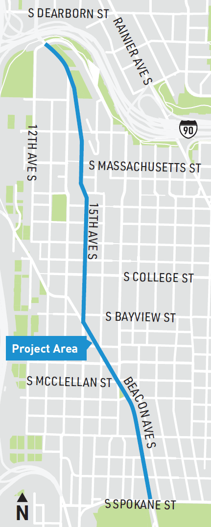
Here’s a map of the north segment of the project:
Next steps:
- We’ll conduct additional community engagement about this project, as we continue to advance the design informed by public input.
- Please stay tuned for an online survey coming later this month where you can share your thoughts, travel patterns, and priorities for the project.
- We are building the project in segments, from the Dr. Jose Rizal Bridge to the intersection of Beacon Ave S and 39th Ave S.
- Segment 1 extends from the Dr. Jose Rizal Bridge to S Spokane St.
- Segment 2 is between S Spokane St to S Myrtle St.
- Segment 3 completes the route to 39th Ave S.
- Information we gather through the survey and our upcoming outreach activities will help us select a preferred design alternative for Segment 1. We’re currently focused on planning and design for Segment 1 through 2023, with construction in 2024.
- We are working to secure funding to design and construct Segments 2 and 3.
- We’re also looking into potential nearer-term safety improvements in the corridor, such as traffic calming and bike lane maintenance.
Here’s how you can reach us and stay informed:
- Visit our website
- Sign up for email updates
- Call us: (206) 900-8728
- Email us: BeaconHillBike@seattle.gov