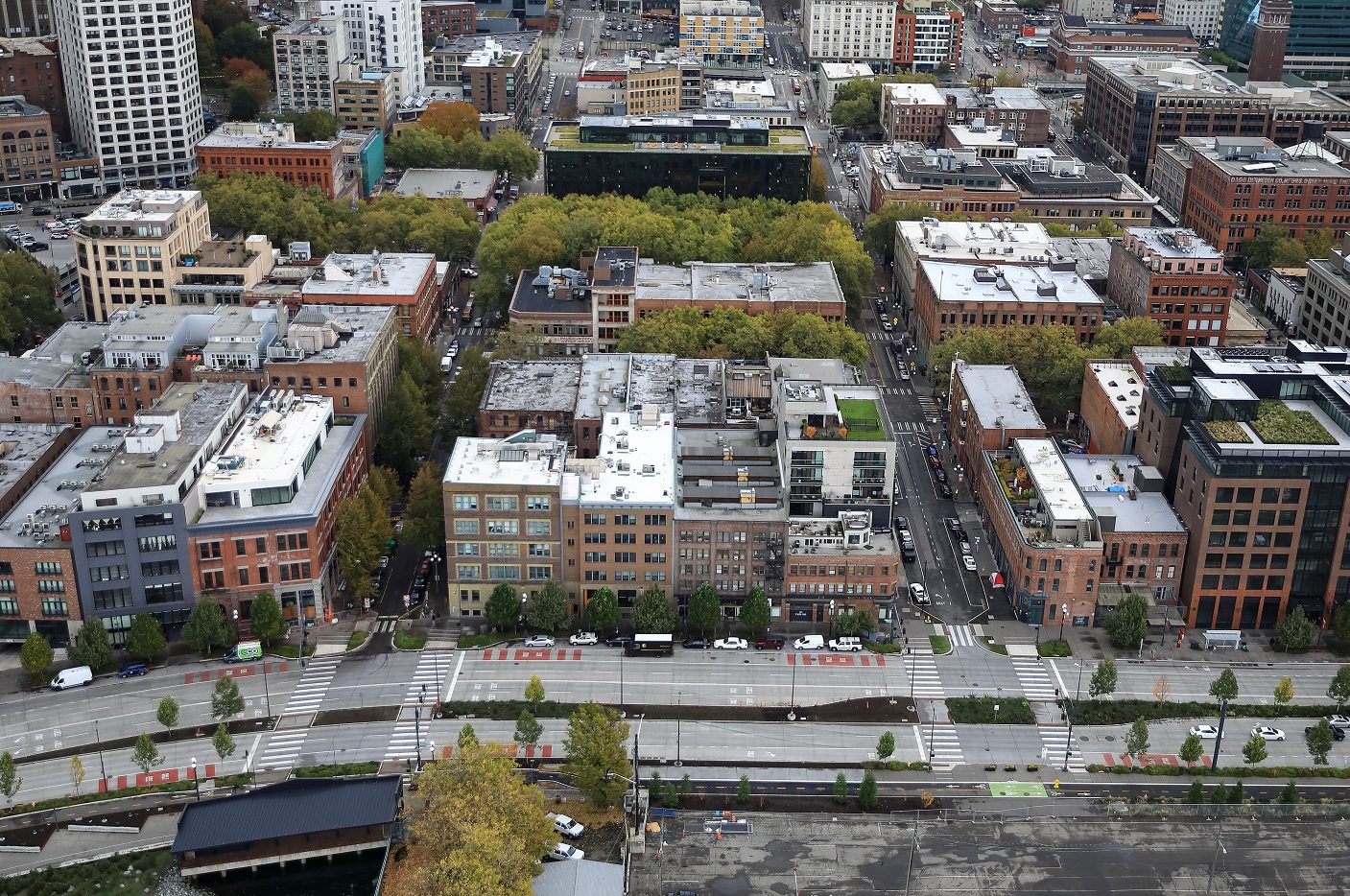
 Aerial view looking east of S Main and S Washington streets, where construction will begin in early January.
 Blog stats: 900 words | 5-minute read
Editor’s Note: This is a blog post from the Waterfront Seattle Program. The Waterfront Seattle Program is led by the City of Seattle’s Office of the Waterfront and Civic Projects, working closely with other City departments, external partners, civic leaders, stakeholders, and the broader Seattle public to create a “Waterfront for All.”
At a Glance:
- As soon as January 2, construction will begin on improvements for people walking and rolling in Pioneer Square on S Main Street between Alaskan Way S and 1st Ave S.
- You’ll see changes on S King, S Main and S Washington streets, as well as Yesler Way in Pioneer Square. These will include:
- The one-way configuration of S Main and S Washington streets between Alaskan Way S and 1st Ave S will be extended to 2nd Ave S
- Widening and upgrading sidewalks with unique paving details
- Adding greenery
- Shorter street crossings and raised intersections in some areas
- During construction, pedestrian and business access will be maintained at all times
- Waterfront Seattle engaged with the Alliance for Pioneer Square and community members on the design of these improvements.
- For more information about the project:
- Contact the Waterfront Seattle team at: info@waterfrontseattle.org or you can call or text us at (206) 499-8040
- Visit the project webpage
- Sign up to receive Waterfront Seattle’s weekly construction email to stay up to date on the project and what to expect during construction
The City of Seattle will start construction on the Pioneer Square East-West Pedestrian Improvements project, part of the Waterfront Seattle Program, in early January.
The project will make pedestrian improvements in the heart of the Pioneer Square neighborhood, for easier and more accessible travel between downtown Seattle and the new waterfront. Waterfront Seattle engaged with the Alliance for Pioneer Square and community members on the design of these improvements.
What to expect starting as early as January 2
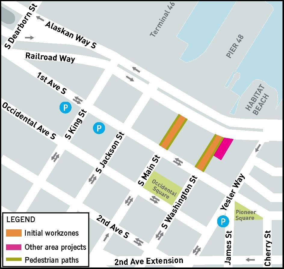
Work is set to begin on S Main St between Alaskan Way S and 1st Ave S as early as January 2. Work at S Washington St between Alaskan Way S and 1st Ave S will begin later in January. Each location is anticipated to take about four months to complete. S Main and S Washington streets will be closed to vehicle traffic during most of the work. Check out this construction flyer to learn more.
During construction:
- Pedestrian and business access will be maintained at all times
- Sidewalks may be narrowed and loading zones may be temporarily relocated to accommodate shifting work zones
- Alleyways adjacent to the work zones will be accessible from at least one end at all times
- Early activities will include potholing and pavement breaking which may cause increased noise and vibration
The project will be conducted in phases to reduce impacts on the neighborhood. Waterfront Seattle and Alliance for Pioneer Square will provide updates to the community prior to changes in work zones.
Waterfront Seattle encourages neighbors in the Pioneer Square area and anyone interested in this project to sign up for weekly construction updates. This is the best way to be informed of upcoming work, shifting work zones, and progress on the project.
What will be built?
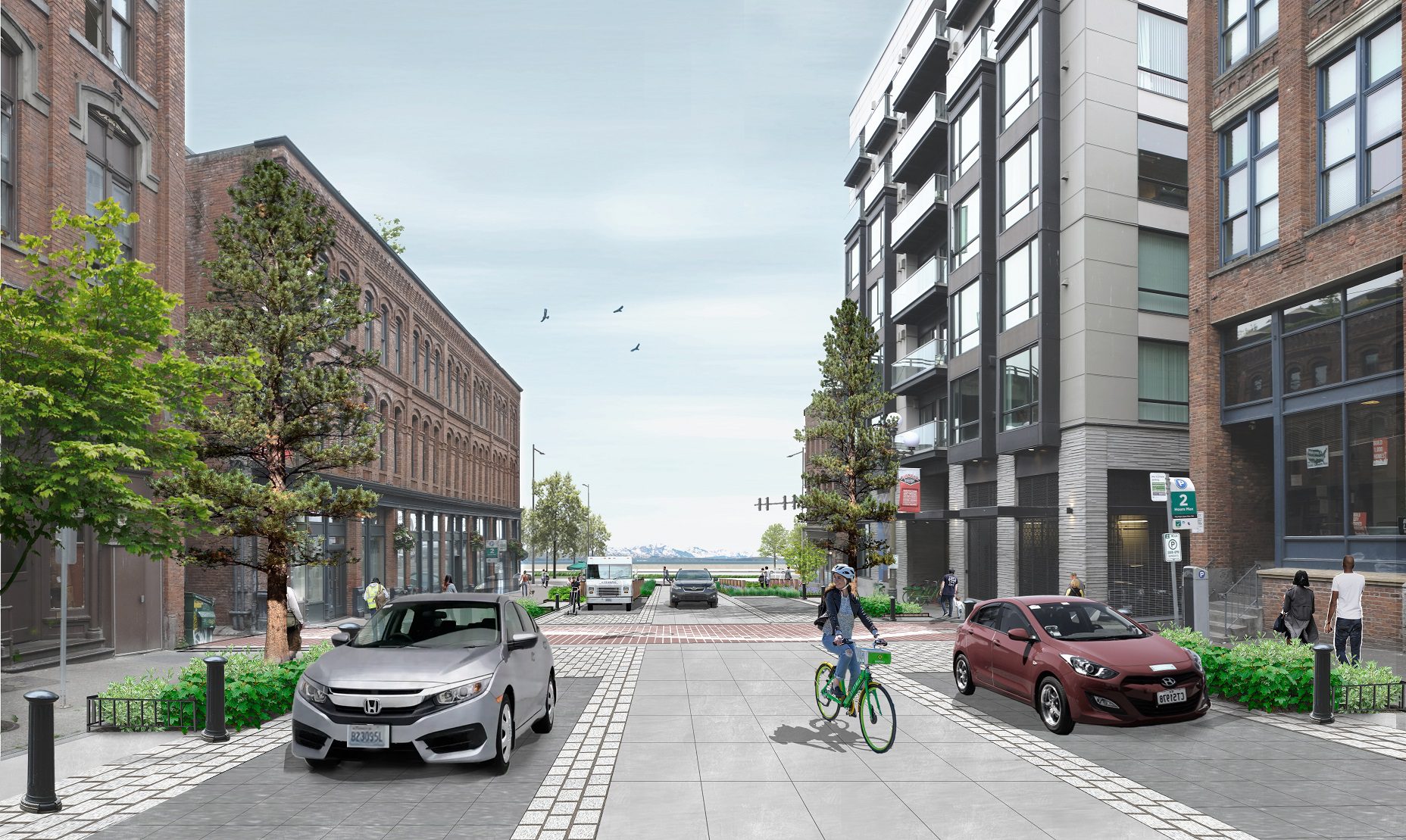
The project will make improvements on S King, S Main and S Washington streets, as well as Yesler Way in Pioneer Square. The one-way configuration of S Main and S Washington streets between Alaskan Way S and 1st Ave S will be extended to 2nd Ave S and each street will be made curbless to calm traffic and prioritize people walking and rolling.
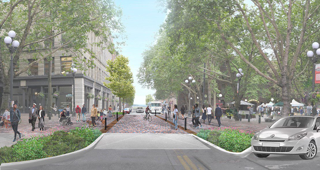
Pedestrian improvements will also include widening and upgrading sidewalks with unique paving details, adding greenery, including native plantings, and moving vehicles away from the historic underground areaways in the neighborhood. The design also incorporates shorter street crossings. Raised intersections at Occidental Park will strengthen the north-south pedestrian connection and create a seamless pedestrian experience in the neighborhood.
Unique design elements highlight the neighborhood’s character and history
The Pioneer Square East-West Pedestrian Improvements project includes unique design elements like “Shoreline Alley,” artistic pavement markings that will mimic the original location of the historic Elliott Bay shoreline from the mid-to-late 19th century. Contrasting patterns of light and dark brick pavers will line the alleyway crossing on S Main & Washington streets. The visual markings of the old shoreline help pedestrians explore the unique history of the area while strolling along the historic shoreline.
Pedestrians will also be able to identify native plant life as they stroll through the improved blocks. Interpretive signage will be in place throughout the area that provides the species name and uses of native plantings by indigenous people from the area.
Do you want to learn more about the design details of the Pioneer Square project? Check out our narrated guided PowerPoint.
Learn more:
- Contact the Waterfront Seattle team at: info@waterfrontseattle.org or you can call or text us at (206) 499-8040
- Visit the project webpage
- Sign up to receive Waterfront Seattle’s weekly construction email to stay up to date on the project and what to expect during construction.
- Learn more about our community partner, Alliance for Pioneer Square