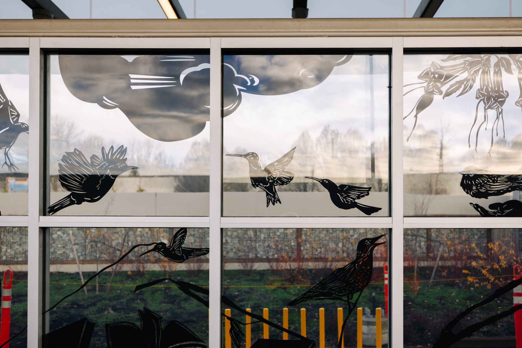
 Artwork on the windows of Judkins Park Station. Seattle’s newest light rail station opens on Saturday, March 28, as part of Sound Transit’s Crosslake Connection, bringing the 2 Line from the Eastside to our city. Photo: Sound Transit
 Blog stats: 1,100 words | 6-minute read
Seattle’s new Judkins Park Station officially opens on Saturday as part of Sound Transit’s Crosslake Connection, making cities like Mercer Island, Bellevue, and Redmond accessible by light rail. The new station also connects Judkins Park to downtown for the first time by train.
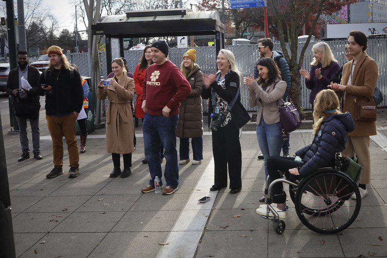
To celebrate the grand opening, Sound Transit is hosting a ribbon-cutting at 9 a.m. at Sam Smith Park, across the street from the station’s east entrance. The day will be filled with festivities, and you’ll even have the chance to be part of history:
“Following the speaking program, we’ll welcome the public on board for a world first, a light rail passenger service across a floating bridge.”
That first train is expected to leave Judkins Park Station around 10 a.m.
Jump to:
- Getting to Seattle’s newest light rail station
- Key definitions for features on the map and guide
- Walking, biking, or rolling
- Taking transit
- Learn more
Getting to Seattle’s newest light rail station
Saturday’s historic sendoff is just the beginning.
Judkins Park Station will serve as a pivotal transfer point, connecting Seattle and the Eastside like never before.
Something to keep in mind: to help people access businesses, schools, and parks in the area, there is only short-term parking (2-hour and 4 hour) on public streets around the station. For residents, there is 2-hour Restricted Parking Zone (RPZ) parking. Residents who live in the RPZ are eligible to purchase RPZ permits. Read more about the parking on public streets around Judkins Park Station here.
Judkins Park Station has two entry points, a west entrance at Rainier Ave S and east entrance at 23rd Ave S. To help you navigate to the new station, we’ve put together a guide highlighting the best routes and connections.
Whether you’re walking, biking, rolling, or taking transit, here’s how to get there.
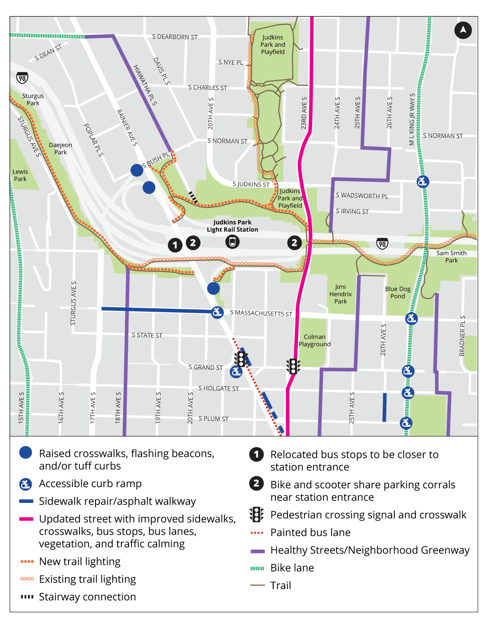
Key definitions for features on the map and guide:
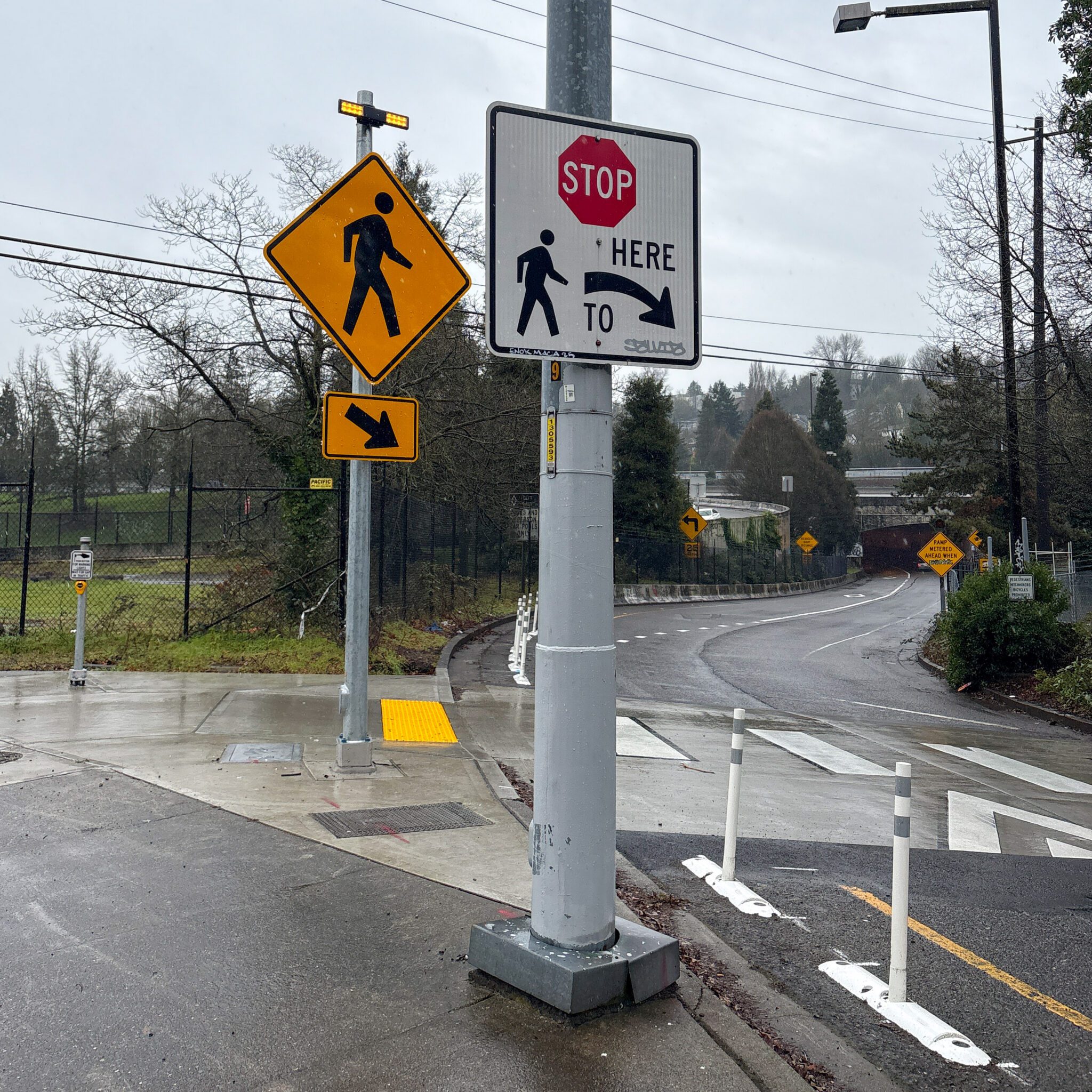
- Curb Ramp: A sloped transition between the sidewalk and the street, designed to provide easier access for people using wheelchairs, strollers, or other mobility devices.
- Flashing Beacons: Pedestrian-activated lights that alert drivers to people walking or rolling across the street.
- Neighborhood Greenways and Healthy Streets: Safer, calmer neighborhood streets for people walking and biking.
- Parking Corral: A designated area for organized bike or scooter parking, helping reduce clutter and keep pathways clear. SDOT is more than tripling Seattle’s bike and scooter parking downtown by summer – ahead of the FIFA World Cup.
- Protected Bike Lanes: Dedicated lanes for bicycles and scooters, separated from motor vehicle traffic for safety.
- Raised Crosswalk: Elevated pedestrian crossings designed to improve visibility and encourage drivers to slow down.
- Traffic Calming: Measures like speed bumps or narrowed lanes designed to slow down vehicle traffic and create safer streets.
- Trail Lighting: Lighting installed along trails to improve visibility and safety during low-light hours.
- Transit Lanes: Street lanes that keep buses moving by separating them from other vehicles, reducing travel times and increasing reliability.
- Tuff Curbs: Durable curbs used to separate bike lanes or transit lanes from vehicle traffic, providing added safety.
Walking, biking, or rolling
Coming from the northwest
Depending on how north you are, you may want to pass through the Central Ridge Neighborhood Greenway. Check out this map for routes north of the Judkins Park area.
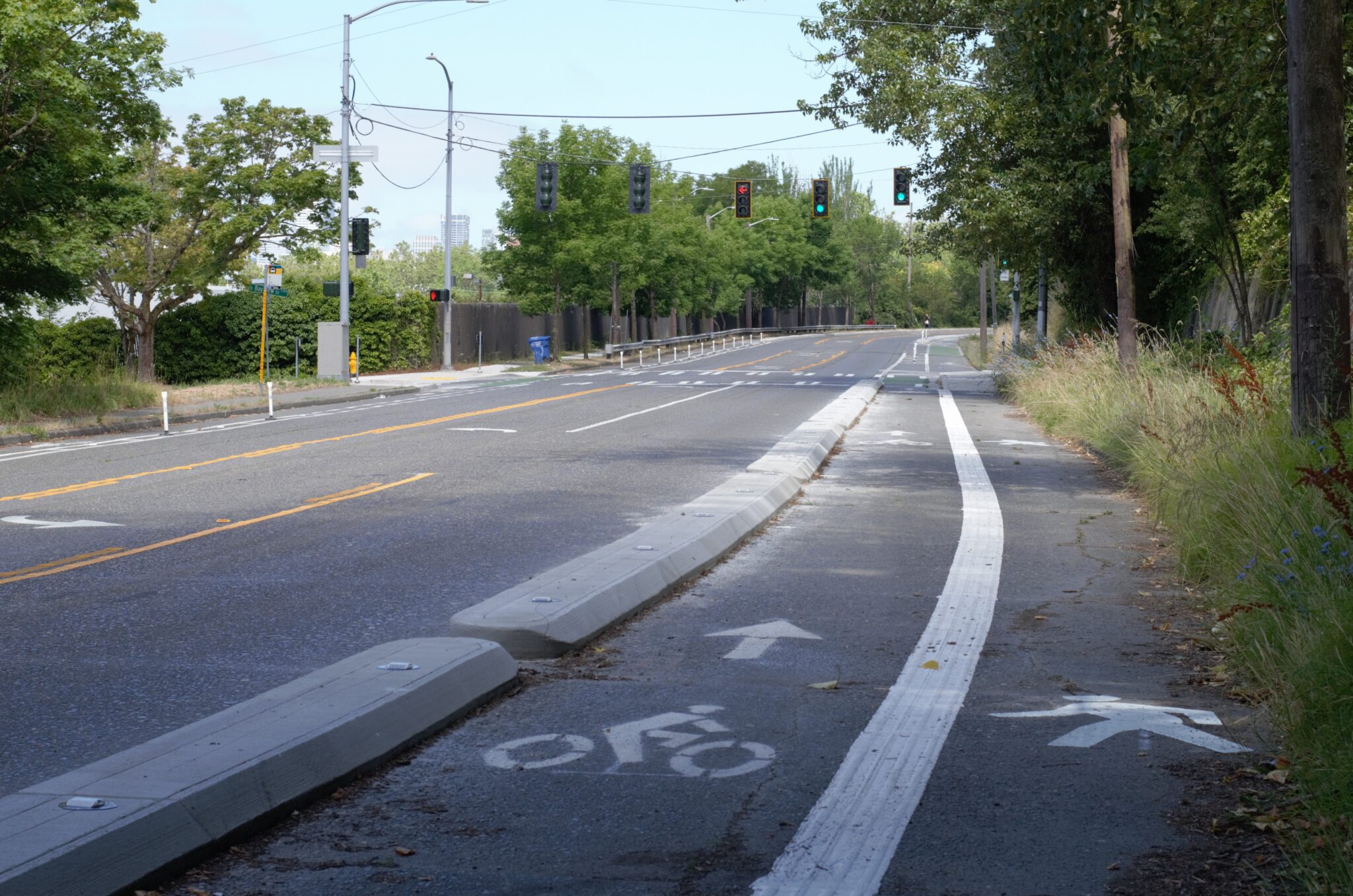
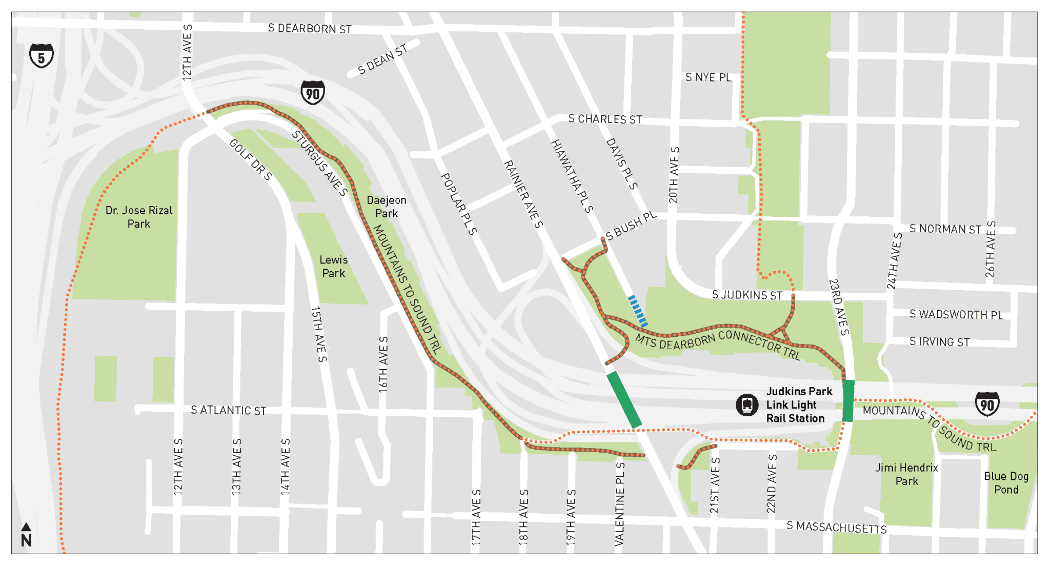
Closer to the station, S Dearborn St was repaved and upgraded with a protected bike lane in 2019. It connects to Hiawatha Pl S, a Neighborhood Greenway with calmer traffic and improvements from the Judkins Park Station Access Project, completed in 2024. This includes the Hiawatha Place Staircase and 1.5 miles of new trail lighting leading to the station.
Coming from the southwest
Take the Beacon Hill Healthy Street, which brings you north on 18th Ave S. From there, follow the new trail lighting just outside Judkins Park Station to reach the west entrance.
If you prefer the east entrance, stay on the multi-use trail until you reach 23rd Ave S.
Coming from the east
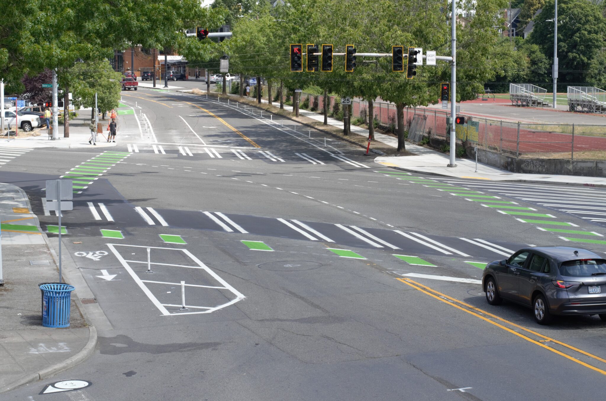
East of Rainier Ave S, along Martin Luther King Jr Way S, you’ll find a protected bike lane and several recent curb ramp improvements.
There’s also a Neighborhood Greenway along 25th Ave S, running parallel to Martin Luther King Jr Way S.
Both routes connect to the new trail lighting near the station.
Taking transit
If you’re planning to take transit, here are some key routes and updates to help you get to Judkins Park Station:
- Route 7: One of King County Metro’s most popular and frequent routes, with new bus-only lanes added to Rainier Ave S in November.
- Route 8: With the opening of Judkins Park Station, Route 8 will no longer run on Martin Luther King Jr Way S between S Massachusetts St and S Jackson St. It will instead travel on 23rd Ave S, serving southbound stops at S Jackson St, S Dearborn St, S Norman St, S Judkins St and S Massachusetts St S. Northbound stops at Massachusetts St & Martin Luther King Jr Way S, 23rd Ave S & S Judkins St, S Norman St and S Lane St. Read more about services changes on King County Metro’s website.
- Route 48: Runs north-south along 23rd Ave/24th Ave, with new signals and bus-only lanes added last year.
- Route 106: Shares much of its route with Route 7, making it a great alternative for transit riders. Bus stops in both directions are located right outside the station’s west entrance on Rainier Ave S.
We’ve also made significant safety improvements:
- Raised crosswalks were installed at three I-90 on- and off-ramps on Rainier Ave S.
- Rapid flashing beacons were activated just this week to enhance pedestrian safety.
Learn more
The 2 Line’s arrival on March 28 marks an exciting new chapter for our region. We’re proud to collaborate with transportation partners like Sound Transit and King County Metro to make Seattle a more connected and accessible city.
Learn more about other transportation updates, including ORCA’s new tap-to-pay feature for credit cards and digital wallets, in our previous post about the Sound Transit Crosslake Connection.
For even more ways to get around Seattle visit FlipYourTrip.org.
Angela Warner contributed to this report.