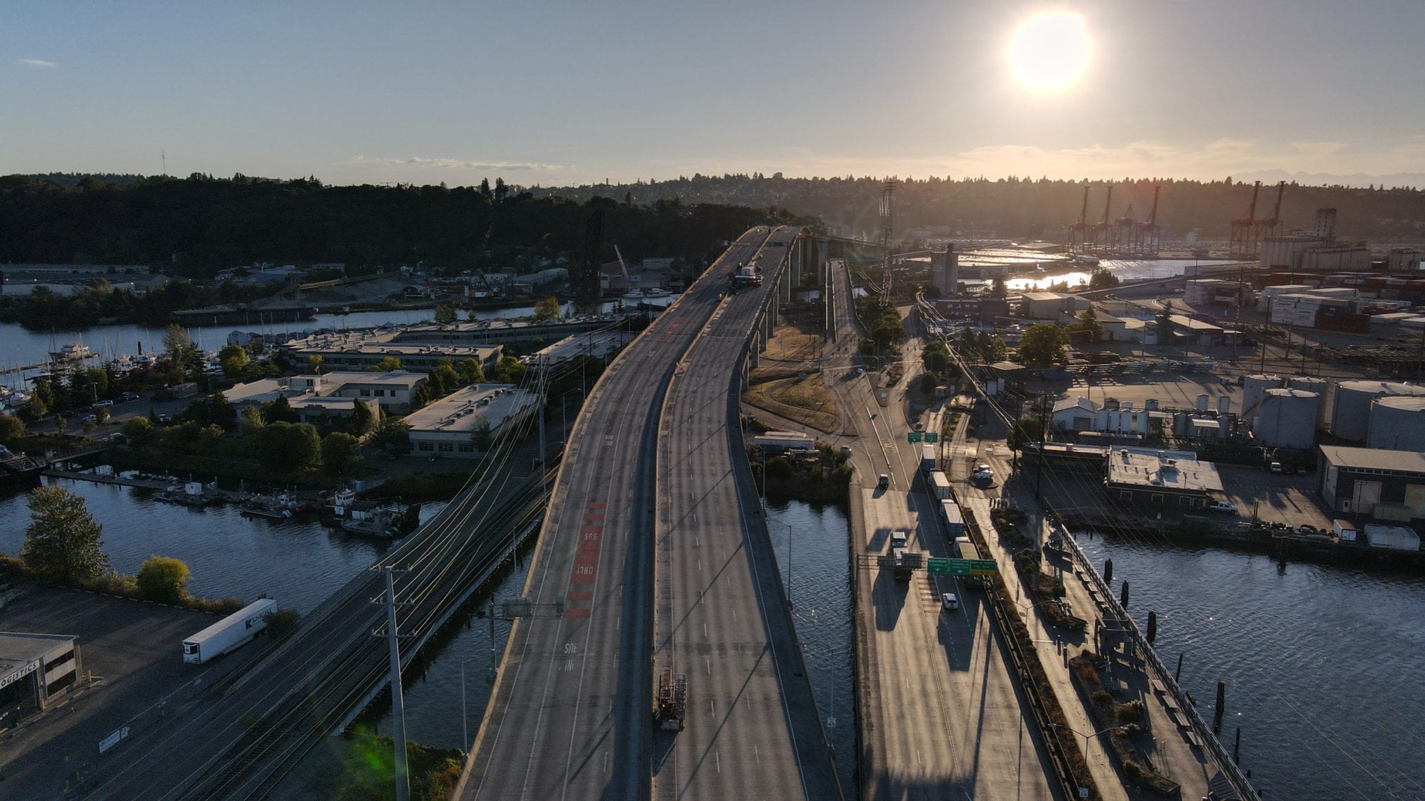
 West Seattle Bridge at sunset. Photo Credit: Madison Linkenmeyer
 During the closure, we’re working to keep people moving, lessen the impacts to the best of our ability, and preserve/enhance public safety.
We know that no level of traffic mitigation can overcome the 100,000+ travelers displaced across West Seattle, Duwamish Valley, and Seattle as a whole by the closure of the High-Rise Bridge. But to the greatest extent of our ability, we’re working diligently to mitigate the impacts and above all else, maintain public safety for you.
In this blog edition, we’re spotlighting some of the important work (from the 175+ projects both big and small completed since March) to support those who are affected by the closure.
Catch up on the latest West Seattle Bridge update – such as details about HNTB, the infrastructure solutions firm selected to design the West Seattle Bridge replacement and updates on project funding.
Every day since the closure, our teams have been actively listening to the community and taking action in and around the peninsula to keep you safe.
From a recent Reconnect West Seattle community survey (BTW, thanks so much to those who took the survey!), we identified and began implementing some of our biggest safety, mobility, and traffic calming improvements to date. Survey responses were valuable in helping guide our ongoing dialogue with the community and increase our understanding of each neighborhood’s unique needs.
Here are some of the highlights of what we’re doing:
On the Bridge
- Stabilizing and shoring the West Seattle High-Rise Bridge
- Continuing to develop repair and replacement designs, timelines, and costs for the West Seattle High-Rise Bridge
On the Ground
- Mitigating traffic to help residents and businesses while the bridge is closed
- Closely monitoring and maintaining the Low Bridge
In the Community
- Providing ongoing, clear communication, access, and transparency
- Public safety
We’re actively meeting with and listening to West Seattle, Georgetown, South Park, Harbor Island, Duwamish, and neighboring communities to determine traffic mitigation solutions that support their needs, prioritize safety and lift voices of historically under served people. Here’s how:
- The West Seattle Bridge Community Task Force helps us center the communities’ voices in decision making. Community Task Force members represent neighborhoods, industries, government, and services across West Seattle and nearby communities. (Read an update from the Community Task Force’s last meeting.)
- We’re committed to meeting with any organization in West Seattle or South Seattle that requests to meet with us – a commitment that has resulted in over 70 stakeholder meetings to-date.
- We’re proactively soliciting participation through outreach letters to community groups and businesses, where we ask for input and offer to meet.
Since May, when we shared the completion of over 80 delivered projects to mitigate traffic, we’ve implemented over 95 new improvements.
So let’s jump right in the highlights. Let’s start with safety. Here are a few of the important safety-focused projects we’ve implemented since May.
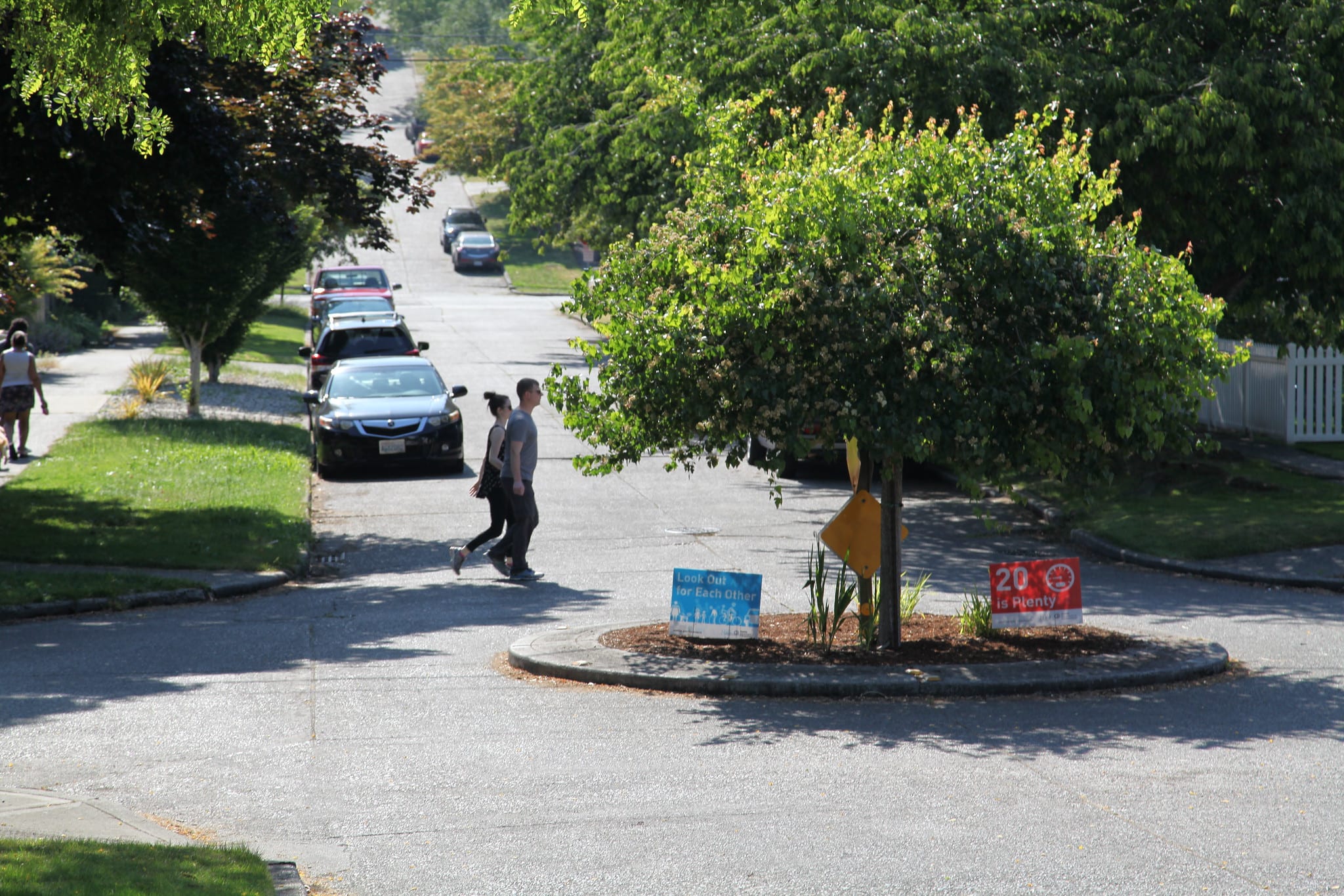
We’re making it safer to cross the street by adding pedestrian-first safety upgrades to intersections.
Public safety is our highest priority. One of the most effective ways that we can make crossing the street safer is to adjust traffic signals so that people have a few-second head start to begin walking across the street before cars get a green light. These pedestrian-first safety upgrades (AKA in transpo-speak: leading pedestrian intervals) make people in the crosswalk more visible to drivers and drastically reduce the risk of being hit by a car.
Across Seattle, we reached our Vision Zero goal to create 250 pedestrian-first intersections six months early.
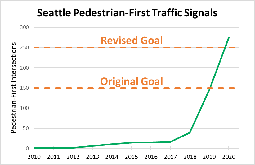
New data shows these have led to a 48% reduction in the number of people hit by cars crossing the street in these locations.
We’re surpassing our Vision Zero goal and turned a lot of our focus to communities impacted by the West Seattle Bridge closure and as a result, we’ve installed over 275 pedestrian-first intersections across Seattle. Here’s where they’ve been installed in the communities impacted by the closure (FYI – it’s 20 intersections, to-date!):
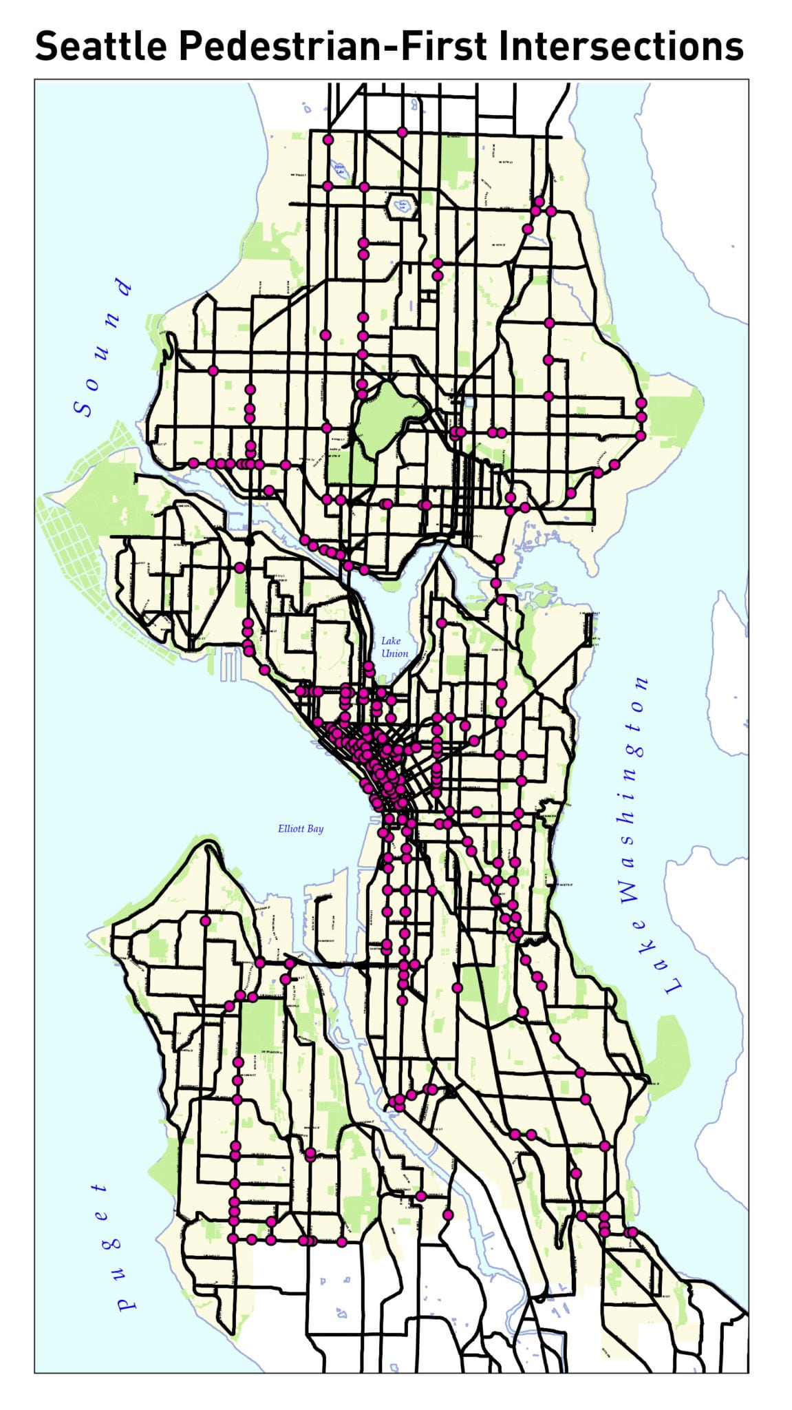
- 15th Ave SW and SW Roxbury St
- 16th Ave SW and SW Austin, SW Holden, and SW Roxbury Streets
- 17th Ave SW and SW Roxbury St
- 26th Ave SW And SW Roxbury St
- 26th Ave SW and SW Roxbury St
- 30th Ave SW and SW Roxbury St
- 35th Ave SW and SW Findlay, SW Henderson, SW Holden, SW Morgan, SW Raymond, SW Roxbury, SW Thistle, SW Trenton, SW Webster Streets
- 8th Ave SW and SW Roxbury St
- Delridge Way SW and W Marginal Way SW/SW Chelan Way
- West Marginal Way SW and Highland Park Way SW
We’re continuing to reduce speed limits to 25 MPH, which is especially important right now for safety and mobility. Here’s why:
- About a quarter of the time we spend sitting in traffic is due to crashes. In other parts of the city, we’ve seen as much as a 35%-45% reduction in crashes after installing 25 MPH speed limit signs on comparable streets. These 25 MPH speed limits will be an essential part of our plan to keep West Seattle moving.
- Even more importantly, a person walking, rolling, or biking is twice as likely to be killed if they’re hit by a person driving 30 MPH than someone going 25 MPH. Ninety percent of people hit by cars going 20 MPH survive.
To reach our Vision Zero goal of no serious injuries or fatalities, Seattle is reducing speed limits to 25 MPH across the city.
Since the bridge closure, we prioritized West Seattle, South Park, and Georgetown streets, and reduced speed limits along 42 miles on over 50 streets. See which streets have had their speed limits lowered on our city speed limit map.
We zeroed in on Vision Zero on and around Sylvan Way SW.
Sylvan Way SW is a sloped and curvy road along the detour route to the 1st Ave Bridge. Unfortunately, drivers have been taking the hill too aggressively resulting in an increase in crashes. In response to these concerns, also expressed by the community and elected officials, we:
- Will be installing four speed radar signs to show drivers their speed as they travel down the hill and encourage them to slow down.
- Distributed Vision Zero signs for neighbors to place in their yard to remind drivers to slow down.
- Worked with landscape crews to cut back vegetation and trees to improve sightlines on Sylvan Way SW between Delridge Way SW and SW Holly St.
We’re working to make Highland Park safer for everyone by installing speed humps and cushions to reduce speeds and calm traffic.
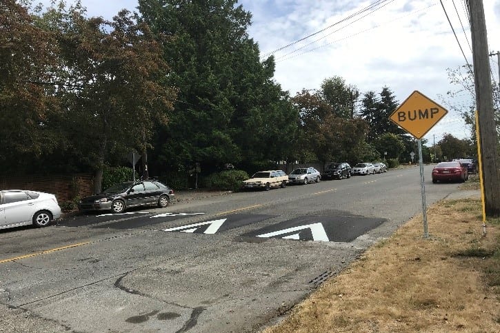
Seattle, we want you to know that we hear you. As displaced travelers seeking new routes cut and speed through neighborhoods, more traffic calming measures are needed to keep you and your loved ones safe.
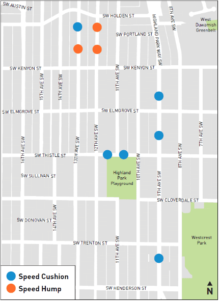
The community asked for more safety and traffic calming features and we installed them.
As part of the Highland Park Way SW and SW Holden Street Safety Project, we installed safety and traffic calming elements throughout the neighborhood. Check out the map to peek where new speed humps and cushions have been added in the community!
We’re also making strides to mitigate traffic, manage detours, and enhance access to transit.
Traffic and Detour Management
- At the 16th Ave SW and SW Holden St intersection, we added new turn pockets so drivers can make protected left turns going east and west on SW Holden St. To limit the cut-through traffic on 20th Ave SW, we installed new signs to better identify the arterial streets near the intersection. We also made signal timing adjustments to help people get through the intersection better.
- We made upgrades to traffic signals all over West Seattle and nearby neighborhoods that allow us to better manage and fine-tune the traffic signals remotely in response to real-time traffic conditions. In particular, we’ve made signal timing changes in the SW Michigan St corridor to improve travel flow.
Transit
At 11th Ave SW and SW Spokane St, we installed both west- and east-bound bus stops to provide access to Harbor Island.
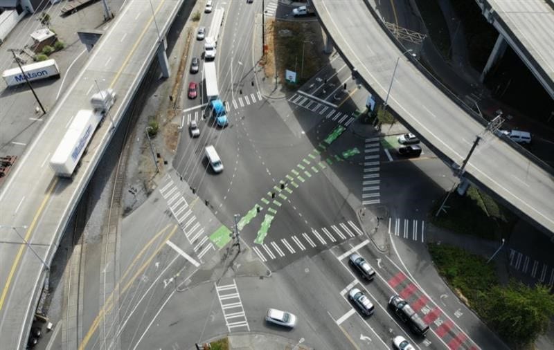
As part of our ongoing improvements to the 5-legged intersection of Delridge Way SW, Chelan Ave SW, and W Marginal Way SW, just west of the Spokane St Low Bridge, we’ve added red bus lanes west of the diverge for westbound SW Spokane St and SW Spokane Place. Red markings help to make bus lanes more visible to drivers so that it’s clear where cars are not allowed. This helps increase compliance with bus-only restrictions, which is essential to keeping transit moving.
We’ve also completed many other improvements to promote mobility and safety!
- We restriped the local business access road at the Terminal 5 Low Bridge Access Road and Terminal 5 Bridge, which means we’ve restriped all major roads in West Seattle.
- We rebuilt concrete roadway panels at the intersection of 32nd Ave S and SW Barton St.
- We installed a temporary four-way traffic signal and made pedestrian and bike safety improvements at Highland Park Way SW and SW Holden St – an intersection that has long been a priority for safety improvements.
In partnership with the community and to honor their priorities, we’re developing additional projects to enhance safety, support biking, manage traffic, and much more.
This is still the beginning of all of the important work to be done. We’re excited to keep you up to speed on all of these projects!
Stay connected with us!
Sign up to receive West Seattle High-Rise Bridge project update emails. Visit our West Seattle High-Rise Bridge website and stay informed!
- Peek at the frequently asked questions at the bottom of the page.
- Check out the inspection reports.
- Find links to other West Seattle Bridge blog articles.