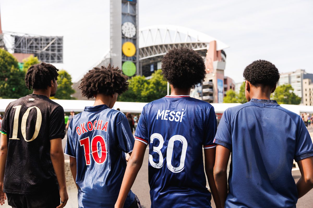
 Fans arrive at Lumen Field after taking transit to the Club World Cup game between the Seattle Sounders and Paris St. Germain on June 23, 2025. Photo: Peter Bohler, Sound Transit
 Seattle is preparing to welcome visitors from around the world for FIFA Men’s World Cup. We’re doing this in a coordinated and thoughtful way to help everyone travel safely and reliably.
Over the next few months, you’ll see changes across the city. These changes may affect how streets work, how you travel, and how we share real-time information. This is a coordinated effort across the region.
This blog starts our #WCSeattle (World Cup Seattle) series for what we’re doing to get ready, what you can expect, and how to plan ahead.
This story is part of our #WCSeattle series. Check out our bike and scooter guide, the Pioneer Square pedestrian zone plan and a Roadside Chat with SDOT’s head of construction and mobility about the construction pause and our traffic strategy.
Additional languages:
- ሲያትልለፊፋ (FIFA) የወንዶችየዓለምዋንጫእየተዘጋጀችነው | #WCSeattle
- استعدادات سياتل لكأس العالم لكرة القدم للرجال FIFA | #WCSeattle
- Seattle se priprema za FIFA Svjetsko prvenstvo za muškarce | #WCSeattle
- Seattle se prepara para la Copa Mundial de Fútbol de la FIFA | #WCSeattle
- سیاتل آماده میزبانی برای جام جهانی فوتبال مردان فیفا میشود | #جامجهانیسیاتل (WCSeattle#)
- Seattle se prépare à la Coupe du Monde de la FIFA #WCSeattle
- Seattle si prepara per i Mondiali di calcio # WCSeattle
- 시애틀, FIFA 남자 월드컵 개최 준비 본격화 | #WCSeattle
- Seattle maakt zich op voor het wereldkampioenschap voetbal voor mannen | #WCSeattle
- Сиэтл готовится к чемпионату мира по футболу среди мужских команд ФИФА (Международной федерации футбола) | #WCSeattle
- Seattle oo isu diyaarinaysa Koobka Adduunka ee Ragga ee FIFA | #WCSeattle
- Naghahanda ang Seattle para sa FIFA Men’s World Cup | #WCSeattle
- Сіетл готується до Чемпіонату світу з футболу серед чоловіків | #WCSeattle
- Seattle sẵn sàng cho FIFA World Cup | #WCSeattle
- 西雅图蓄势待发,迎接国际足联男子世界杯(FIFA Men’s World Cup)|#WCSeattle
- 西雅圖蓄勢待發,迎接國際足總男子世界盃(FIFA Men’s World Cup)|#WCSeattle
Jump to:
- A Regional Effort to Keep Seattle Moving: Hosting the World Cup takes coordination across the region, not just within Seattle.
- What We’re Doing Behind the Scenes: Getting ready for an event of this scale means preparing early, fine tuning daily operations, and making long-term improvements, not just for the games but for Seattle’s future.
- Designing for People: Pioneer Square and Pike Place Market: Some of the biggest changes you’ll see will be in Seattle’s most well-known neighborhoods.
- What You Can Do Now: Flip Your Trip! During the World Cup, travel will look different, and everyone can help.
- Stay Connected: We’ll keep you posted with updates, tips, and travel info across all SDOT channels so you can stay informed and plan with confidence.
A Regional Effort to Keep Seattle Moving
Hosting the World Cup takes coordination across the region, not just within Seattle.
We’re working closely with transit agencies, neighboring cities, and partners to help you travel between the airport, downtown, stadiums, and other key destinations. That includes coordination with partners like:
Together, transit connections and clear and consistent information will happen across agencies.
What We’re Doing Behind the Scenes
Getting ready for an event of this scale means preparing early, fine tuning daily operations, and making long-term improvements, not just for the games but for Seattle’s future.
Here’s what’s already in place and what’s underway.
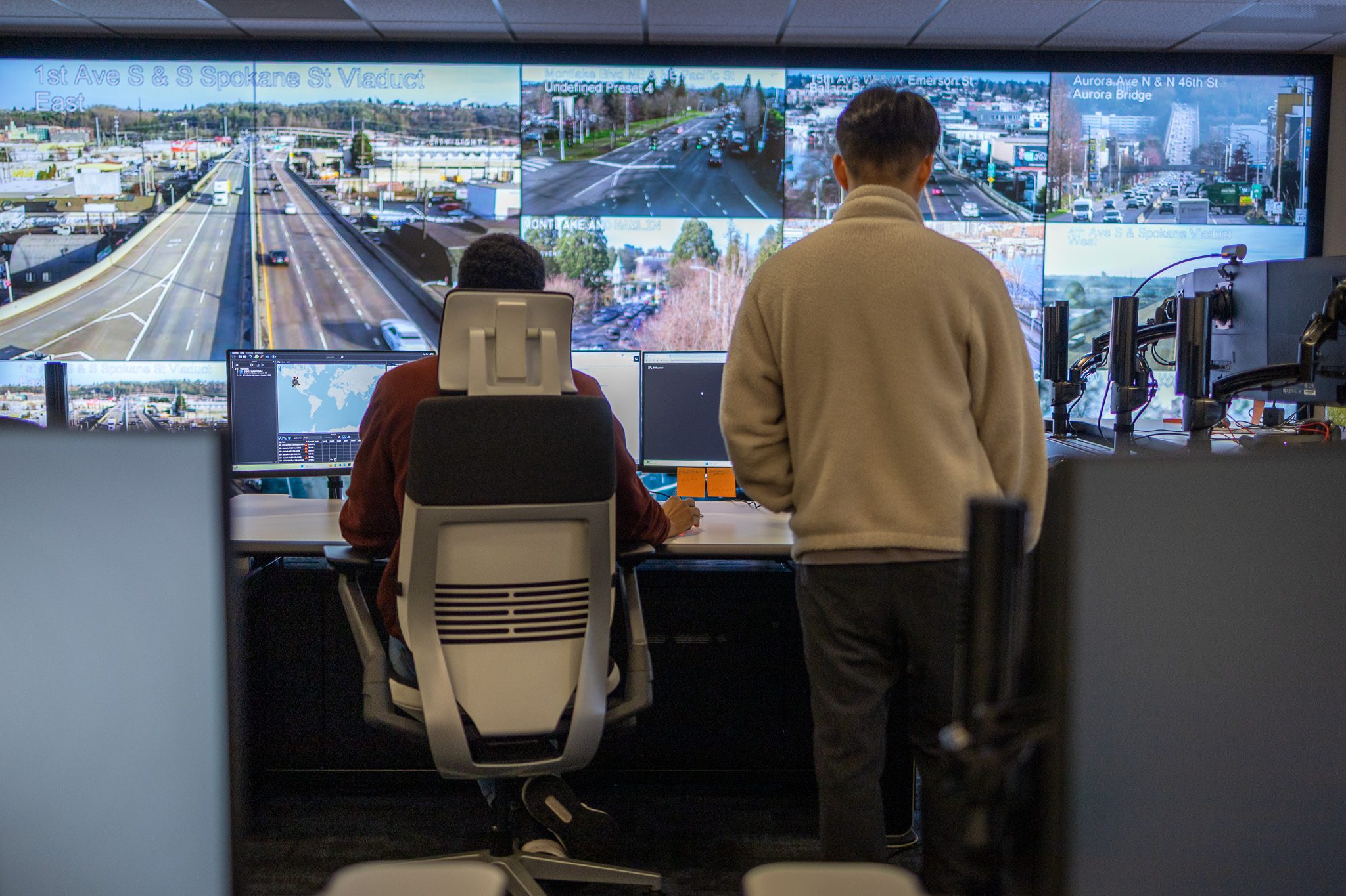
Real-Time Traffic Operations
We watch the transportation system and make real-time changes, like adjusting traffic signals. The SDOT Transportation Operations Center monitors traffic conditions 24 hours a day and shares information on the X platform (@SDOTtraffic). View the Travelers Map on seattle.gov/Travelers.
Construction Pause to Reduce Disruptions
Construction will pause in key areas from June 8 through July 6, 2026. This means fewer private and public work zones on streets and sidewalks and more space for transit and people walking, rolling, and biking. With fewer construction impacts, it will be easier to use our public spaces.
Transit-First Travel
We’re making it easier to travel by transit.
What’s already in place:
- Expanded transit priority, such as 24/7 bus lanes on corridors like Aurora Ave and Rainier Ave
- Upgraded transit stops, including improvements at 3rd Ave and Main St
- Upgrades along 3rd Ave with better lighting and access
- Stronger connections between light rail, buses, streetcars, ferries, and Coleman Dock with service like Madison St RapidRide G
- New downtown signs and visitor information to help people find transit connections and destinations
- A Bike & Scoot to Transit program with free transit tickets and bike and scooter share ride credits
What we’re doing for game days:
- Seattle Streetcar’s First Hill Line will have extra service on match days, with streetcars arriving more frequently. For streetcar service updates, sign up for King County Metro’s Transit Alerts and check First Hill Streetcar and South Lake Union Streetcar.
- Sound Transit plans to run more service on game days, including more frequent Link light rail and additional Sounder trains to help people get to and from the stadium.
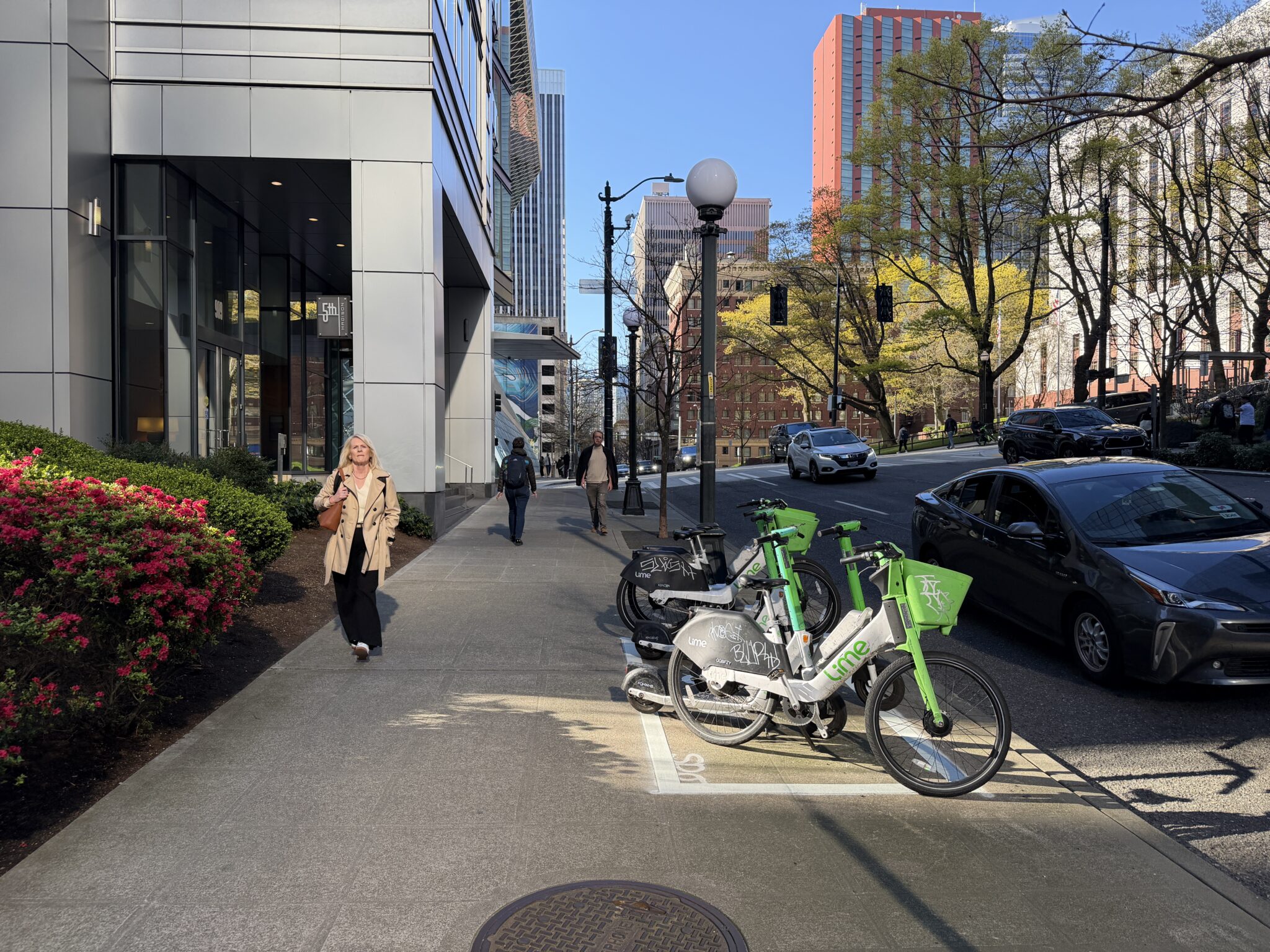
New Ways to Get Around
We’re making it easier (and more fun!) to get around without a car.
What’s already in place:
- Improved sidewalks, wheelchair ramps, and crosswalks near Lumen Field, Union Station, and Pioneer Square.
- Better connections between downtown and the waterfront, including the Union Street elevator and stairs, the Marion Street Bridge and Coleman Dock, the Overlook Walk, and east and west improvements on Washington St, Yesler Way, and 2nd Ave S.
- A new sidewalk on 4th Ave S, improving access between SODO and downtown.
- A connected bike network, including a protected bike lane on Alaskan Way, safety upgrades on E Marginal Way, Yesler Way protected bike lane from Occidental Ave S to the waterfront, and upgraded connections in the Center City Bike Network
- More bike and scooter parking to manage demand help reduce sidewalk crowding
- Offering bike and scooter “valet” parking near stadiums on game days
Managing Curb Space and Access
We’re organizing curb space and creating maps to account for more people walking and continued need for loading and unloading.
What’s already in place:
- New signs and visitor kiosks across downtown with maps, landmarks, and transit information to help visitors and residents easily find their way across downtown neighborhoods
What we’re doing on World Cup game days:
- Designating rideshare and taxi zones away from the busiest areas near stadiums
- Providing clear guidance on game day loading and unloading locations
- Creating extra space for people waiting to ride light rail
- Supporting ADA drop-off
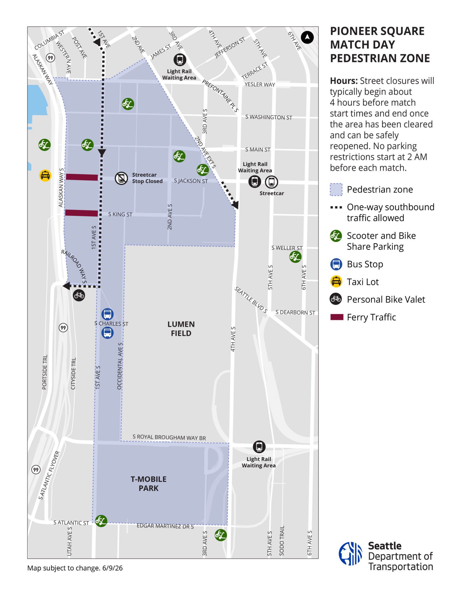
Designing for People: Pioneer Square and Pike Place Market
Some of the biggest changes you’ll see will be in Seattle’s most well-known neighborhoods.
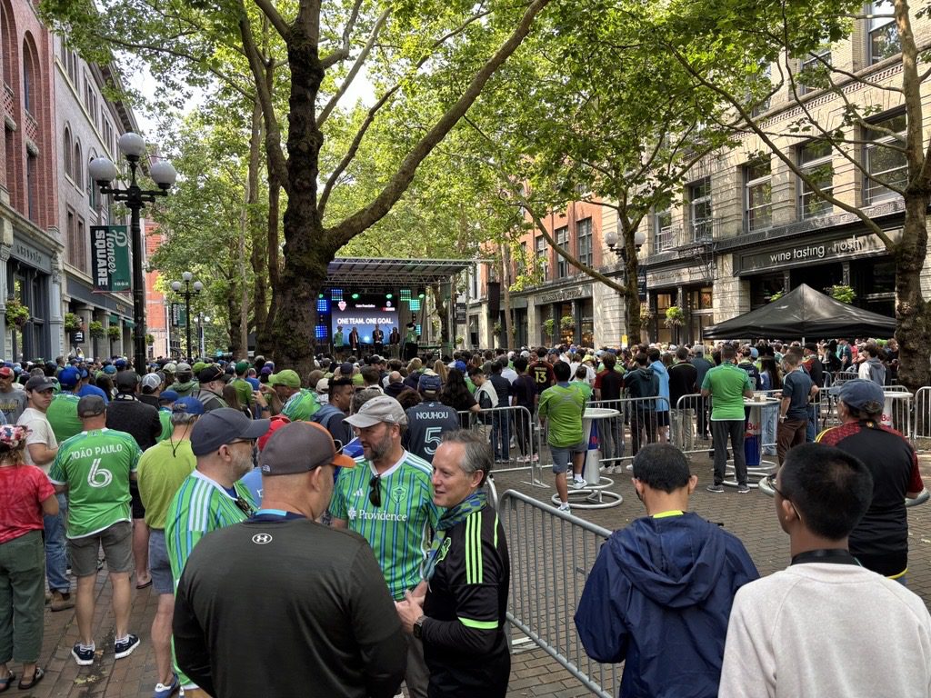
We’re planning for more walkable, people-focused streets in areas like:
These changes include operational changes and are designed to:
- enhance safety
- make space for thousands of visitors
- manage bike and scooter share speeds at 8 MPH
In Pioneer Square, improvements to public spaces like Fortson Square, along with nearby walking, lighting, and access improvements will help create a more welcoming gateway into the neighborhood.
Click here for an interactive map of SDOT FIFA street closures and operational changes.
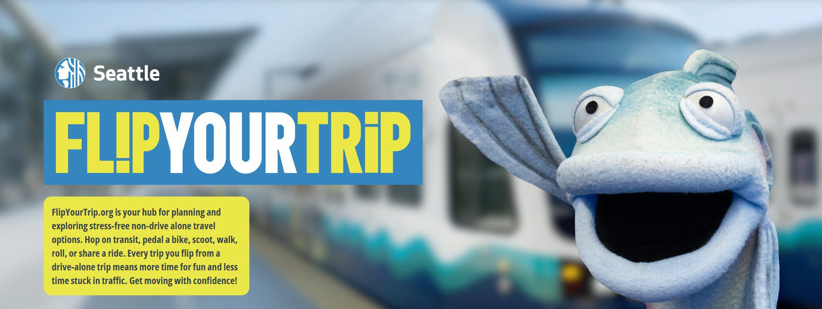
What You Can Do Now: Flip Your Trip!
During the World Cup, travel will look different, and everyone can help.
As we get closer to the World Cup, you can expect:
- Busier travel, especially on game days
- Temporary street changes near stadiums and fan areas
- Real-time updates to help you plan ahead
The good news: we’ll share clear and timely information so you can make informed travel choices.
Even small changes like taking transit, biking, walking, carpooling, or changing your commute times can make a big difference in keeping the city moving.
That’s why we’re encouraging everyone to “Flip Your Trip”:
- Try transit before the tournament starts
- Test a new route or schedule
- Practice now so travel is easier during match days
- Watch these short videos to help you learn how to ride transit and travel without a car!
Visit FlipYourTrip.org to explore all your travel options.
Stay Connected
We’ll keep you posted with updates, tips, and travel info across all SDOT channels so you can stay informed and plan ahead with confidence. This blog is just the beginning.
Visit and follow along:
Web | Blog | X | X Traffic | Instagram | TikTok | Facebook | LinkedIn | YouTube | Flickr | Customer Service | Alert Seattle
More from our #WCSeattle series:
Seattle Will Be Ready
We’re preparing now so residents and visitors alike can travel safely, reliably, and enjoy everything Seattle has to offer. We look forward to welcoming visitors from around the world!