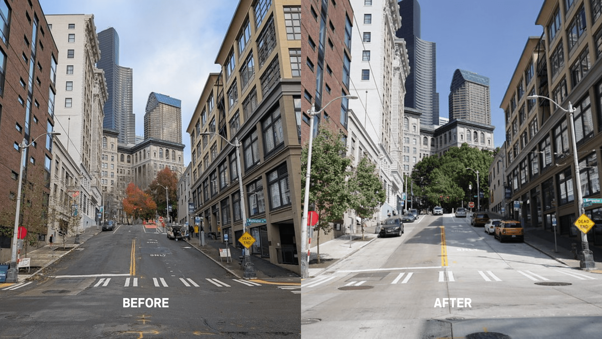
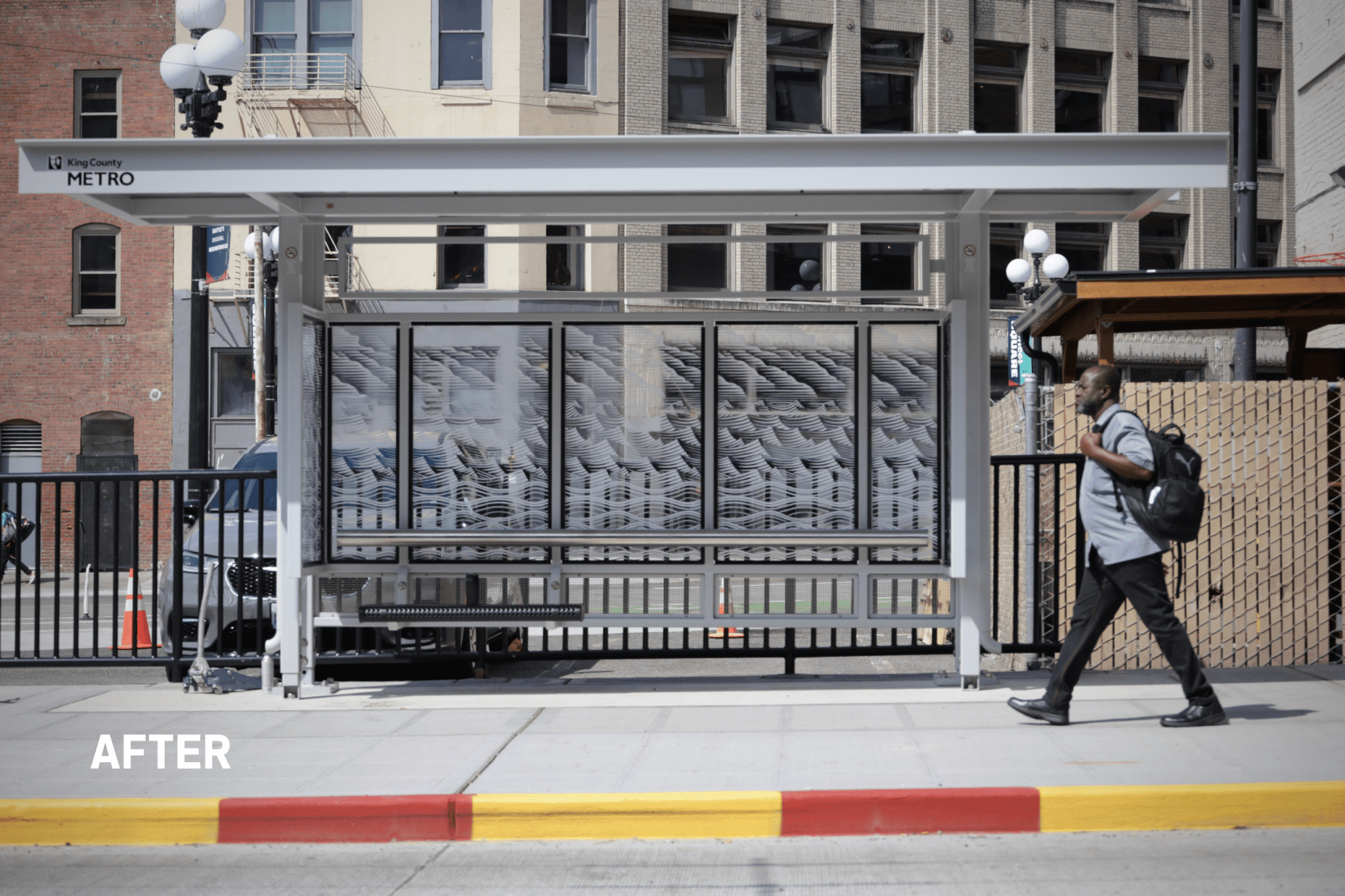
 A “before” and “after” view of 3rd Ave near Washington St. Photo: SDOT
 If downtown is the heart of Seattle, then 3rd Ave is its main artery. Lined with bus stops and light rail stations, it’s the city’s busiest transit corridor connecting people to shops, restaurants, and so many of Seattle’s neighborhoods and attractions.
Tens of thousands of people travel to 3rd Ave on buses every weekday.
Over the past three years, we partnered with King County Metro, residents, businesses, and other community partners to improve 3rd Ave, including:
- Upgrading bus stops
- Widening sidewalks
- Installing new lighting
- Making crossing signals more accessible for people who are blind or have limited vision
- Repaving several parts of the street
Thanks to these investments it’s easier to get to, from and around Downtown Seattle.
Much of the improvements were locally funded by the voter approved Levy to Move Seattle and Seattle Transportation Levy. So, thank you, Seattle.
Continue reading to learn how investments are upgrading 3rd Ave, and for more on the broader Downtown Seattle area, check out these stories about adding illuminating lighting and marvelous murals, redeveloping Fortson Square public space in collaboration with the Chief Sealth Club, and the grand opening last year of the Central Waterfront Park.
Jump to:
3rd Ave repaving and water main replacement
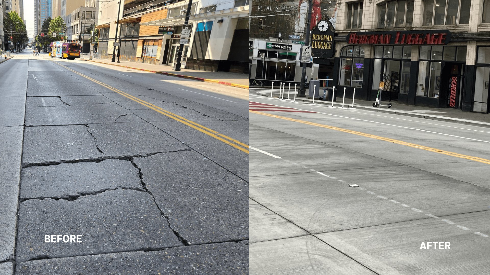
As of May 2026, we have officially finished repaving 3rd Ave between Virginia St and Pine St. This project had two goals:
- Replace the 100-year-old water main under the street
- Repave the street, making it smoother
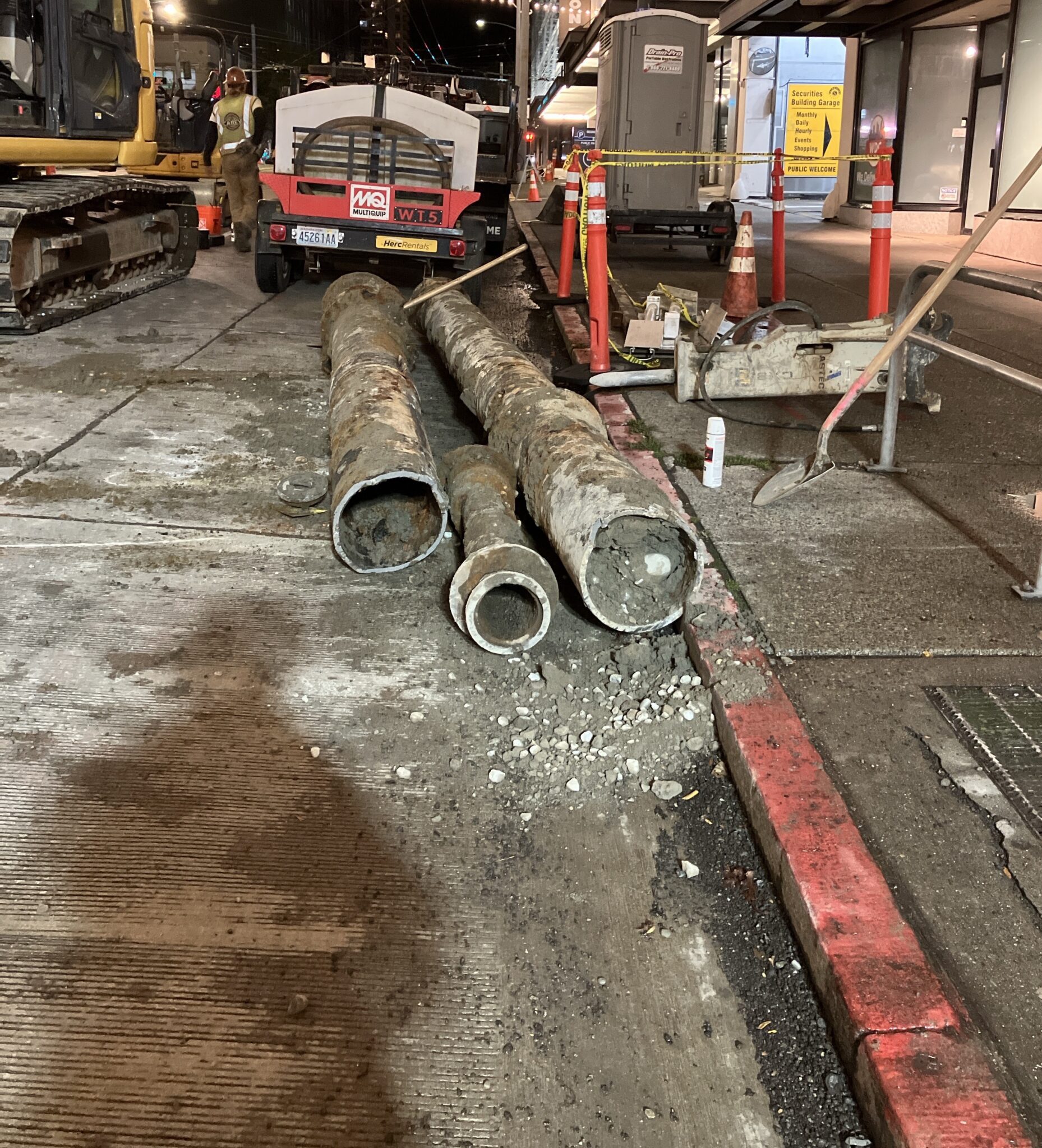
We partnered with Seattle Public Utilities to replace the water main. After we demolished the street surface, they dug up the old pipe and installed the new one. Once SPU completed their work, it paved the way (joke intended) for us to do the next phase of improving 3rd Ave.
The concrete on the street had numerous cracks, potholes, and uneven parts. Because of these, bus rides on this part of 3rd Ave were extra bumpy. The new, smooth concrete panels will ensure bus riders are in for smoother rides.
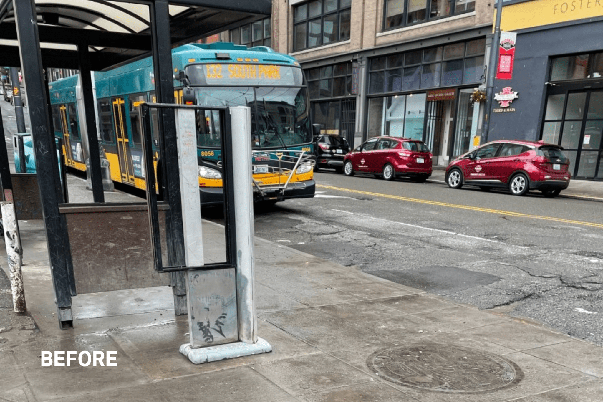
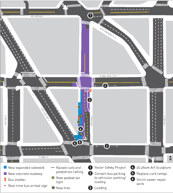
3rd Ave S and S Main St bus stop area improvements
With King County Metro’s help, we made a lot of changes to the bus stop a 3rd Ave S and S Main St.
This major transit hub is near several art galleries, non-profit organizations, and other vital services and destinations that make Pioneer Square such an important area.
This part of 3rd Ave’s street had numerous potholes, cracks, and divots. It was in dire need of repair. So, a major part of our project was to repave the street.
Watch a video about the 3rd Ave and Main St bus stop improvements project below.
And we didn’t stop there. We also made the area more accessible for people who are walking and rolling. We widened the sidewalk to give extra space for people waiting for the bus, while also allowing other people to pass by comfortably without crowding or stepping into the road.
Some other things we did to make the area more inviting and accessible:
- Planted two new street trees
- Installed new pedestrian lighting
- Replaced the ADA-accessible curb ramps on the west side of 3rd Ave S.
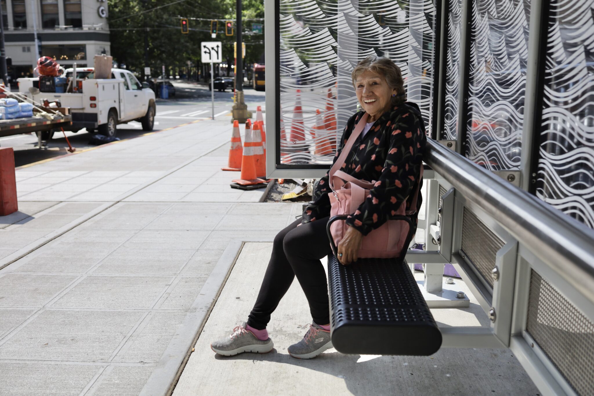
The bus stop also received:
- A new covered shelter
- New benches
- Rails for bus riders to lean on
- Real-time information signs
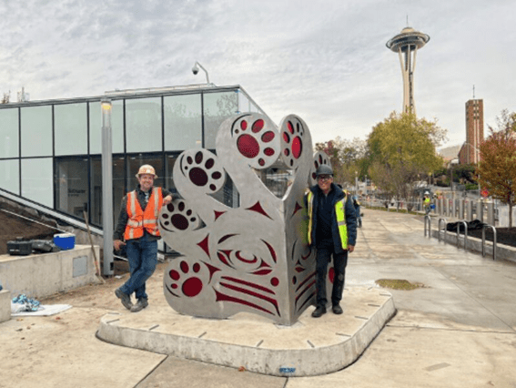
4Culture (King County’s cultural funding agency) will install a sculpture called “The Raven” by artists Preston Singletary and David Franklin after the World Cup. It will showcase Pioneer Square’s beloved art scene and highlight the stories and history of indigenous people and Tlingit culture.
3rd Ave S & Yesler Way pedestrian and bike improvements
The 3rd Ave S and Yesler Way intersection in Pioneer Square is a major bus thoroughfare and transfer point for Pioneer Square bus and Link light rail riders.
Today, the protected bike lane on Yesler Way connects to Seattle’s Waterfront and more bike lanes on 2nd and 4th Aves. Our bike network has grown a lot since Downtown Seattle’s first bike lane was installed on 2nd Ave in 2014, launching the City Center Bike Network project a year later.
RELATED: Seattle’s newest bike lane closes final gap on ‘City Center’ map! Well, kind of… | LEVY FUNDED
In 2022, we tried to make 3rd Ave and Yesler Way easier to navigate by removing:
- A northbound vehicle lane
- A right turn lane on 3rd Ave that crosses Yesler Way
These changes made it safer for people on bikes to cross Dilling Way and get to and from the 4th Ave protected bike lane. We also reconfigured the traffic signal to provide more time for buses and people to cross. Lastly, we used paint and flexible plastic posts to indicate the additional space for people to walk, roll, and bike.
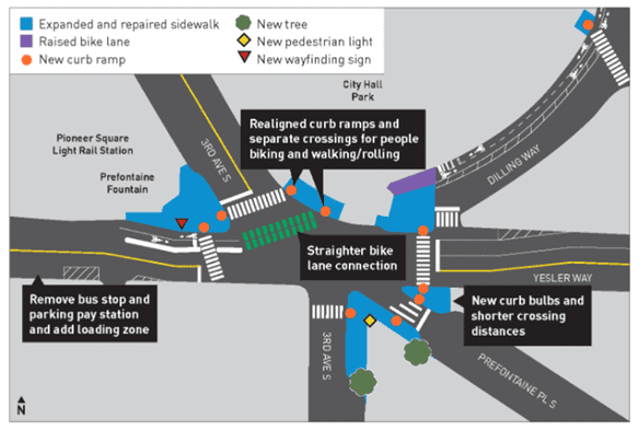
These changes were generally successful. In 2024, we began making these improvements permanent. We also made some adjustments based on lessons learned during the trial period. Here’s what we did:
- Created new, wider concrete sidewalk
- Planted new street trees
- Added more pedestrian lighting
- Installed directional signs for pedestrians
- Installed new bike traffic signals
- Built permanent bike lane protection along Yesler Way west of 3rd Ave
- Repaved the bike lane on Dilling Way
- Redesigned the bike crossing at 3rd Ave to separate people on bikes from people walking
Seattle and the World Cup
These improvements will make traveling around Seattle better during the World Cup, and for many years to come.
Learn more about what we’re doing to prepare:
Local funding matters
Local funding sources like the Levy to Move Seattle, our current Seattle Transportation Levy, and the Seattle Transit Measure are critical for maintaining and modernizing our city’s transportation network and making transit more reliable and accessible.
So, thank you again, Seattle.
This is your city, and together we’re building sidewalks, paving streets, repairing bridges, and improving our transit connections.
RELATED STORIES:
Stay connected:
Thank you for your interest as this important work moves forward. For 3rd Ave Improvements specifically:
- Visit our web page to for project details.
- Questions? Email us at 3rdAveImprovements@seattle.gov or call (206) 900-8729.
We post transportation updates, travel tips, and more across all SDOT channels so you can stay informed and plan ahead with confidence.
Web | Blog | X | X Traffic | Instagram | TikTok | Facebook | LinkedIn | YouTube | Flickr | Customer Service | Alert Seattle
You can also visit FlipYourTrip.org for mode-specific travel tools, video guides, links to resources from our regional transit partners, and more.