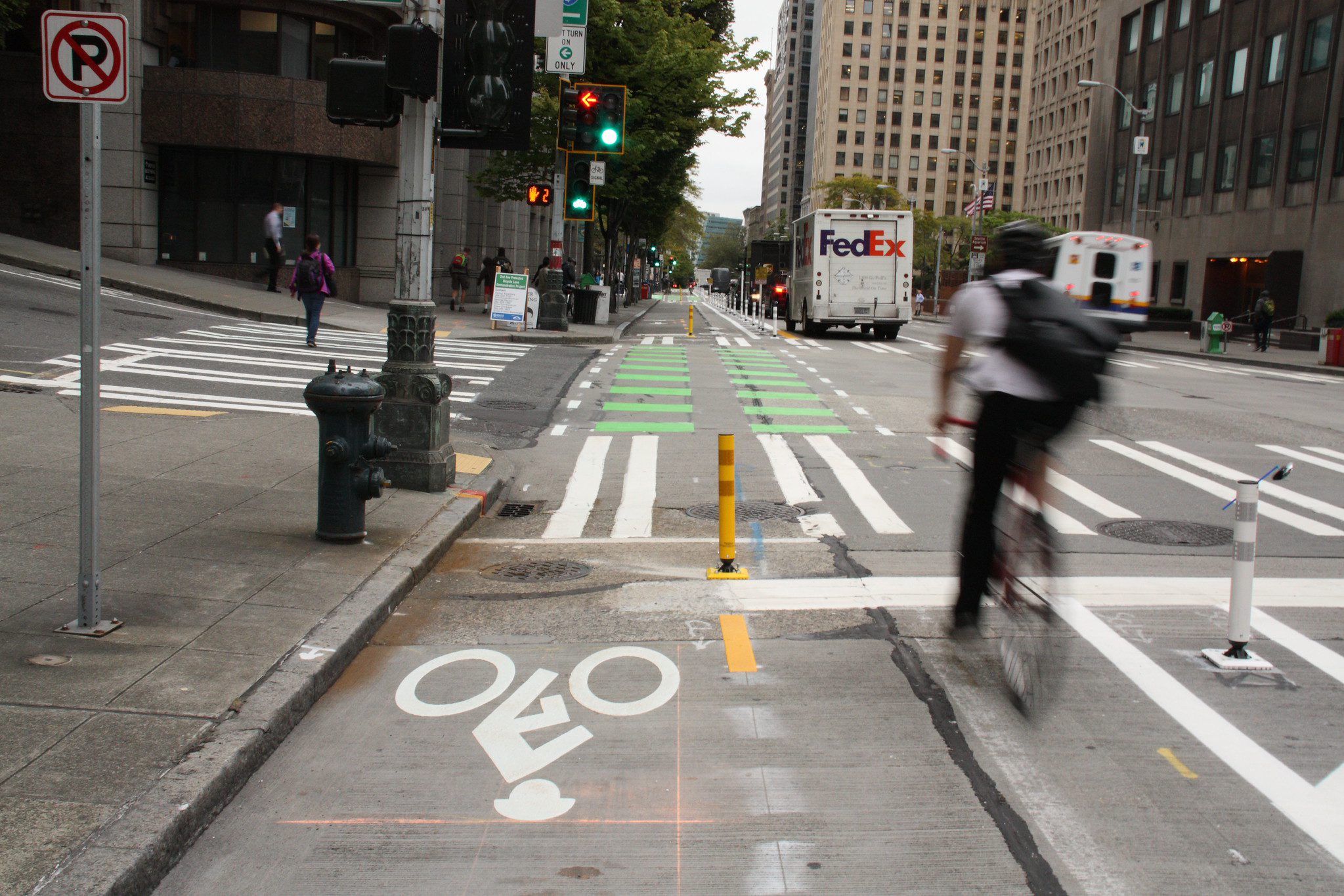
 Seattle’s first downtown protected bike lane opened Sept. 8, 2014 on Second Avenue between Pike Street and Yesler Way. Photo: SDOT
 Editor’s note: The protected bike lane southeast of Seattle Center is now open and it includes some colorful new art barriers! Read on to see how much Seattle’s City Center Bike Network has grown and where you can find other new bike lanes around town. Enjoy your ride.
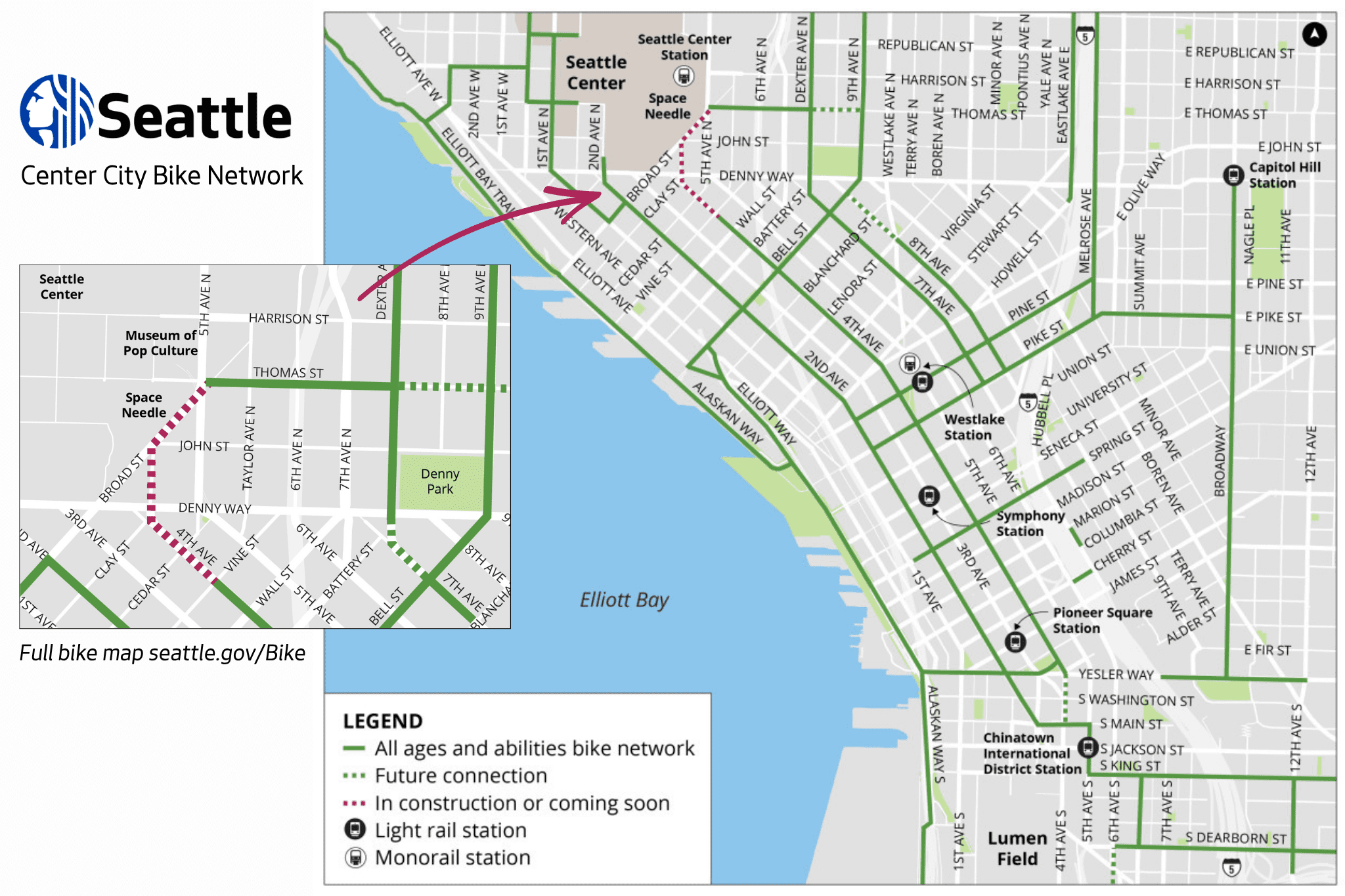
Seattle’s newest protected bike lane will connect Belltown to Seattle Center’s southeast corner, near the Space Needle and the Museum of Pop Culture.
When this bike lane project is complete, the City Center Bike Network map will be fully green for the first time since the broader downtown project launched in 2015!
Ok, fully green does not mean fully done. In fact, you’ll find future connections on the map indicated by green dotted lines. But boy, have we come a long way since the City Center project launched.
Back then, Downtown Seattle had its first and only protected bike lane on 2nd Ave between Pike St and Yesler Way. What began as a 10-block pilot program has evolved into a bike-friendly and award-winning network that connects neighborhoods and communities across the city.
This milestone doesn’t mark the end of Seattle’s bike lane expansions; but let’s celebrate all that solid green as we kick off Bike Everywhere Month and gear up for the FIFA Men’s World Cup.
Here’s what you can expect near Seattle Center in the coming days, and some other recently completed bike lanes to check out.
Jump to:
- What to expect near Seattle Center
- Alaskan Way
- Bell Street
- East Marginal Way
- Renting bikes and scooters, riding safely, and parking properly
- More ways to get around Seattle
- Local funding matters
- Stay connected
What to expect near Seattle Center
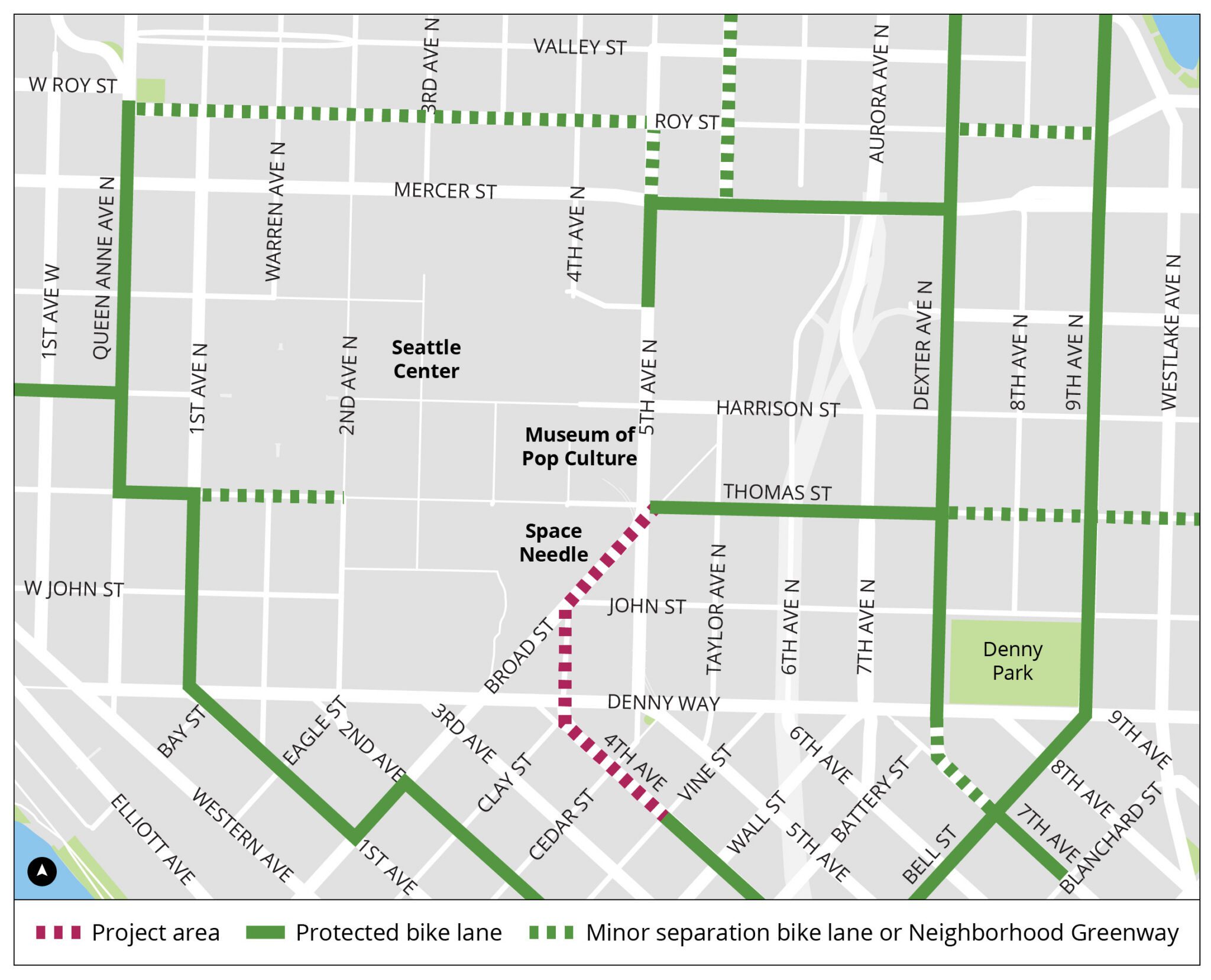
Belltown to Seattle Center Connection Project
The Belltown to Seattle Center Connection Project is wrapping up and you will likely notice bike lane markings as early as this weekend.
Before the new bike lanes officially open, here’s what needs to happen first:
- If weather allows, crews are planning to stripe the new bike lane this weekend, May 1-2.
- Following that, crews will install the protected barriers and do signal work.
In addition to the new protected bike lane, this project also includes:
- A new All Way Walk at Broad St, 4th Ave N, and John St
- Vehicle Parking and Loading Zones on 4th Ave, Cedar St, 4th Ave N, and Broad St
- Bike parking areas for shared and personal bikes and scooters
- New bike signals at 4th Ave and Vine St and 4th Ave and Denny Way
- New bike signals at the diagonal crossing at 4th Ave and Cedar St
Learn more about the project on the Belltown to Seattle Center Connection Project page.
Thomas St Plaza
We’re also working on a shared-use path nearby on Thomas St as part of Thomas St Plaza construction.
This is the second phase of the East of Seattle Center connection in the Thomas St Redefined project. Much of it was completed last year.
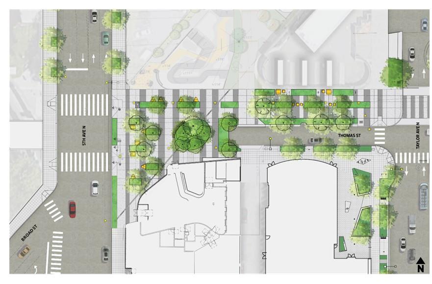
Still to come, you can expect improvements between 5th Ave N and Taylor Ave N, like:
- A shared-use path on the north side of Thomas St Plaza
- Additional seating
- New trees, landscaping, and lighting
Learn more on the Thomas St – Phase 2: Plaza project page.
Yesler Way’s new bike lane above hidden history
A key gap in the bike network is now closed in Pioneer Square and downtown, creating a safer, smoother connection from Occidental Ave S to the waterfront and ferry terminal.
The historic nature of Pioneer Square and the age of the infrastructure made adding modern bike and signal improvements complicated, requiring careful design and coordination.
Learn more about the project and the hidden history below our new bike lane in the video below.
RELATED: Yesler Way to get new bike lane, closing critical gap in Seattle’s bike network
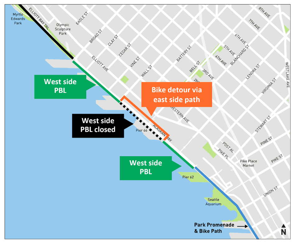
Alaskan Way and the new Elliott Bay Connections greenway
Along Seattle’s central waterfront, you can now enjoy a protected bike lane connecting the waterfront bike path to the Elliott Bay Trail, with great views along the way.
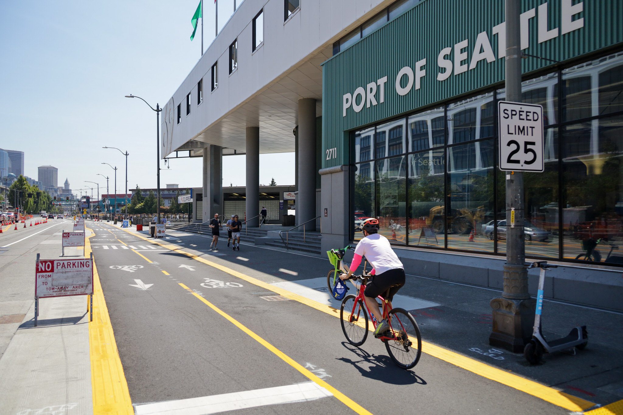
Seattle’s new greenway on the east side of Alaskan Way is officially open! This multi-use trail was created by the Elliott Bay Connections (EBC) and will serve as the bike detour during cruise sailing operations.
RELATED STORIES:
- Complete! Alaskan Way Safety Project expands bike & pedestrian connections on Seattle’s new waterfront
- New greenway on waterfront opens this month
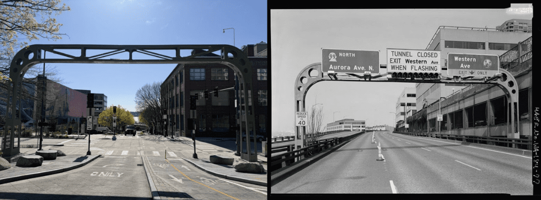
Bell Street and the historic sign bridge
The Waterfront Seattle Program cut the ribbon on a new bike lane connecting Belltown and Waterfront Park. You’ll also find a bit of Seattle history.
A salvaged sign bridge from the Alaskan Way Viaduct now arches over Bell St east of the Western Ave intersection.
RELATED: Seattle celebrates Bell Street’s new historic sign bridge, bike lanes
East Marginal Way
In the industrial corridor south of downtown, including connections serving SoDo, Georgetown, and the Duwamish/Port area, upgrades are making it easier and safer for people biking to and from the Port of Seattle and nearby job centers.
RELATED: East Marginal Way S project delivers safer streets and more reliable freight access

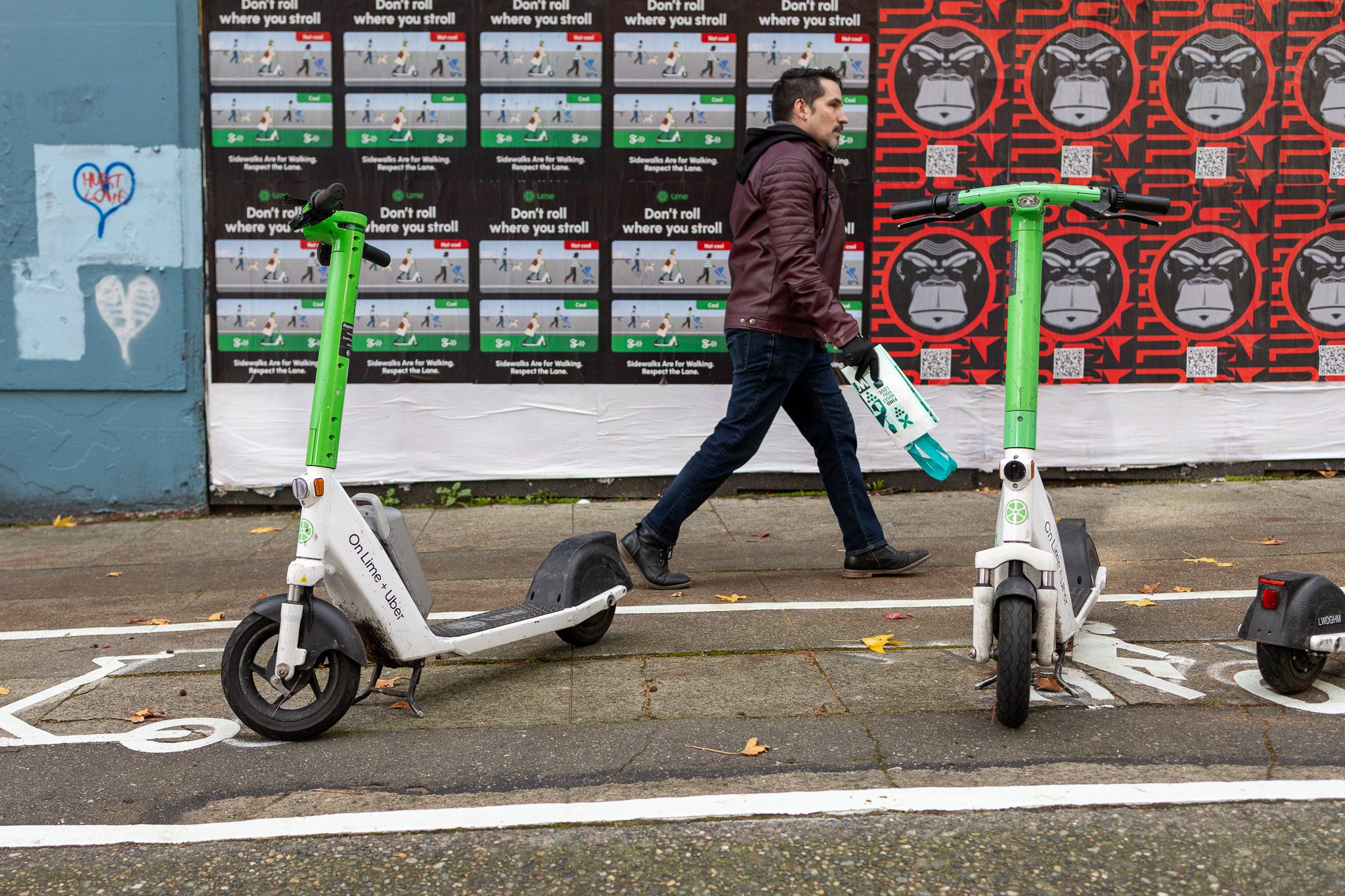
Renting bikes and scooters, riding safely, and parking properly
Shared bikes and scooters are easy to find in Seattle and are often parked near transit stops. Many people rent and ride. So much so, we hit a record-breaking 10.5 million rides last year.
If you choose to rent a shared bike or scooter, please remember to:
- Always wear a helmet. You can pick one up for free at one of our Customer Service Centers.
- Plan your trip to use bike lanes whenever possible. Here are some bike lane maps:
- Park out of the way at the end of your ride. If you see a designated parking spot or bike rack, please use it. We have a bike rack map and more information about parking here.
Learn more on seattle.gov/BikeShare.
RELATED: Seattle bike & scooter share sets new record in 2025
More ways to get around Seattle
Public transportation is a great way to get around Seattle.
Anyone 18 and younger rides local buses, streetcars, Link light rail, and ferries for free and discounted fares are available for eligible adults.
Explore your travel options on FlipYourTrip.org.
RELATED STORIES:
- Seattle gears up for FIFA Men’s World Cup | #WCSeattle
- SDOT’s ‘Flip Your Trip’ wins national award, gets revamp ahead of FIFA
Local funding matters
The bike lanes featured in this story were all locally funded thanks to voter-approved transportation levies.
Local funding sources like our current Seattle Transportation Levy and the Seattle Transit Measure are critical for maintaining and modernizing our city’s transportation network and making transit more reliable and accessible.
So thank you, Seattle.
This is your city, and together we’re building bike lanes and sidewalks, paving streets, repairing bridges, and improving our transit connections.
Stay connected
We regularly share updates, tips, and travel information across SDOT channels so you can stay informed and plan your routes with confidence.
Visit and follow along:
Web | Blog | X | X Traffic | Instagram | TikTok | Facebook | LinkedIn | YouTube | Flickr | Customer Service | Alert Seattle