Find Posts By Topic

Posts categorized under SDOT Archives - Page 2 of 285 - SDOT Blog

Best of the Month | Spokane St Swing Bridge emergency response, free ORCA cards for Seattle Housing Authority residents, and more!

Blog stats: 1,200 words | 8-minute read In case you missed it, we’re sharing highlights from the SDOT Blog each month. Here are some of our top posts from January. 1) Spokane St Swing Bridge is now reopen following successful repairs and testing After the major ice event in late-December,… [ Keep reading ]

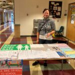
Good News! Our new and improved outdoor dining, vending, merchandise display, and street closure permits are here to stay!

Blog stats: 600 words | 4-minute read During the early days of COVID, we made temporary changes to how we permit outdoor dining, merchandise displays, vending, and street and sidewalk closures. These changes were called “Safe Start Permits.” These were temporary, free permits that made it easier for businesses and… [ Keep reading ]

LEVY DOLLARS AT WORK | Beacon Hill Bike Route | Safety enhancements coming this spring + nearing 30% design on the bike route

Blog stats: 1,000 words | 6-minute read At-a-Glance: Project overview The Beacon Hill Bike Route project has evolved, and along with that comes a name change to Beacon Ave S & 15th Ave S Safety Project. This reflects the range of improvements the project will provide. It will create a… [ Keep reading ]

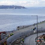
The Waterfront’s Overlook Walk project construction soars to new heights!

Blog stats: 950 words | 5-minute read At-a-glance: Along the waterfront, much has changed since last summer, when the Waterfront Seattle team first began construction of the Overlook Walk project. With many new elements of the waterfront currently under construction within previously existing work areas, it could be easy to… [ Keep reading ]

Changes are coming to Bell St and Waterfront Seattle wants to hear from you! 

Quick link: Visit the Bell Street project online open house to learn more and share your thoughts! Blog stats: 250 words | 2-minute read Waterfront Seattle is kicking off a design process for the Bell Street project, which supports the program’s goal to create more accessible and comfortable east-west connections…. [ Keep reading ]

West Marginal Way SW Safety Corridor Improvements – A Data-Driven Safety Project

Blog stats: 1,200 words | 7-minute read At-a-glance: Through collaboration with the community, we identified safety improvements on West Marginal Way SW as a priority for all travelers, especially people biking and walking, as a way to cross the Duwamish River during the West Seattle High-Rise Bridge closure. As we… [ Keep reading ]

LEVY DOLLARS AT WORK | We built smoother sidewalks & protected mature trees on Aurora Ave N!

Blog stats: 600 words | 4-minute read At-a-glance: This week, we finished repairing sidewalks along the eastern side of Aurora Ave N, from NE 85th to N 105th St. The result: safer, smoother travel for people walking and rolling. Our sidewalk repair program is possible thanks to your tax dollars… [ Keep reading ]

LEVY DOLLARS AT WORK | 23rd Ave E is safer thanks to new signals, crossings, curb ramps, and much more! 

Summary All photos are credit to SDOT unless otherwise indicated. As part of the third phase of work on 23rd Ave E, you’ll now see: New protected left turns We installed these left turn lanes at E John St for vehicles turning from 23rd Ave E and from eastbound E… Filed Under: Accessibility, Biking, Funding & Levies, Move Seattle, Pedestrians, Safety, SDOT, Signals, Vision ZeroTagged With: ,

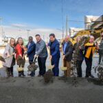
City of Seattle distributing free ORCA cards to more than 10,000 Seattle Housing Authority residents

Blog stats: 1,000 words | 6-minute read At-a-glance: The City of Seattle is partnering with the Seattle Housing Authority (SHA) to provide free unlimited-use ORCA cards to all residents who are living in SHA-owned and managed housing through December 2026. This pairing between an affordable housing program and an accessible… [ Keep reading ]

Seattle Transportation Plan | Let’s create our transportation maps together. Are we on the right track? 

Summary   NEW! Let’s create our transportation maps together. Are we on the right track? There are so many ways we use our streets and public spaces every day! Before we began to develop the STP, we had four transportation network maps (pedestrian, bicycle, transit, and freight). For the STP, we… Filed Under: Community Involvement, SDOTTagged With: